An outbreak of dangerous thunderstorms and heavy rainfall will impact parts of eastern Australia in the next two to three days, including the Sydney and Illawarra regions.
A low pressure system centred to the southeast of SA and a series of associated troughs have brought heavy rainfall to parts of SA, Vic and southwestern NSW in the last 24 hours. This complex pattern will cause widespread thunderstorm activity and rain across eastern and southeastern Australia in the coming days.
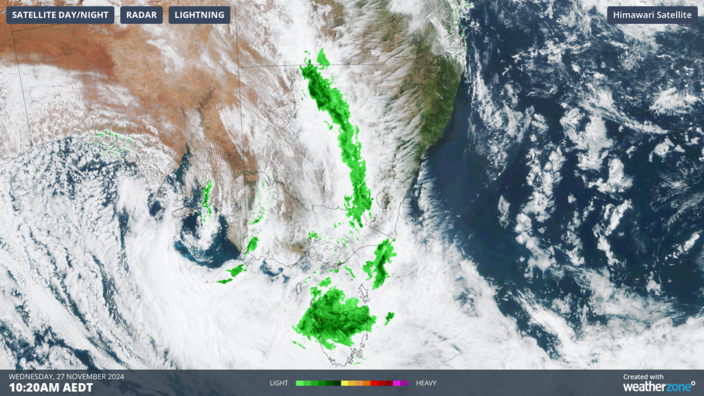
Image: Himawari-9 satellite image and radar at 10:20am AEDT on Wednesday, November 27
These systems will provide multiple lifting mechanisms, allowing air to ascend high above earth’s surface causing thunderstorms to develop
Another couple of key mechanisms for thunderstorm formation are a humid and unstable atmosphere which will be abundant across eastern Australia in the coming days.
Where will the storms occur?
Widespread thunderstorm activity will impact much of Vic, western, central and southeastern NSW and western Qld on Wednesday. Severe thunderstorms are likely across central and eastern Vic in during the afternoon and evening, with severe storms possible in Melbourne. Heavy rainfall, damaging winds and large hail are all a risk particularly across the eastern half of the state. Across the border in NSW, severe thunderstorms are likely in the Riverina and possible across the western inland. Meanwhile severe thunderstorms are possible across western Qld.
On Thursday, widespread severe thunderstorms are expected across central and eastern parts of NSW during the afternoon and evening. These thunderstorms could produce heavy rainfall with the risk of flash flooding, large hail and damaging winds to parts of the state on Thursday. Severe thunderstorms are likely across Sydney, the Illawarra, the Central Tablelands, parts of the Hunter, the Central West Slopes and Plains and the Southern Tablelands.
The main risk for Sydney is heavy rainfall from thunderstorms which could continue into Friday afternoon. However, damaging winds and large hail are still possible for the city in large thunderstorms.
Meanwhile thunderstorm activity should ease in Vic and continue across western Qld. The thunderstorm activity, thick cloud and the low pressure trough will all cause rain to fall over large areas of the southeast in the next three days.
During the next 72 hours widespread falls of 30 to 60 millimetres are forecast across large areas of Vic, NSW and Qld, while isolated falls of 60 to 100 millimetres could fall with thunderstorms.
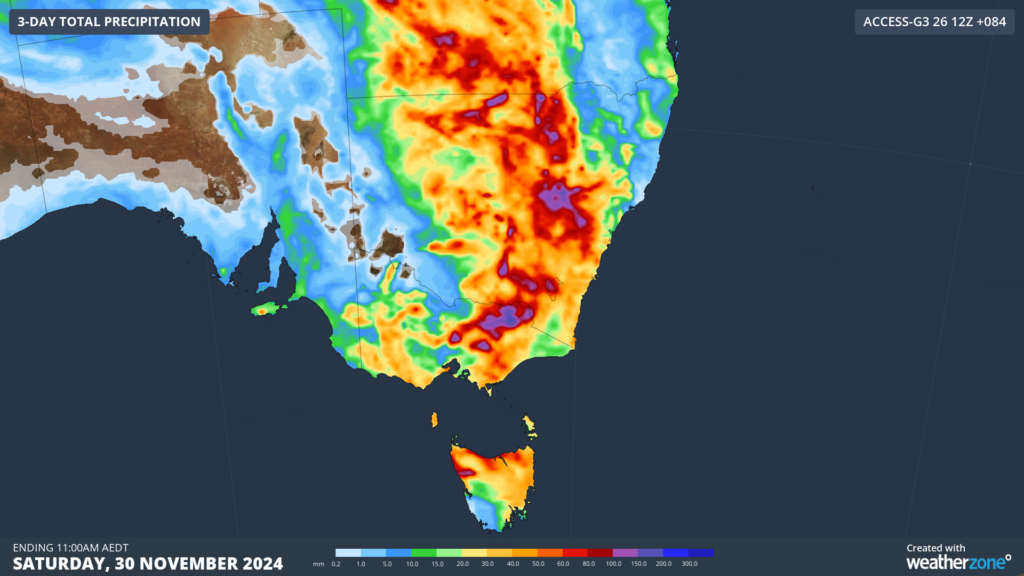
Image: Accumulated rainfall forecast for the three days leading up to 11am AEDT on Saturday, November 30, according to Access-G
The rain and thunderstorm activity will continue on Saturday across southeastern Australia, with the low pressure system sitting near Tasmania. On Sunday, the central and southern coastline of NSW should see heat and clear skies return in the morning before rain returns in the afternoon.
Stormtracker is a severe weather solution that can assist you in observing, in real-time, any storm or event that has the potential to impact your business.
Embedded in DTN’s industry interfaces, the system gives you a time advantage when monitoring conditions developing over your infrastructure and location.
Stormtracker is our Global Information System (GIS) tracking tool, providing multiple weather layers and zoom controls overlaid on a map of your location and infrastructure. You can choose a snapshot or full screen view, depending on your requirements. The maps allow you to monitor all weather, and specifically any systems likely to cause risk for your business. You also have the capacity to observe:
- real time lightning and thunderstorm alerts
- localised lightning strike frequency
- official warnings for storm, cyclone, wind, flood and fire
- sentinel hotspot fires and fire agency current incidents
Stormtracker’s radar imagery updates every 10 minutes, so you are always able to respond rapidly to changing conditions. You can customise alerting to notify you when your staff or infrastructure are under threat. With increased situational awareness, your ability to make informed decisions quickly is optimised.
DTN’s experience and intelligence gives you a clear path through complex situations. Let us assist you, offering actionable insight when extreme weather poses risk to your business. For more information please visit our website or email us at sales.apac@dtn.com.
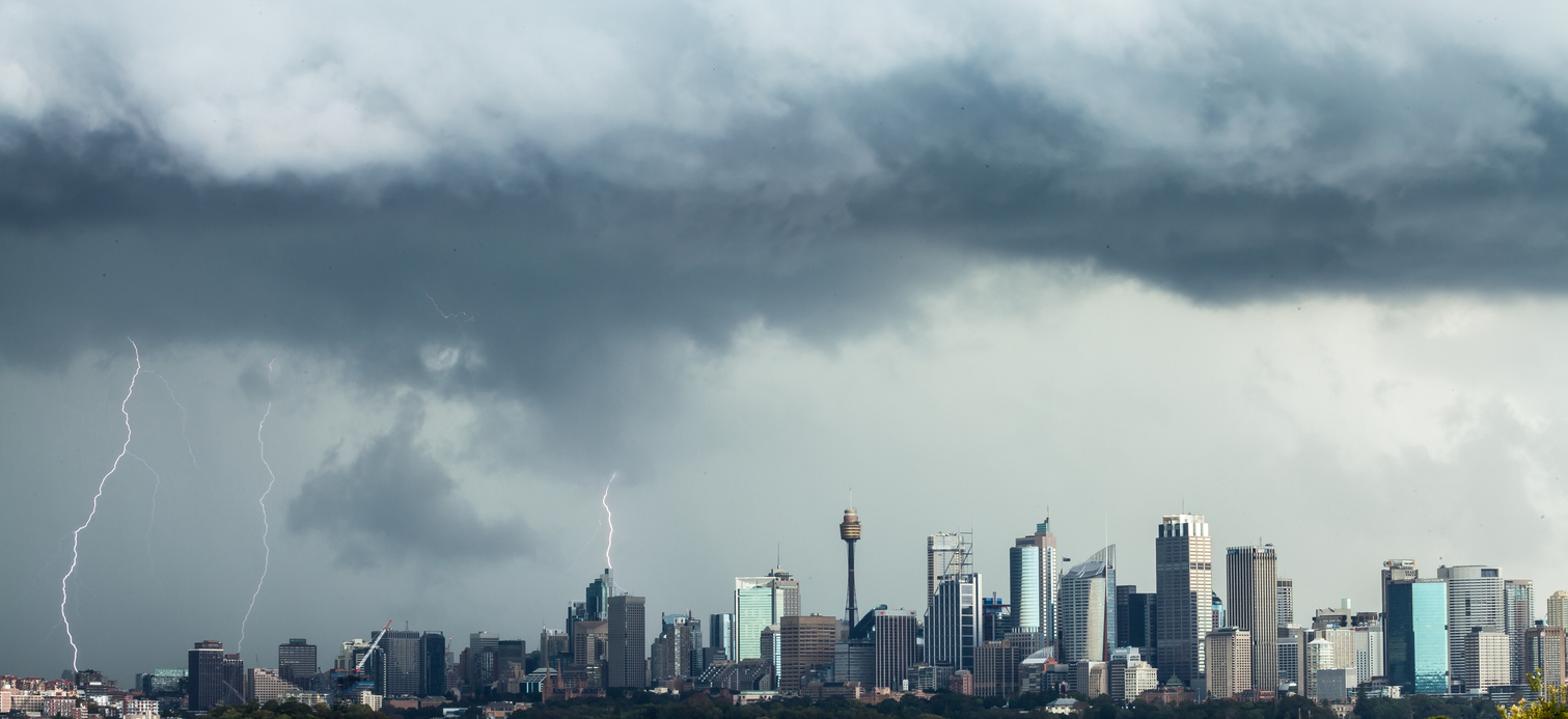
Title image credit: iStock / sjallenphotograpy