The Illawarra has endured heavy rainfall overnight and this morning, with the deluge set to continue and spread north into the Warragamba catchment on Thursday.
The persistent rainfall is being caused by an upper low pressure system over NSW, which has caused a surface trough and low to deepen over the Tasman Sea. A continuous stream of moisture laden southeasterlies is feeding into the Illawarra and South Coast regions from this trough and low.
The rainfall overnight was very heavy, with Currarong recording 100mm in the six hours leading up to 2:30am on Thursday, June 6. Vincentia saw 90mm fall in just two hours to around 8am this morning.
The map below shows that nearly 200m of rain fell in the Illawarra region during the 24 hours to 9am on Thursday, June 6.
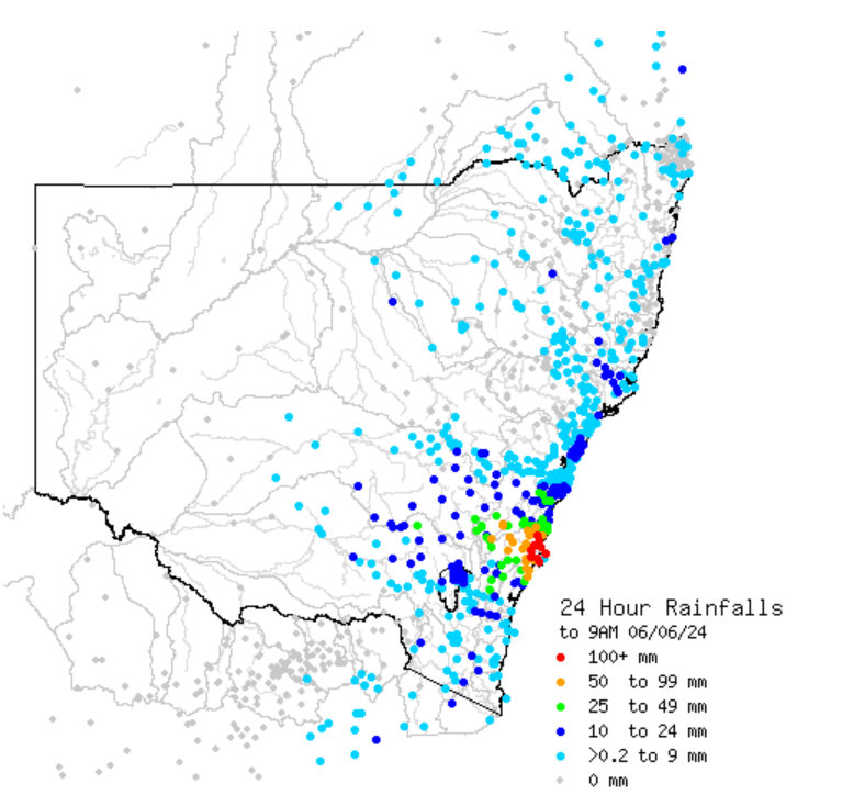
Image: 24-hour rainfall observations to 9am on Thursday, June 6. Source: Bureau of Meteorology.
During this period large rainfall totals fell in the South Coast region;
- Currarong recorded 188mm, with 168mm of this fall in the 12 hours to 9am Thursday, June 6.
- Nearby, Vincentia saw 176mm fall, with 164mm of this falling in the last 12 hours.
- Greenwell Point recorded 159mm
- Nowra saw the most rainfall the town has seen in 8 years, recording 102.2mm during this period.
And it’s not over yet. The satellite images below show relentless rain streaming into the Illawarra and South Coast regions on Thursday morning.
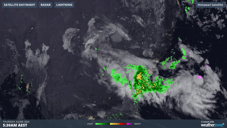
Image: Himawari-9 satellite images for the three hours leading up to 8:30am on Thursday, June 6.
Heavy rainfall is set to continue in the Illawarra, South Coast and Southern and Central Tablelands on Thursday.
The map below shows one model’s forecast daily rainfall, with another 100 to 150mm in 24 hours is likely in these regions, with isolated falls of 150 to 250mm possible. This includes rainfall deluges with six hourly totals of 50 to 90mm likely and isolated falls of 120mm possible for the southeasterly facing ranges. This amount rainfall in a short space of time could cause flooding in these areas.
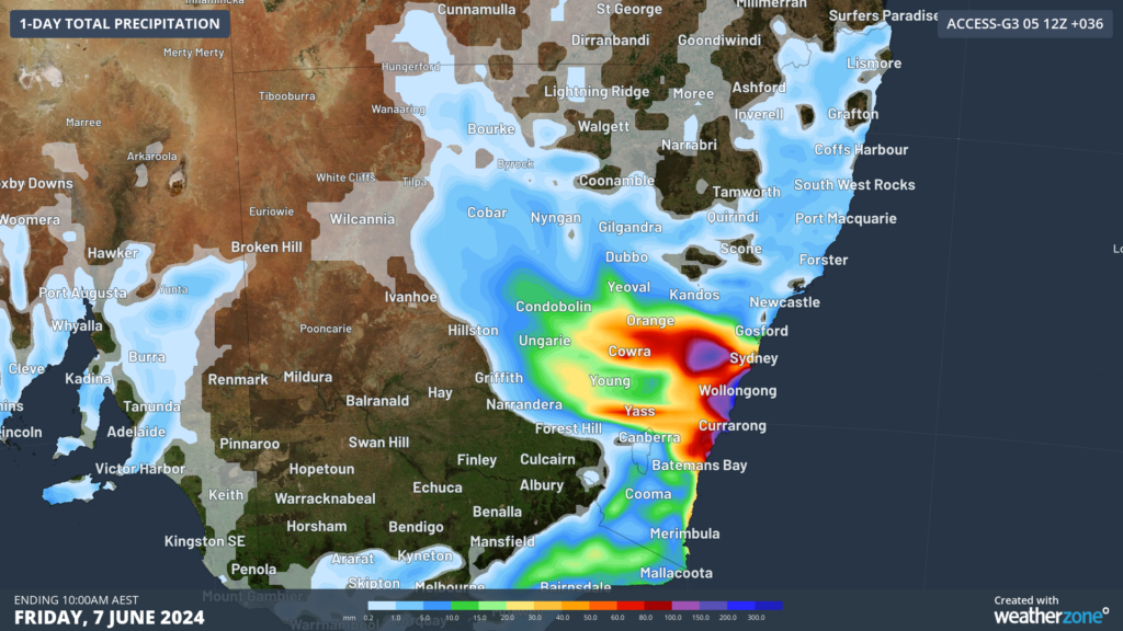
Image: Accumulated 24-hour rainfall to 10am AEST on Friday, June 7, according to Access-G
Rain will also increase in the Sydney region on Thursday, with 30 to 60mm expected to fall in the 24 hours to 9am on Friday. Over the Warragamba dam catchment 60 to 80mm is likely with 100 to 150mm possible. As of Thursday morning, the Warragamba Dam is at 98% capacity, meaning this rainfall has the potential to spill the dam in the Napean River.
While there is some uncertainty on the movement of this low, models suggest that the rain should ease in parts of Sydney and Illawarra on Friday. However, heavy rainfall could persist in the South Coast and impact eastern Vic. Be sure to keep abreast with the latest warnings as the day unfolds.
DTN APAC, a DTN company, specialises in building customised weather monitoring and alerting solutions. These guide transport operators to plan and respond effectively. We tailor our data and analytics to your exact requirements. We support you whilst conducting a thorough
assessment of your weather and environmental monitoring as well as forecasting requirements. This identifies how weather impacts your network and where improvements can be made. You can then choose tailored solutions to boost your operational efficiency and profitability. For more information please contact us at apac.sales@dtn.com.


