
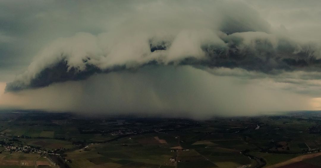
Flooding could affect parts of Queensland and northern NSW on Thursday and Friday as more rain and thunderstorms soak already saturated river catchments.
The first few days of February have seen widespread rain and storms spreading across eastern Australia. During the 24 hours to 9am on Thursday, widespread falls of 50 to 100mm were recorded from central Queensland down to northeast NSW.

Image: Stormy skies in Gympie, QLD this week. Source: @gympie_weather_and_floods / Instagram
Some of the higher totals in the 24 hours to 9am Thursday included 145mm at Theodore and 130mm at Mundabbera in Queensland, and 124mm at Mooral Creek near Comboyne in NSW. Casino’s 81mm was its highest daily total in a year.

Image: An ominous thunderstorm dumping rain on Maitland, NSW on Wednesday. Source: @vision_above / Instagram
On Thursday, areas of heavy rain and potentially severe thunderstorms will continue over a broad area of Queensland and northeast NSW, as moisture-laden air feeds into a low pressure trough.
The map below shows where and how much rain one computer model is predicting on Thursday, which gives an indication of where some of the heaviest rain could fall. It shows that another 50-100mm of rain is possible for some areas that have already had a decent drop this week.

Image: Forecast accumulated rain on Thursday, February 3, according to the ECMWF model.
Flood Watches have been issued in northeast NSW and parts of southern and southeast Queensland in response to this week’s rain, with minor to moderate flooding possible in both states on Thursday and Friday.
Severe thunderstorm warnings are also likely to be issued during the next 24-48 hours as abundant atmospheric moisture causes areas of intense rainfall and flash flooding.
The moisture that is fueling this week’s wet and stormy weather has also been making it feel very hot and muggy in parts of eastern Australia over the last few days and nights.
In Brisbane, the temperature felt like 40ºC at times on Wednesday and didn’t feel cooler than 30ºC at any point last night.
Fortunately for those that don’t like this muggy warmth, it won’t last much longer. Showers, thunderstorms and a southerly change will flush the heat out of southeast QLD on Thursday.
How can Weatherzone help you and your insurance, when storms hit?
SMS alerts
As a thunderstorm moves towards a customer’s home address or business, Weatherzone can provide SMS messages directly to the insurance holder, enabling them to move their car or equipment undercover. This helps to reduce the premium payout by the insurance company and the number of insurance claims. These alerts can also be sent to the insurance provider enabling them to plan, up staff and alert customers.
Storm Query
Storm query is a post event analysis tool that insurance providers can investigate claims. This tool uses Total Lightning Network database enabling the provider to determine if there was lightning at a particular location on the date of the claim.
Severe Weather Advisories
Severe weather advisories can be sent to insurance companies each day detailing the risk of severe weather. This allows the provider to plan and take preventative action when severe weather is on the horizon. The company can upstaff call centres during a severe weather event, reducing wait times and improving customer service and satisfaction.
Seasonal forecasts
Weatherzone conducts detailed seasonal forecasts which can help with long-term planning out to 6 months or so. The seasonal forecasts are tailored to the business and can include risk of heavy rainfall, thunderstorms, extreme heat, bushfires and much more.
For more information, please contact us at apac.sales@dtn.com.




