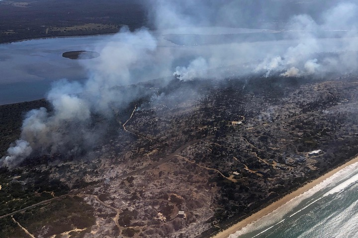
A fire that destroyed buildings and stranded residents in Dolphin Sands on Sunday night has continued to burn into Monday, forcing the Tasmania Fire Service to reissue an emergency warning.
An initial Emergency Warning was issued for an out-of-control fire burning near Dolphin Sands on Tasmania’s East Coast on Sunday night. Fanned by wind gusts exceeding 50 km/h, the fire grew quickly and caught the Dolphin Sands community by surprise.
The location of the fire cut the only access road running along the Dolphin Sands spit, leaving some residents and holiday makers stranded on Sunday evening. The fire started around 6pm AEDT on Sunday and quickly escalated from Advice to Emergency Warning level within a couple of hours, forcing emergency services to advise people in the area to take shelter immediately.
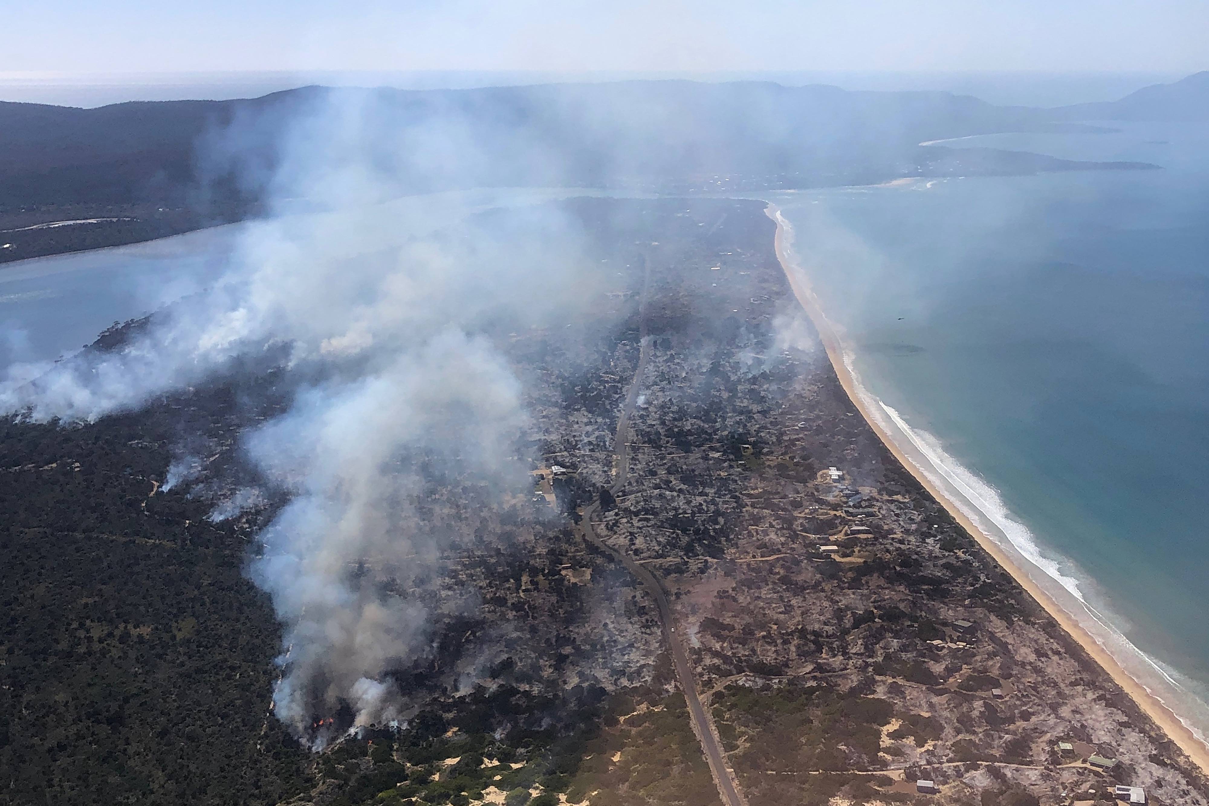
Image: Smoke above Dolphin Sands on Monday, November 13. Source: AAP / TFS
According to reports, two homes were lost in Sunday night’s blaze and around two dozen people gathered on the Dolphin Sands boat ramp to take shelter.
Calmer winds allowed the fire to be brought under control on Monday morning, with the Tasmanian Fire Service (TFS) downgrading the Emergency Warnings to a Watch and Act advisory. However, moderate northeasterly winds allowed the fire to start spreading along its western flank on Monday, prompting the TFS to reissue an Emergency Warning.
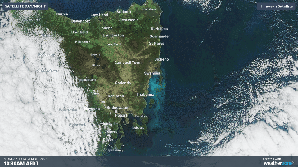
Smoke from the Dolphin Sands fire could be seen blowing to the east of Tasmania in satellite imagery on Monday, showing that the fire was still actively burning through dry coastal heath on the spit.
You can check the latest fire warnings for this fire and other areas of Tasmania by visiting the Tas Alert website.
Working in often severe conditions in the high-risk fields of forestry and emergency, our consolidated weather services can ensure full situational awareness for you and your team.
DTN APAC serves the forestry and emergency sectors, delivering trusted weather data and severe weather alerting to maintain safety, protect your assets and underpin your planning.
Weatherzone’s trusted nowcasting and forecasting system, OpticastTM, is independently proven to outperform other industry models, allowing you to respond rapidly to changing conditions. Opticast can ingest data from your on-site weather observation equipment, ensuring your forecast is customised to your local microclimate. From nowcasting and 14 day forecasting to seasonal outlooks, you have powerful, hyper-local weather alerting and intelligence, giving you decisive confidence when it’s most needed.
With lightning a prominent cause of forest fires throughout Australia, Weatherzone’s Total Lightning Network offers real-time detection and unsurpassed accuracy of lightning strikes to <200m. Based on a vast sensor network, both intra-cloud and cloud-to-ground strikes are located, ensuring you are alerted when severe weather is building and threatening your teams, assets and infrastructure. When volatile conditions increase the ferocity of fire it’s imperative you have lead-time to enact safety plans, keeping your people out of harm’s way.
Your weather intelligence is accessible across all devices in your network via our Weatherguard App, and your customisable interface.
We are there for you when you need us the most – 24/7, 365 days a year. For more information, please contact us at apac.sales@dtn.com.


