Australia just had an unusually strong tropical cyclone season, despite having only six systems named inside Australia’s area of responsibility.
The 2022-23 Australian tropical cyclone season officially ran from November 1, 2022, until April 30, 2023. During this six-month period, the Bureau of Meteorology assigned names to six tropical cyclones that formed inside Australia’s area of responsibility.
While this number is well below the long-term seasonal average of 9-10 tropical cyclones, there was an unusually high proportion of strong tropical cyclones that originated inside the Australian region over the last six months.
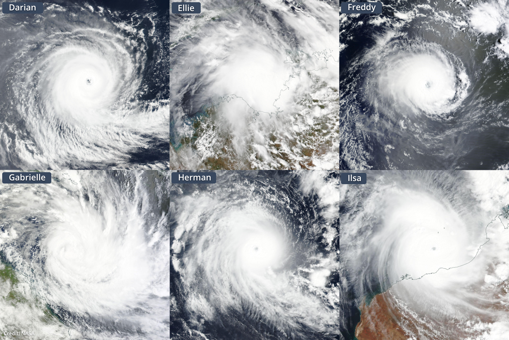
Of the six cyclones that were named in the Australian region, five went on to become severe tropical cyclones (category three or higher) and three reached category five intensity, the highest possible category in the Australian scale.
This was the first time in 23 years three category five tropical cyclones have been named in the Australian region in a single season.
The video below shows the entire 2022-23 tropical cyclone season using enhanced infrared satellite images captured from the Himawari-9 satellite.
Video: Enhanced infrared satellite images captured by the Himawari-9 satellite between November 1, 2022, an April 30, 2023. This animation shows images captured every 2 minutes throughout this six-month period.
Records broken
Three of the severe tropical cyclones that were originally named inside the Australian region went on to challenge or break national or global records.
Tropical Cyclone Freddy set a new preliminary world record for the longest lasting tropical cyclone on Earth. This incredibly tenacious cyclone lasted for more than 31 days as a named tropical cyclone, crossing the entire Indian Ocean from east to west. The World Meteorological Organization is setting up an expert committee to evaluate this remarkable world record.
Freddy also set a world record for the highest number of rapid intensification cycles (seven) from a single cyclone. Some estimates rank Freddy as the new world record holder for the highest amount of accumulated cyclone energy generated by an individual system.
Tropical Cyclone Ilsa also broke records in Australia this season. When Ilsa approached the Pilbara coast in mid-April, a weather station on Bedout Island registered a sustained 10-minute wind speed of 218 km/h. This was the highest sustained wind speed ever officially recorded by the Bureau’s observation network.
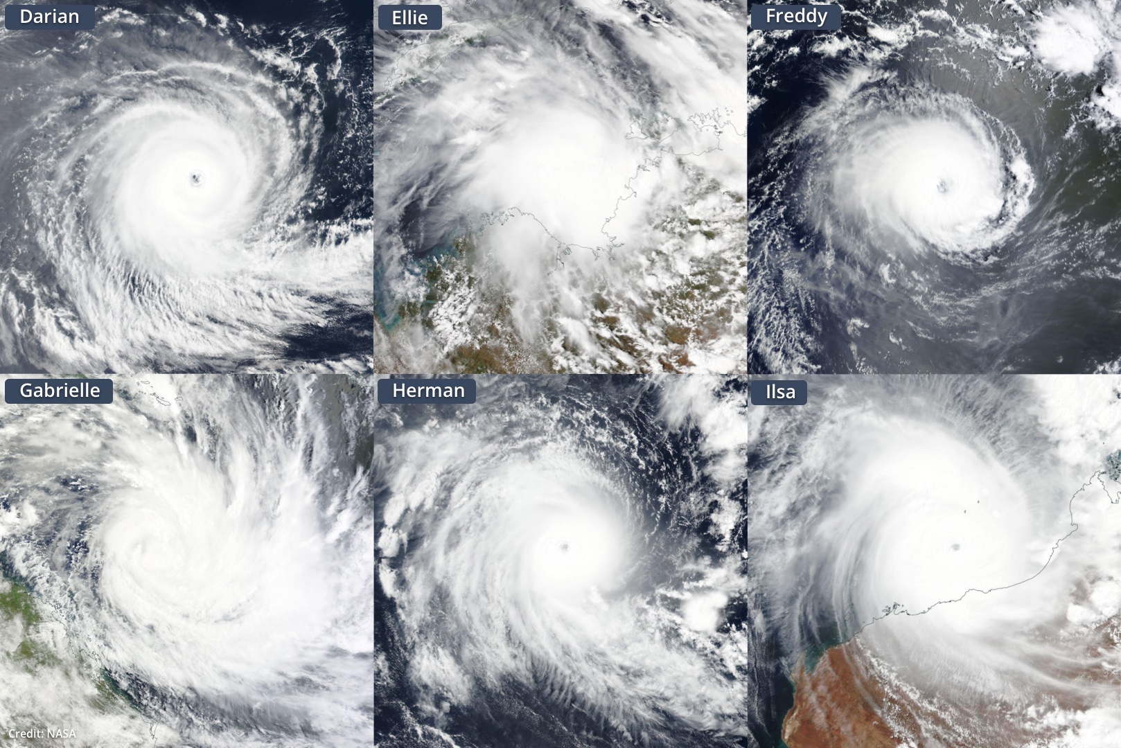
Image: The six tropical cyclones named inside Australia’s area of responsibility during the 2022-23 season.
According to the BBC, the damage caused in New Zealand by Cyclone Gabrielle is expected to cost around NZD $13.5 billion. This is on par with the Christchurch earthquake in 2011, the country’s costliest natural disaster.
While the 2022-23 Australian tropical cyclone season was a relatively quiet one based on the number of named cyclones, it was a remarkable season for the amount of high-end tropical cyclones originating in Australia’s area of responsibility.
DTN APAC has a suite of tropical cyclones services we provide to deliver our clients with as much forewarning of tropical cyclones as we can. We have 4 levels of forecasts timeframes:
- Tropical cyclone seasonal outlooks
- Weekly tropical update
- Daily 7-day tropical cyclone forecast
- Detailed tropical cyclone impacts (issued every 1-6 hours aligning with offical advisories)
Through these products you can have as much preparation as possible for tropical cyclones and their impacts. Now is a great time to enquire about these services in preparation for next season. To find out more, please visit our website or email us at apac.sales@dtn.com.


