
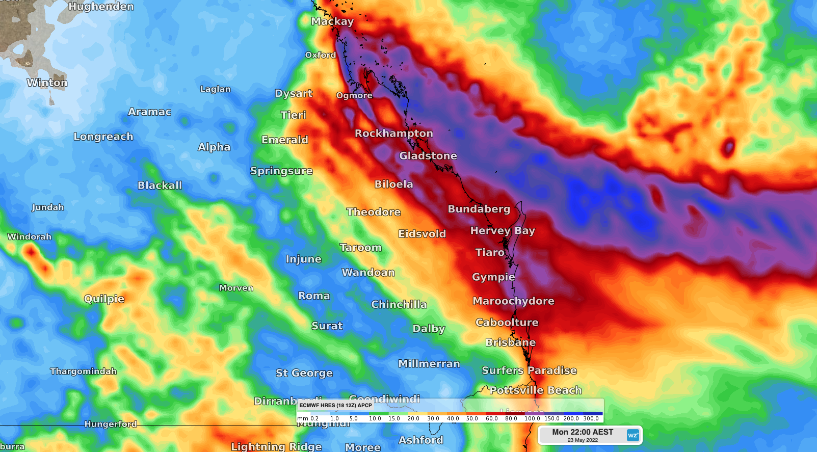
Heavy rain is about to soak parts of central and southeast QLD, with some areas also expected to have their coldest days in about 10 months.
A slow-moving high pressure system passing over southeastern Australia during the coming week will direct a persistent stream of onshore winds into eastern QLD. These onshore winds will carry moisture-laden air from the Coral Sea towards QLD, producing thick clouds and rain on multiple days.
While showers will develop over a broad area of QLD between Thursday and the middle of next week, the heaviest rain is likely to occur over central and southeast QLD on Friday and Saturday.
The map below shows how much rain two computer models expect to fall between now and Sunday night. While there is potential for 50 to 150 mm in some central and southeast coastal districts, there is uncertainty around whether the heaviest rain on Friday and Saturday will fall over land or out to sea.

Image: ECMWF (left) and GFS (right) forecasted accumulated rain between Thursday and Sunday.
The heaviest rain should clear offshore from Sunday, however showers will linger over much of the state through most of next week.
Temperatures will also be impacted by this prolonged run of wet and cloudy weather, with some places likely to have their coldest day so far this year.
Brisbane’s coldest day of the coming week is likely to be on Saturday, when the temperature could struggle to reach 20ºC, well below the long-term May average of around 24ºC. If it stays below 19ºC in the city on Saturday, which is a decent chance, this would be Brisbane’s coldest day since July 2021.
Wind chill will also be a noticeable factor in eastern QLD from Friday through to at least early next week, making temperature fell several degrees colder than they are. In Brisbane, it could feel like the low-to-mid teens for most of the day on Saturday.
This cool weather may cause energy demand to increase as people heat their homes and buildings. This increase in demand will be compounded by a reduction of solar output on the supply side, due to the cloudy weather.
Weatherzone’s Energy services are designed to put the power back in your hands. Our principle value proposition to the energy industry is the timely delivery of highly accurate weather information, to allow intelligent and effective decision making, reducing weather risk and maximizing profit. Weatherzone leads the energy industry with a wide range of products and systems that allow better visibility on forecast generation (such as wind and solar) as well as demand.
No matter how volatile the market is, Weatherzone’s energy services are designed to give you the tools to understand risk and make quick and correct decisions. For more information, please contact us at apac.sales@dtn.com.




