A tongue of water warm enough to support tropical cyclone development has been detected off the central NSW coast this month, breaking temperature records in the western Tasman Sea.
Sea surface temperatures off the NSW coast have been running around 2 to 3°C above average in recent weeks, with some areas more than 3°C warmer than usual for this time of year.
These temperature anomalies would be exceptional in any month, but in early autumn, which is typically the warmest time of year in the western Tasman Sea, they represent record-breaking warmth.
An Argo float located around 180 km to the east of Forster registered a sea surface temperature of 27°C on March 8. This reading, which was just over 2°C above average, captured part of a warm tongue of water that has been stretching beyond Sydney and into waters off the Illawarra coast in recent weeks.
Another temperature sensor located just over 10km off Long Reef Beach on Sydney’s Northern Beaches detected water temperatures of 26.75°C on March 8 and March 9. These were the highest readings on record for this buoy, with data dating back to the early 1990s.
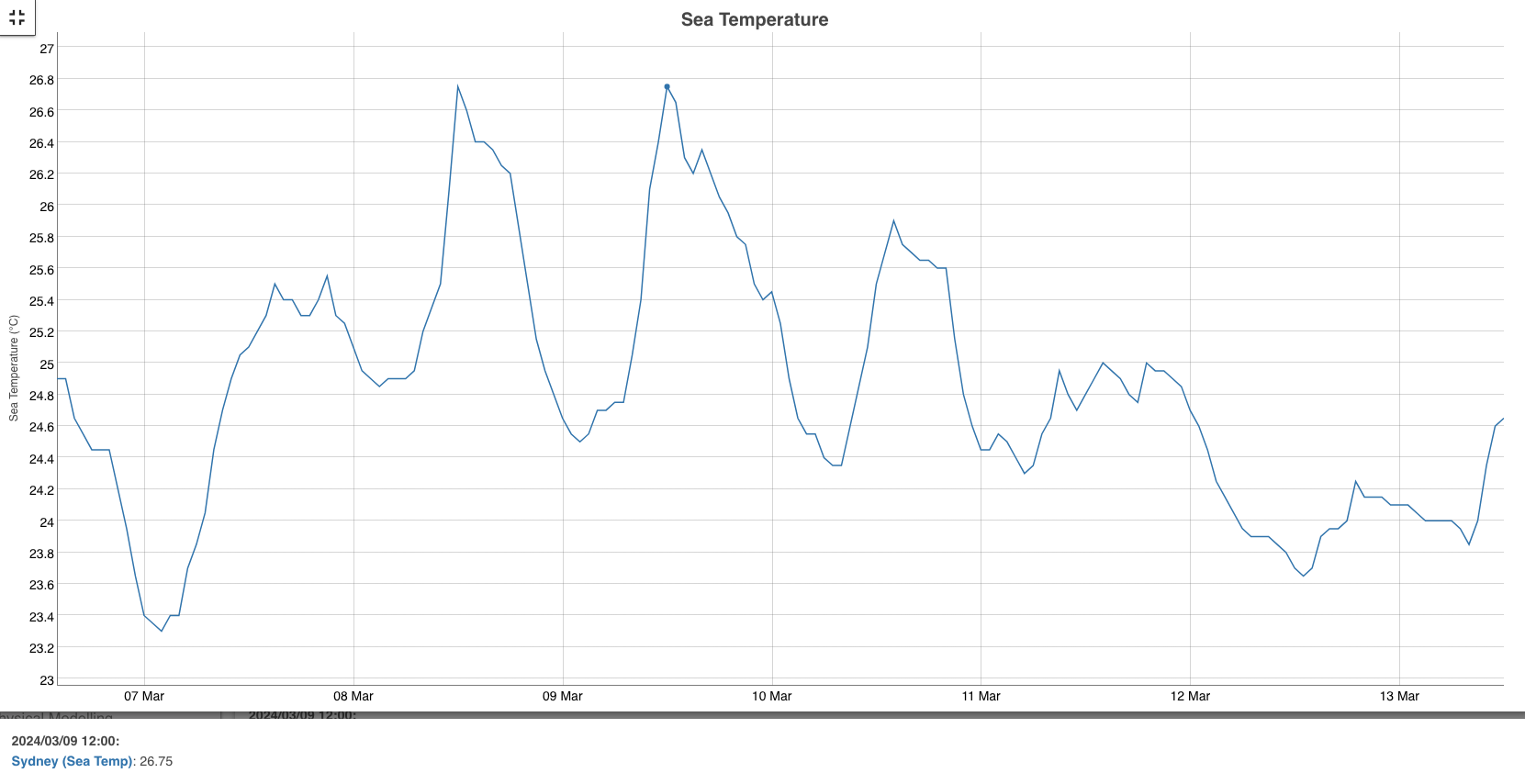
Image: Sea temperature observations from a waverider buoy located to the east of Long Reef on Sydney’s Northern Beaches. Source: MHL
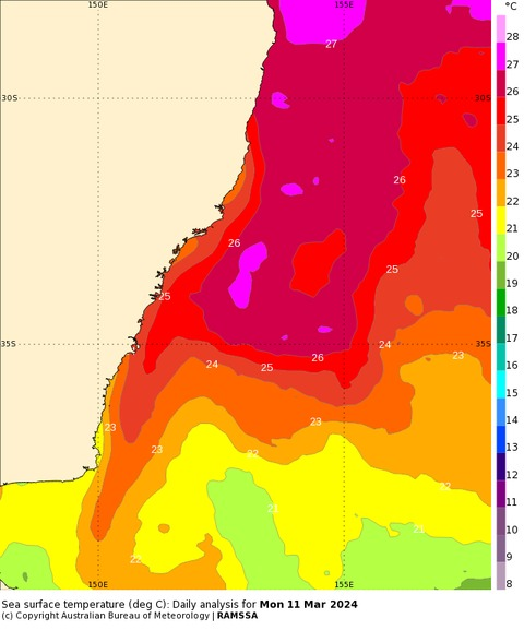
Satellite-based sea surface temperature data has confirmed that water exceeding 26°C has been extending a long way down the NSW coast this month, getting further south than Sydney.
Image: Observed sea surface temperatures off the central coastline of NSW on March 9. Source IMOS
It’s not just NSW that is feeling the heat this month. Sea surface temperatures have also been more than 1.5°C above average over parts of the Coral Sea in recent weeks, and more than 3°C warmer than usual to the south of Vic and east of Tas.
In theory, ocean temperatures at or above 26.5°C can provide enough energy to support tropical cyclone development. While the water has been warmer than 26.5°C near Sydney in recent days, there are no signs that a tropical cyclone will develop over, or move across, the western Tasman Sea over the next 7 to 10 days.
However, what is concerning about the record-breaking warmth in the Tasman Sea is how it could help to fuel the development of low pressure systems or troughs in the coming months.
Autumn and winter are the peak seasons for East Coast Lows (ECLs) in Australia. If we continue to see abnormally warm water to the east of NSW over the next few months, this will increase the likelihood of East Coast Low development. Any low pressure systems that do form over the abnormally warm Tasman Sea will also have more moisture at their disposal to convert into rain. For more information on our energy or port forecasts, which include ECLs, please contact us at apac.sales@dtn.com.


