There were “striking” scenes in the skies above the southwest of Western Australia on Sunday afternoon, as a quarter of a million lightning strikes sparked a spectacular sky show.
The awesome natural fireworks display was caused by a trough moving through the area, with significantly cooler air behind the warm airmass east of the trough. Heat and heat/cold contrast lines are strong drivers for storms.
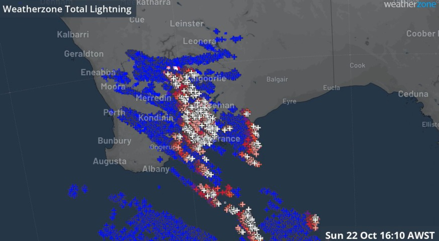
The loop below shows the action as it unfolded on Sunday.
To illustrate the temperature contrast that made conditions conducive to an outbreak of lightning:
- Esperance reached its maximum temperature of 33.5°C before midday
- By 4:30 pm, the mercury was sitting below 20°C and will likely not reach that mark again until Wednesday
The cool air had already reached Perth by Sunday morning, which explains why most of the lightning strikes occurred east of the WA capital on Sunday.
Perth also missed out on rain from this event, meaning there has been no rain there since October 3, in what is turning out to be a very dry October.
- Perth has seen 8.2 mm of rainfall in October 2023 to date, all in the first three days of the month
- The driest October on record was 2000, when just 5.2 mm was recorded
- So Perth won’t break an unwanted record this year, but with no rain forecast for the next week, the city will likely fall well short of the monthly average of 40.4 mm

Image: We strongly advise you to hop on over and check out the beaches near Esperance, WA. Source: iStock.
The shifting climate is bringing increasingly severe weather events, so it’s time to safeguard your business against the potential damage lightning can cause.
Our Total Lightning Network is the intelligent solution that goes above and beyond to increase your lead time before the storm hits.
We utilise a vast global sensor network, created with our partner Earth Networks. Over 1200 sensors in 40+ countries provide a worldwide view of both intra-cloud (IC) and cloud-to-ground (CG) lightning strikes, enabling businesses to plan and respond with the most precise insight available.
Offering unsurpassed accuracy, with real-time detection to <200m, we integrate with your existing systems to keep your enterprise operating within your defined severe weather thresholds.
Leave nothing to chance. Be confident working outdoors with the most sophisticated lightning alerting system, delivering intelligence to any device across your business network. For more information, please contact us at apac.sales@dtn.com.


