
Sultry weather across southeastern Australia could increase the risk of heat stress in some communities this week.
The map below shows that much of NSW, the ACT, VIC, Tas and parts of the NT and Qld will be impacted by a heatwave in the next 72 hours.
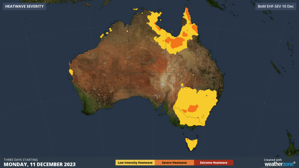
Heat will build across the southeast on Monday and Tuesday ahead of a low-pressure trough, which will sweep across the region on Wednesday and Thursday.
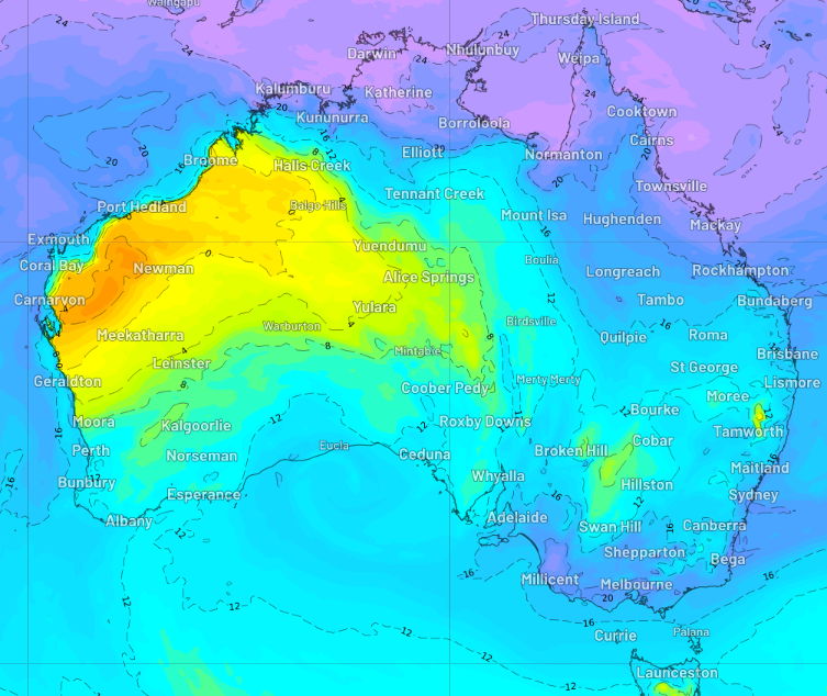
This heat will be accompanied by a very humid airmass sitting over eastern Australia this week. While humidity is normal across Qld and NSW, persistent northeasterly winds are dragging the sticky air down to Vic and SA.
The map below shows the humid air (blue/purple) impacting several states and territories on Tuesday.
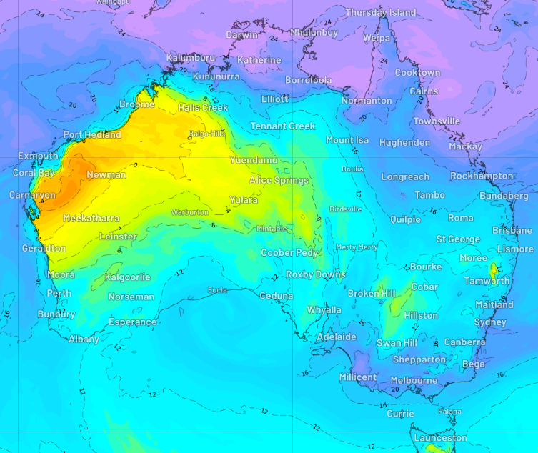
Image: Dewpoint temperature at 12pm AEDT on Tuesday, December 12, according to the ACCESS-G model.
Some notable capital city temperature and humidity forecasts are;
- Melbourne’s maximum temperature on Tuesday and Wednesday could both reach 33 °C, these temperatures could feel around 3-4 degrees hotter due to the humidity
- The temperature will fail to drop below 22°C Tuesday night in Melbourne, which is nearly 9°C above average
- Bankstown and Sydney will see another hot day on Thursday, with 39°C and 36°C forecast respectively, feeling another 4-5 degrees hotter with the humidity
- The minimum temperature Wednesday night across the Sydney basin will be a warm 22°C,
- Brisbane’s temperature will reach 35°C on Friday, 34°C on Saturday and 33°C on Sunday
- The overnight temperature in Brisbane will not drop below 22°C for three consecutive nights beginning Thursday night
- The humidity in Brisbane over the weekend will make it feel around 4-6 degrees hotter than the actual temperature
While hot days can be uncomfortable on their own, the combination of humidity and abnormal heat during both day and night can significantly increase stress on the human body.
High overnight temperatures also give the daytime heating a head start, which can allow the mercury to reach uncomfortable levels early in the day and increase into the afternoon. This is why heatwaves typically cause increased air conditioner to use and energy demand during both the day and night.
High humidity air can make the temperature feel a lot hotter than it is, as it prevents sweat from evaporating off our skin which cools our body temperature down. For this reason, humidity increases the risk of heat stress and adverse health effects.
Why is it so humid?
Slow moving weather patterns have resulted in moisture– laden air streaming into Australia’s east for several days off the unusually warm Tasman Sea. The dynamic mix of tropical cyclone Jasper and a low pressure system being cradled by a stubborn high-pressure system is directing persistent easterly winds into the region.
The map below shows the exceptionally warm water in the Tasman Sea, driven by the East Australia Current and an associated large eddy in the Tasman Sea.
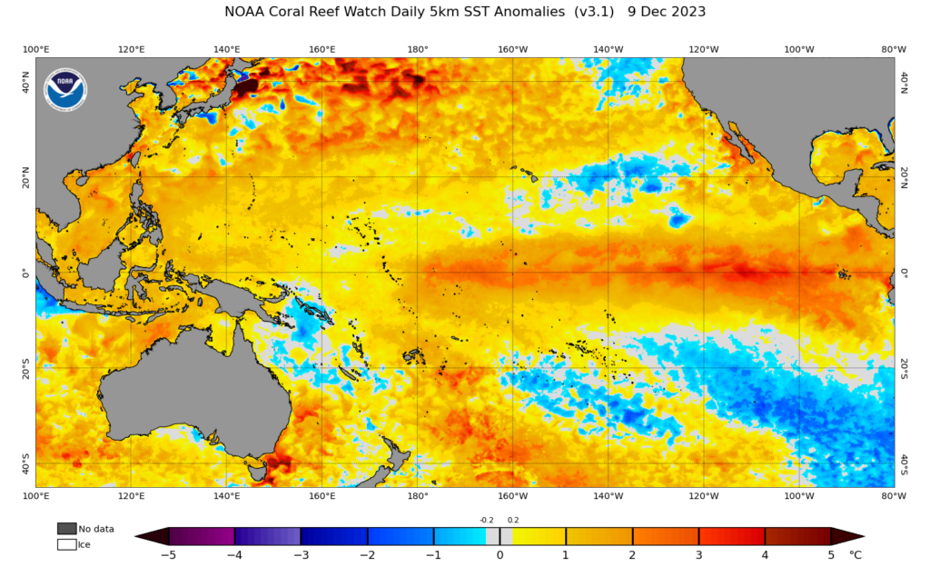
Image: Sea Surface Temperature (SST) anomalies on Saturday, December 9, according to NOAA.
Looking ahead, humidity will plummet across Vic on Thursday, while it will continue to be sticky In eastern NSW until Sunday.
How can Weatherzone help?
Independently verified to significantly outperform other industry models, Opticast gives you a strategic advantage if weather impacts your enterprise. Armed with the most accurate nowcasting and forecasting data, you can mitigate operational and safety risks, and plan to make the most of severe weather windows.
Opticast is powered by machine learning, intelligently adapting to the local conditions of your site area. Gain a world-leading forecasting system that rapidly responds to changing conditions.
We give you the foresight to make quick and powerful decisions when you need to protect your valuable team and assets, and ensure maximum productivity.




