
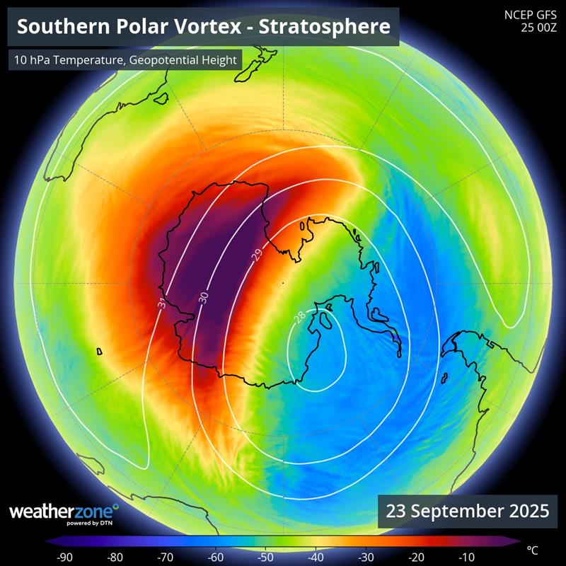
The southern hemisphere’s polar vortex is weakening in response to a rare episode of stratospheric warming above Antarctica, a phenomenon that could affect weather patterns across Australia in the coming weeks.
What is the polar vortex?
The term polar vortex refers to a large rotating column of cold air surrounded by powerful winds, which develops above Earth’s polar regions during the cooler months of the year. In the southern hemisphere, the polar vortex usually forms in autumn, reaches a peak strength in winter and breaks down during spring.
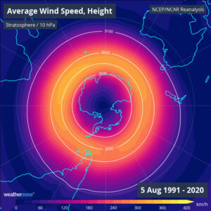
Image: A top-down view of the polar vortex based on long-term average shape and size in early August, using data from 1991 to 2020. This image shows the average wind speed at the 10hPa level of the atmosphere, which is about 30km above the surface.
The polar vortex extends from the surface up to the stratosphere, although meteorologists typically refer to it in two distinct sections:
The stratospheric polar vortex sits about 10 to 50 km above Earth’s surface. This section of the polar vortex is strong and typically shaped like a circle or oval. The stratospheric polar vortex does not directly affect weather near Earth’s surface.
The tropospheric polar vortex extends from the surface up to the bottom of the stratosphere, spanning the lowest 8 to 12 km of the atmosphere. The tropospheric polar vortex can directly influence weather patterns across the southern and northern hemispheres by changing the shape and behaviour of the polar jet stream.
Sudden stratospheric warming
The stratospheric polar vortex can become weakened and displaced by a phenomenon called Sudden Stratospheric Warming (SSW), which refers to a rapid increase in temperature in the polar stratosphere. These stratospheric warming episodes sometimes filter downwards through the atmosphere and can also disrupt the tropospheric polar vortex, causing it to weaken and change shape.
When stratospheric warming causes the tropospheric polar vortex to weaken, we usually see the polar jet stream become wavier and expand towards the equator, which allows nodes of cold air to spread away from the polar region into the mid-latitudes.
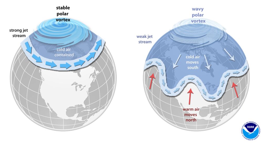
Image: A stable polar vortex (left) helps keep cold air close to the polar region, while a weaker polar vortex (left) can allow the jet stream to become wavier and shift towards the equator, sending nodes of polar air into the mid-latitudes. Source: NOAA
SSW episodes are common in the northern hemisphere, but they happen less frequently in the southern hemisphere, where the polar vortex is stronger. However, an episode of stratospheric warming is currently occurring above Antarctica.
The animation below shows the evolution of the current stratospheric warming in the southern hemisphere.
Video: Temperature and geopotential height of the 10 hPa pressure level above Antarctica over the last three months, showing a previously stable polar vortex being disrupted by stratospheric warming in September.
If the current episode of stratospheric warming filters downwards through the atmosphere, it could cause the tropospheric polar vortex to weaken, allowing southern hemisphere’s polar jet stream to drag cold air away from Antarctica. This jet stream pattern, which is associated with a negative phase of the Southern Annular Mode (SAM), would make the following conditions more likely in Australia during late September and early October:
- More rain and westerly winds over far southern Australia, including parts of Tasmania, Victoria, SA and WA, promoting wind energy generation and rainfall over drought affected agricultural and forestry industries.
- Drier-than-average weather over eastern Australia, promoting increased solar energy production.
- Higher chance of abnormally hot days in southern Australia driving high energy demand.
The influence of this month’s stratospheric warming may also counteract other broad-scale climate drivers in the Australian region over the coming weeks. For example, a negative Indian Ocean Dipole (IOD) is currently occurring to the northwest of Australia. While a negative IOD typically boosts spring rainfall over large areas of Australia, it may not have this rain-promoting influence if the polar vortex is weaker than normal.
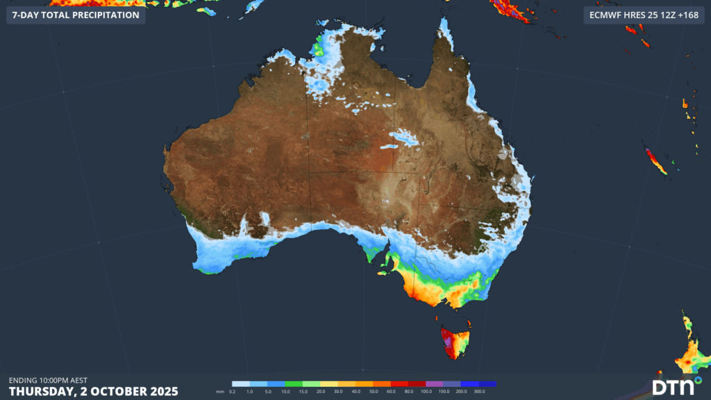
Image: Forecast accumulated rain during the next 7 days, showing a rainfall pattern that is to be expected under a negative SAM phase, with most of the rain confined to far southern Australia.
DTN APAC’s meteorologists will be keeping a close eye on the polar vortex over the next couple of weeks, and giving updates to our forestry, energy and agricultural clients likely to be affected.
DTN APAC has grown to become the outright leader within the Australian energy market, serving wind, solar, hydro, trading, utilities and network companies.
You can’t control the weather, but you can gain precision insights to optimise your response. What lights us up is providing your energy business with tailored weather information to reduce your risk and keep you moving ahead of the curve.
Our services cover all aspects – from wind and solar generation to demand forecasts, wholesale markets to retail so, no matter where your company sits, we have solutions for you. We have worked closely with market participants to create products that meet the evolving needs of the sector, aiming to increase safety and profitability for our customers.
Your customisable Energyzone interface can assess heat/heatwave potential from 14 days out to 12 months. It allows you to benefit from specialised indices for CDD/HDD/apparent temperature/sunshine hours to help accurately predict the demand for electricity. This, along with high-resolution modelling and local knowledge, gives you the most precise information available to make the critical decisions that bolster your production.
Benefit from the timely delivery of accurate weather information, allowing informed and effective decision-making.
Learn more about our large range of industry leading products and services or email us at sales.apac@dtn.com




