A wintry blast, with severe storms, potentially flooding rains, and bitterly cold temperatures are on its way to southwest WA, abruptly ending the region’s taste of spring on Tuesday.
On Tuesday, the mercury was five to eight degrees above the August average, reaching 25°C in Perth and Esperance, and 28°C in Eucla. The state’s north saw unusually hot temperatures for the start of August, with 36°C recorded at Yampi Sound and 34°C at Port Hedland.
Despite it being just the first day of the month, almost the entire state recorded a warmer temperature than all of August 2022.
These warm temperatures along with gusty northerly winds are producing some of the first ‘extreme’ bushfire conditions for the season.
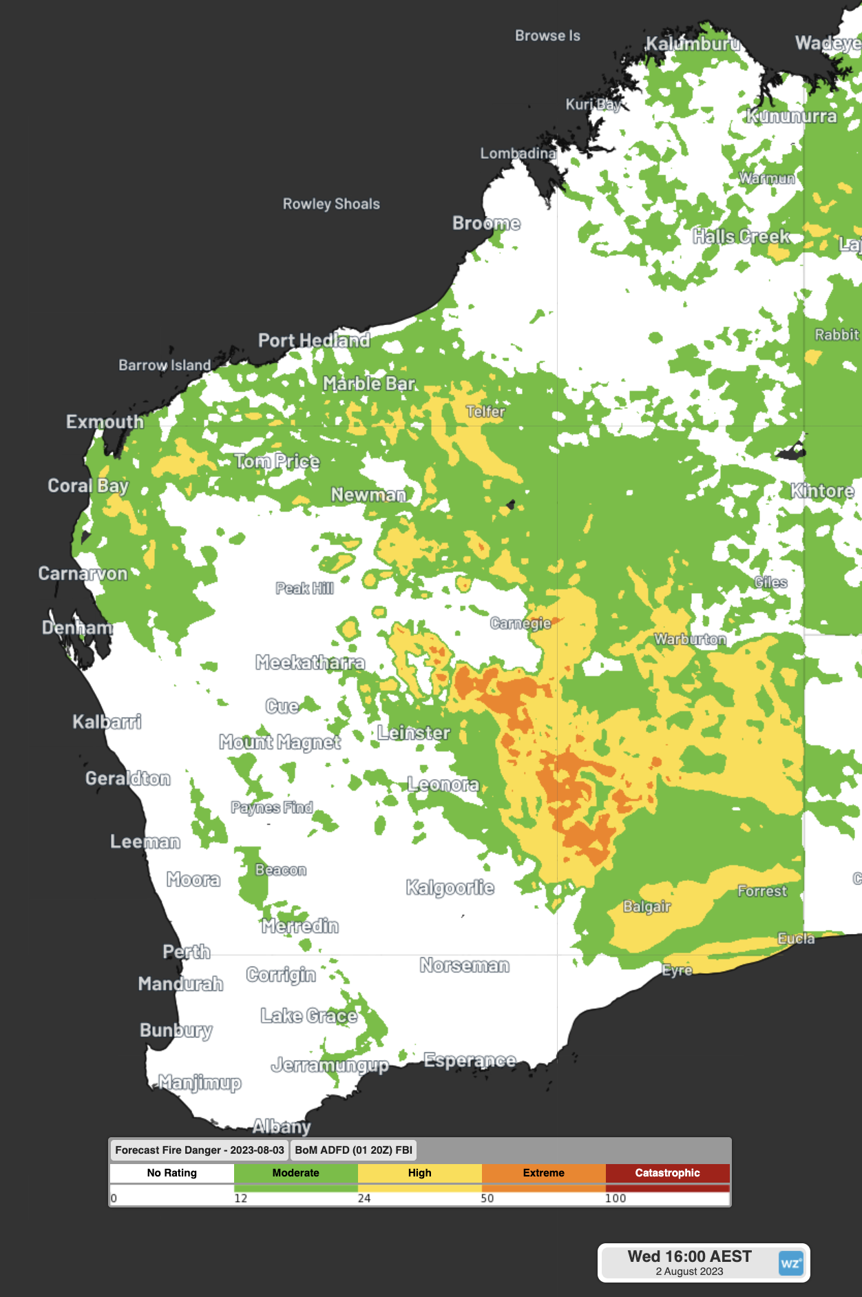
Image: Fire Behaviour Index (FBI) for Wednesday afternoon. Areas in orange show the Extreme Fire Danger Rating in Northern Goldfields
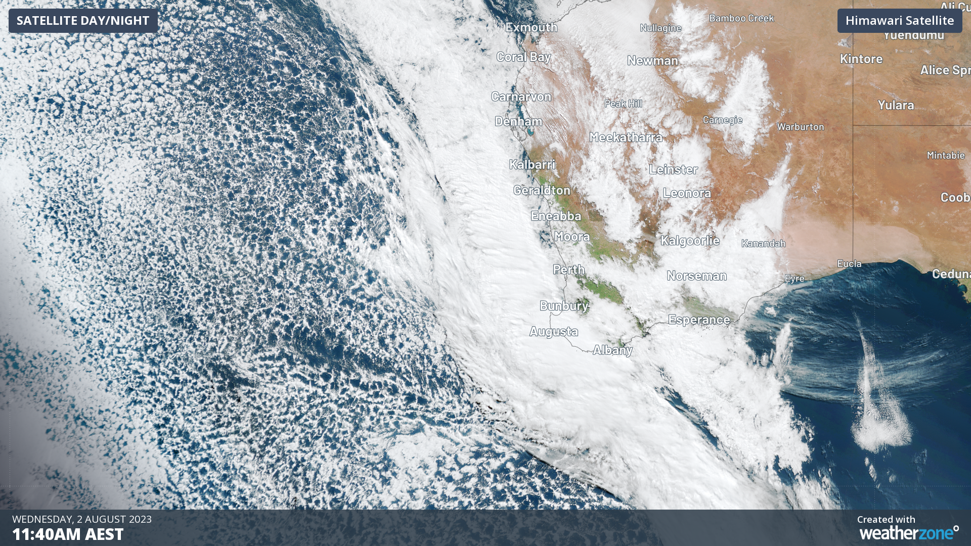
This brief taste of spring will be interrupted by a powerful cold front and trough crossing the region on Wednesday afternoon. In the image below the broad area of speckled cloud is a tell-tale sign that a large mass of cold polar air has broken away from the Antarctic region and is venturing into the relatively warm mid-latitudes.
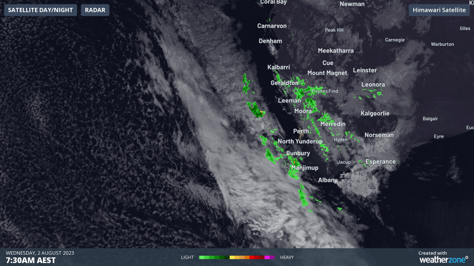
Severe thunderstorms have developed on Wednesday morning ahead of this trough, sparked by the contrast in the temperatures and an unstable atmosphere.
As of 9:30am WST, a severe thunderstorm warning for damaging wind gusts and heavy rainfall is current for South West, Lower West, South Coastal and Great Southern.
Wednesday morning’s storms were uncommonly active for winter. The Total Lightning Network (WZTLN) has already detected 44,000 lightning strikes during Wednesday morning over the region.
The heavy rain is expected to begin for Perth from midday as the trough sweeps across the city. However, the main cold airmass is expected to arrive late on Wednesday afternoon, meaning temperatures will feel no warmer than 8°C during the evening commute tonight.
The southwest corner will broadly see around 30-60mm fall today, with isolated areas possibly seeing 80-100mm in just 36 hours. This could lead to flooding in some areas.
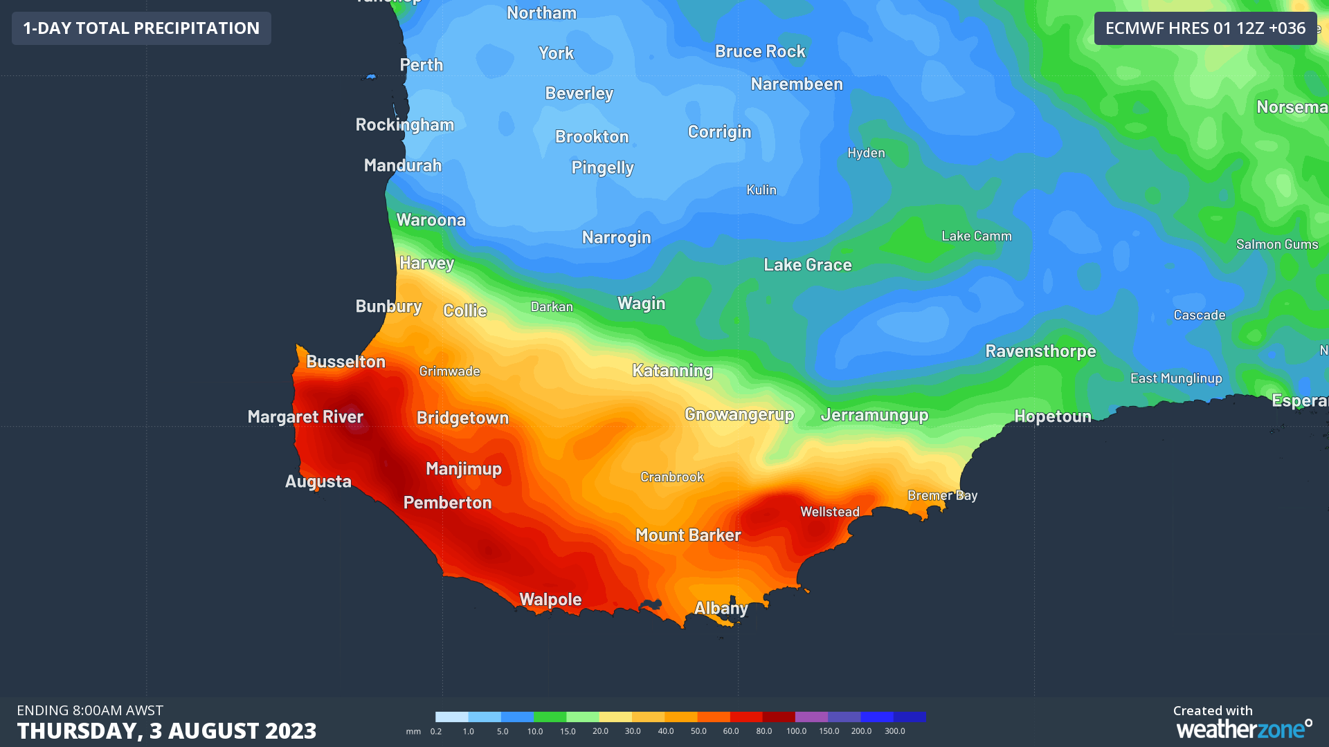
Image: Forecast rainfall in the 36 hours to Thursday 8am WST.
While this system is not expected to hang around for long, the cold air it leaves behind will. Below average days and nights will last until the end of the week before some warmer weather returns on the weekend.
How Weatherzone can prepare you for Thunderstorms
DTN APAC can help your business deal with thunderstorms through:
- Accurate and easy to understand forecasts beforehand
- Thunderstorm tracking and Lightning Alerting during a storm
- Event and Lightning reporting afterwards.
Our colossal influx of data from all the worlds leading weather forecast models and the Total Lightning Network gives us a unique ability to prepare your business for thunderstorms like no other. To find out more, please email us at apac.sales@dtn.com.


