
Brisbane just tossed and turned through its warmest summer on record based on overnight minimum temperatures, with the city also registering one of its top two warmest summers on record based on the mean temperature.
A combination of abnormally high temperatures and atmospheric moisture made Brisbane feel abnormally hot and sweaty this summer.
All three months of the season registered minimum and maximum temperatures that were roughly 1-2°C above the long-term average. This resulted in December, January and February all ranking in the top 6 respective months on record for mean temperature.
Brisbane’s average minimum temperature for summer as a whole came in at 22.5ºC. This is about 1.3ºC above the average from the last 24 years, and the city’s highest summer minimum temperature on record. The previous record was 22.3C during the summer of 1979-80.
Impressively, Brisbane failed to drop below 20ºC during the first two months of 2024. This 60-day spell breaks the previous record of 59 days above 20ºC from 1978. Current forecasts suggest the next one-to-two weeks could stay above 20ºC as well, extending the new record.
?????Brisbane has now recorded 59 consecutive nights at or above 20 °C, having not dropped below 20 °C so far in 2024. This equals the previous record run of nights above 20 °C that occurred in 1978. Minimums are expected to stay above 20 °C this week. https://t.co/bhJyrBIxVn pic.twitter.com/AmCGL0utkg
— Bureau of Meteorology, Queensland (@BOM_Qld) February 28, 2024
Maximum temperatures were also very warm this summer, coming in as the 7th highest on record for the season.
Combining the warm minimums and maximums, Brisbane’s mean temperature for this summer will come in just below 26.8ºC. This will be either the equal warmest or second warmest summer on record for Brisbane, with a similar summer mean temperature to 2016-17.
In addition to the record-breaking temperatures, another standout feature of this summer in Brisbane was atmospheric moisture.
Warmer-than-average sea surface temperatures over the Tasman and Coral seas enhanced evaporation and boosted airborne moisture concentrations during summer.
In January, a weather balloon released by the Bureau of Meteorology detected record high precipitable water values above Brisbane. Precipitable water is a measure of how much moisture is available in a vertical column of the atmosphere.
This summer’s abundant atmospheric moisture exacerbated the heat and generated plenty of rain.
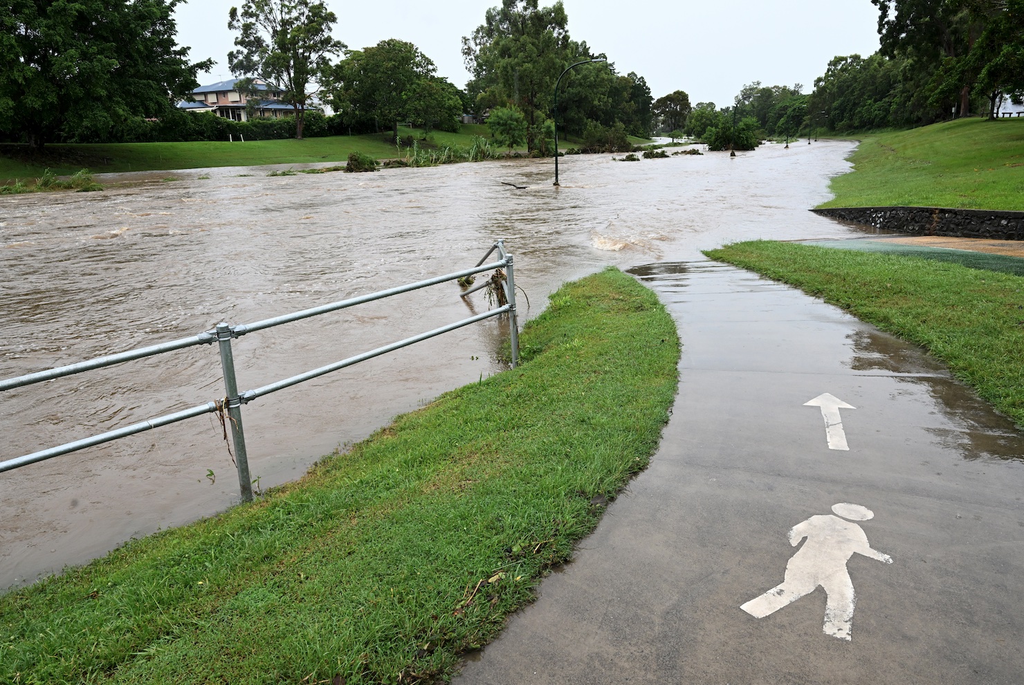
Image: Flooding in the suburb of the Grange in Brisbane, Friday, February 16, 2024. (AAP Image/Darren England)
Brisbane picked up 696.8 mm of rain this summer, which was more than 200 mm above the long-term average.
DTN APAC can provide tailored climate briefings to your business to alert you of the most likely weather conditions and hazards to look out for during the upcoming season. Now is a good time to get a good look at the forecast for autumn and a look deeper into 2024. To find out more or to book a presentation, please email apac.sales@dtn.com.


