People of Perth and southwestern WA, prepare for a scorching last few days to round out the month.
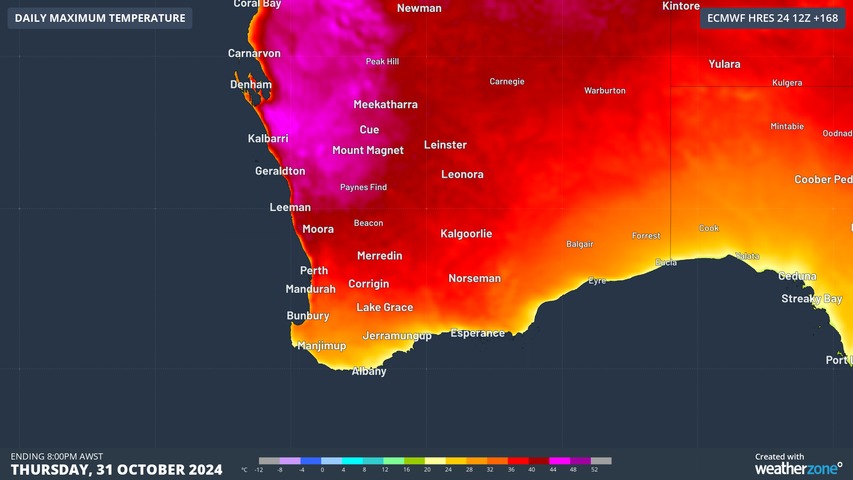
An extreme run of heat is coming next week, with Perth temps set to soar as much as 14 degrees above the October average maximum of 23.4°C.
At this stage, Weatherzone’s forecast maximum temps for Perth for Monday through to Thursday are:
- Monday 33°C
- Tuesday 35°C
- Wednesday 36°C
- Thursday 37°C
These temperatures are obviously not as severe as the temps in the 40s which every Perth resident has sweltered through in recent summers, however they are still exceptionally hot for this time of year.
Indeed, Perth’s hottest October temperature of 37.3°C (in 148 years of records) is very much under threat.
What’s the cause of next week’s heat?
Heat from the interior which will be pushed towards the west coast by persistent easterlies circulating around a large belt of high pressure centred south of the continent.
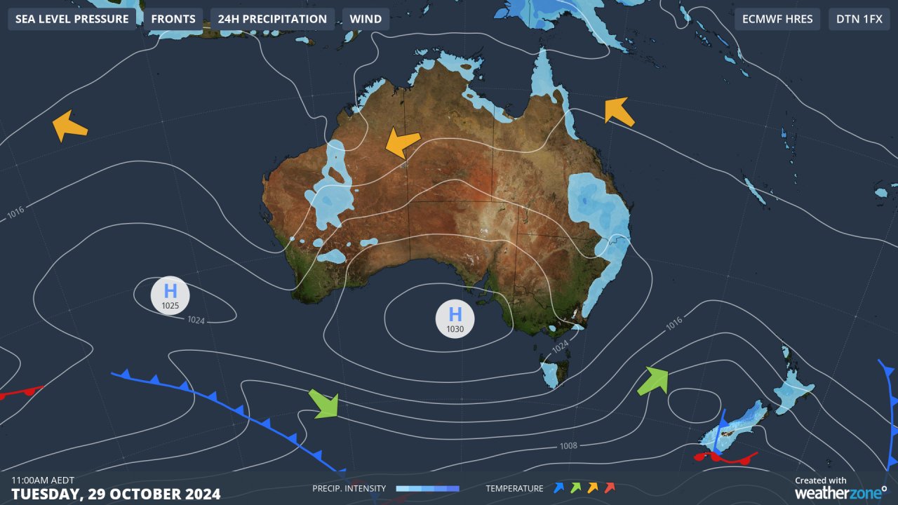
Image: Persistent easterlies usually mean a hot spell in Perth from spring through to autumn.
Meanwhile temps across the entire South West Land Division will gradually increase as a trough in the west of the state deepens throughout next week.
If the mercury does reach 37°C next Thursday in Perth, it’ll be the city’s hottest day since February 20.
Is this event a heatwave?
Not officially at this stage, no. In its official definition of a heatwave, the BoM specifies that there is no single temperature threshold for a heatwave in Australia, but that a heatwave is defined as:
“Three or more days in a row when both daytime and night-time temperatures are unusually high – in relation to the local long-term climate and the recent past.”
Weatherzone Business has grown to become the outright leader within the Australian energy market, serving wind, solar, hydro, trading, utilities and network companies.
You can’t control the weather, but you can gain precision insights to optimise your response. What lights us up is providing your energy business with tailored weather information to reduce your risk and keep you moving ahead of the curve.
Our services cover all aspects – from wind and solar generation to demand forecasts, wholesale markets to retail so, no matter where your company sits, we have solutions for you. We have worked closely with market participants to create products that meet the evolving needs of the sector, aiming to increase safety and profitability for our customers.
Benefit from the timely delivery of accurate weather information, allowing informed and effective decision-making. Please visit our website or email us at apac.sales@dtn.com.


