
Perth is about to get its first taste of winter, with cool, wet and windy weather set to impact southwestern Australia during the next 48 hours.
A strong cold will sweep across the southwest of WA on Wednesday evening and Thursday, causing temperatures to plummet across the region.
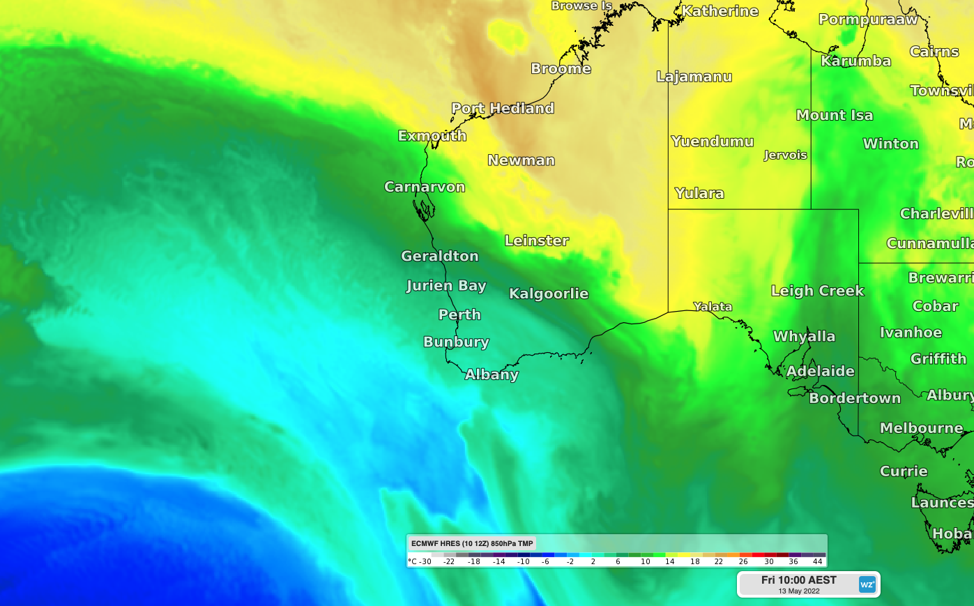
The map below shows a cool airmass moving over WA later this week, behind this strong front.
 Image: Forecast 850 hPa temperature on Friday morning, May 13, according to the ECMWF-HRES model.
Perth could struggle to exceed 16 degrees on Thursday, which is about six degrees below average for May. This will come as a shock after a long and hot summer and could be the city’s coldest day in 6 to 8 months.
Friday and Saturday will also be cool, with maximum temperatures remaining in the high teens, before returning to the low 20’s from Sunday or Monday, which is more typical for this time of year.
The winter doona could make its first appearance for the year during Thursday and Friday nights, with temperatures expected to drop to around 7 to 9 degrees by the following mornings.
This week’s cool temperatures will also be accompanied by significant rainfall and strong winds across some southwestern parts of WA. The mositure fuelling this rain is being dragged south from Tropical Cyclone Karim, which is currently weakening over the central Indian Ocean. Fortunately, Karim will stay away from the Cocos (Keeling) Islands and mainland Australia.
The satellite image below shows cloud associated with Tropical Cyclone Karim drifting towards WA on Wednesday morning.

Image: Visible true-colour image captured by the Himawari-8 satellite on Wednesday morning.
This thick cloud band will help limit daytime heatin over WA and reduce solar power output for several days, as well as producing significant rainfall.
Showers will start to increase over the west coast of WA from late Wednesday, before rain becomes heavier and more widespread on Thursday into Friday. The map below shows how much rain one computer model is predicting by Friday night.

Image: Forecast accumulated rain between Wednesday and Friday, according to the ECMWF-HRES model.
Strong southwesterly winds will impact the west coast on Thursday evening before extending across southwestern WA during Friday.

Image: Access-G instantaneous wind gust speed and direction forecast for 12pm WST on Friday, April 13.
This system should provide a decent spell of wind power on Friday and Saturday for wind farms in the region.
A severe weather warning may be issued for damaging winds for parts of WA as the cold front moves through state on Thursday and Friday. Be sure to keep up to date with the latest warnings as this system evolves. Weatherzone provides our energy clients with 14- day temperature, wind, cloud and rainfall forecasting, for more information, please contact us at apac.sales@dtn.com.




