
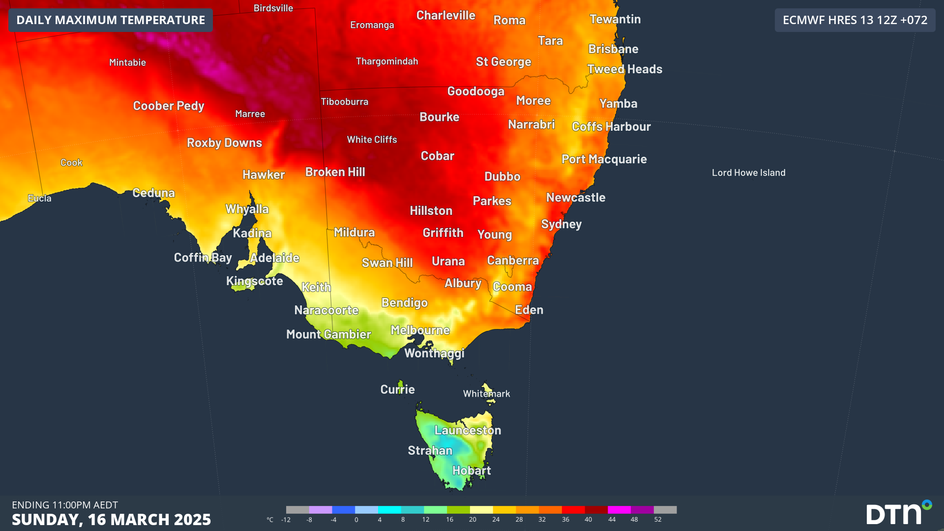
A sweltering inland air mass will filter across NSW on Sunday, bringing scorching autumn heat that could cause challenges across the energy market.
This heat will be drawn from the Australian interior by a broad low pressure trough and cold front crossing the country’s southeast, leading to increasingly hot temperatures into the weekend. The hottest temperatures are expected on Saturday over the far southwest of NSW, where the mercury will hit the low 40s, with heatwave conditions extending into South Australia and Victoria as well.
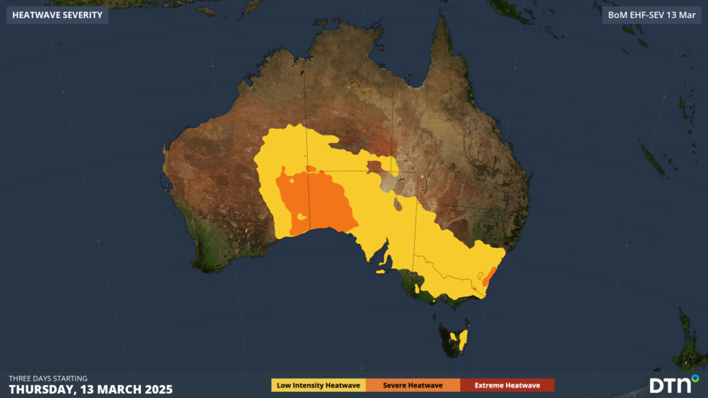
Image: Low-Intensity to Severe Heatwave conditions forecast across South Australia, northern Victoria and much of NSW between Thursday and Saturday.
As this intense heat edges east into the more densely populated parts of eastern NSW on Sunday, energy demand should soar across the state. Hot and relatively dry northwesterly winds should prevent cooling seabreezes across much of the Sydney Basin, as well as coastal regions south from the Hunter down to the South Coast.
This subduing of the seabreeze on Sunday afternoon will allow temperatures to rise to the mid to high 30s, possibly reaching the low 40s in western Sydney. The image below shows hot northwesterly winds continuing into the late afternoon on Sunday.
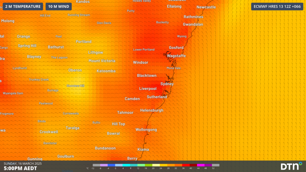
Image: Forecast temperatures and winds at 5pm AEDT on Sunday, March 16, showing hot northwesterly winds across the Greater Sydney region.
This surge of heat on Sunday comes after very warm days on Friday and Saturday, forecast to reach the low to mid 30s. Seabreezes will feature both days, helping bring some daytime cooling relief, however the added humidity will make it feel 2 to 4°C warmer than the actual temperature.
With these muggy daytime conditions, night time relief will become increasingly difficult as the humidity limits overnight cooling. Night time temperatures in the low to mid 20s will make recovery from this heat increasingly difficult, with severe heatwave conditions extending into Sunday for eastern NSW.
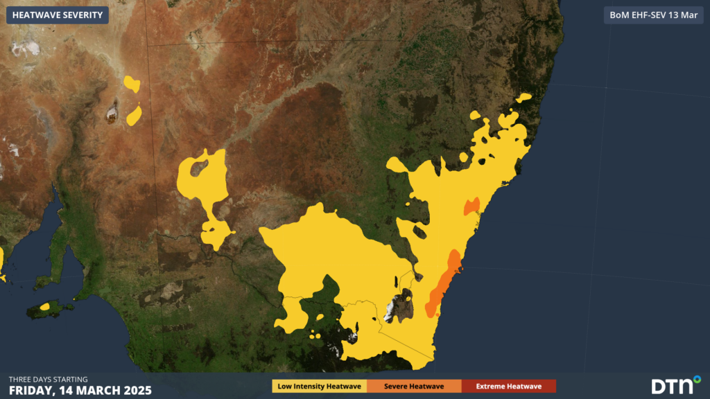
Image: Severe Heatwave conditions forecast to spread over southeast NSW into Sunday.
Unfortunately, much of Sunday night will remain very warm in the high 20s until about midnight for Sydney.
With Sunday’s heat forecast to last well into the evening, energy demand will likely sky rocket as people seek relief from the heat. This energy usage could exceed the state’s energy reserve as people turn on their air conditioners to manage the surge in heat. As a result, the Australian Energy Market Operator (AEMO) has declared a Forecast Lack Of Reserve Level 2 (LOR2) for the NSW region on Sunday, March 16.
According to AEMO, an LOR2 signals a tightening of electricity supply reserves. This condition exists when reserve levels are lower than the single largest supply resource in a state. At this level, there is no impact to the power system, but supply could be disrupted if a large incident occurred.
Relief is in sight on Monday, as a vigorous cold front sends a much needed cooling southerly change up the South Coast on Sunday evening, reaching Sydney in the early hours of Monday, and crossing the rest of eastern NSW during the remainder of Monday.
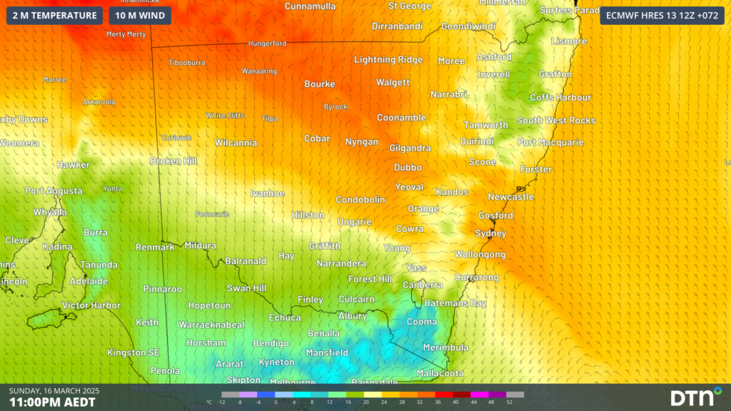
Image: Forecast temperatures and winds at 11pm AEDT on Sunday, March 16, showing heat across northern and central NSW, with the surge of colder southerly winds moving over southern NSW.
The southerly change will cause temperatures to drop into Monday with a forecast maximum in the mid 20s across the Sydney basin early next week.
How DTN APAC can help
DTN APAC supplies precise weather intelligence to over 75% of the National Energy Market (NEM); and is the trusted provider for the Australian Energy Market Operator (AEMO).
DTN APAC’s next-generation nowcasting and forecasting system, OpticastTM, is independently proven to outperform other industry models, allowing energy traders to respond rapidly to changing conditions. From 14 day forecasting to seasonal outlooks, you have access to complete and powerful weather intelligence giving you the confidence to make the best call.
Meeting the needs of the changing market, DTN APAC utilises high-resolution modelling and local knowledge to provide 5-min granularity observations and forecasts, optimising your market bidding and maximising your profits. These, coupled with briefings from our energy meteorologists, give you full awareness of the associated risk.
Benefit from specialised indices such as apparent temperature, Cooling/Heating Degree Days (CDD/HDD) and Effective Degree Days (EDD) to help accurately predict demand. You can get a clear picture of forecast conditions across the market and quickly assess heat/heatwave potential from 14 days out to 12 months
No matter where your energy trading focus lies, we have the power generation and weather insights to inform your critical decisions, keeping you ahead of the curve.
To find out more about our large range of products and services contact us at sales.apac@dtn.com




