Melbourne is forecast to have its coldest weekend in four years as a polar air mass spreads over southeastern Australia during the next few days.
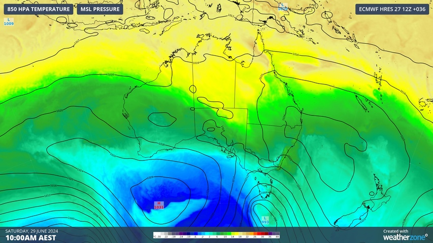
The animation below shows a large cold air mass reaching the southeast of Australia on Saturday and lingering across parts of Vic, Tas, NSW and SA into the first half of next week.
Video: Forecast 850 hPa temperature between today (Friday) and the middle of next week, according to the ECMWF-HRES model.
This polar air mass will combine with cloud, rain and wind to send shivers across southeastern Australia this weekend.
Melbourne won’t be too cold on Saturday morning thanks to northerly winds flowing over the city ahead of an approaching cold front. However, cloud and rain will develop in the morning before a blustery southwesterly change reaches the city in the afternoon. Cold air and chilly winds will then linger over Melbourne for the rest of the weekend in the wake of the change.
Melbourne’s warmest temperatures this weekend will be early on Saturday before things cool down noticeably from the afternoon. The city is only forecast to reach 12°C on Saturday and Sunday, which would make it Melbourne’s coldest weekend since August 2020.
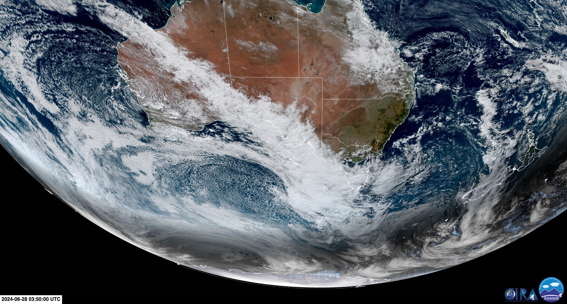
Image: Visible satellite image captured on Friday afternoon. The large field of speckled cloud to the south of Australia shows the located of the polar air mass making its way northwards. Source: RAMMB/CIRA
This weekend’s cold front will also cause vigorous winds over mountainous areas in central and northeast Vic and southern NSW. Severe weather warnings have been issued for damaging wind gusts in both states.
The mainland Alps should also see a nice top-up of natural snow as the polar air turn raindrops to snowflakes.
Stay up to date with the latest warnings if you are spending this weekend in southeast Australia’s High Country.
Weatherzone Business has grown to become the outright leader within the Australian energy market, serving wind, solar, hydro, trading, utilities and network companies.
You can’t control the weather, but you can gain precision insights to optimise your response. What lights us up is providing your energy business with tailored weather information to reduce your risk and keep you moving ahead of the curve.
Our services cover all aspects – from wind and solar generation to demand forecasts, wholesale markets to retail so, no matter where your company sits, we have solutions for you. We have worked closely with market participants to create products that meet the evolving needs of the sector, aiming to increase safety and profitability for our customers.
Benefit from the timely delivery of accurate weather information, allowing informed and effective decision-making. To find out more, please contact us at apac.sales@dtn.com.


