The snow coverage across much of Australia’s hydropower catchment area is scarce after Australia saw the warmest August on record, with lake levels also behind what we saw in 2023.
This was the scene at Perisher on Sunday morning, September 8.
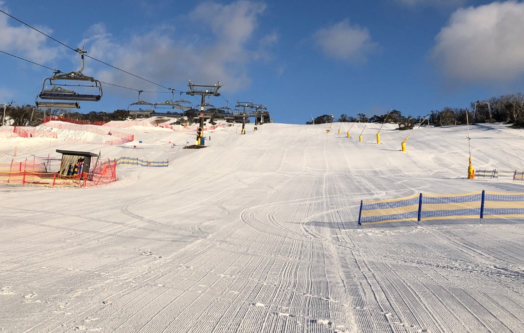
Image: The snow turns to the consistency of mashed potato in the afternoon, but the early morning turns are still nice. Source: Billy Jack via ski.com.au.
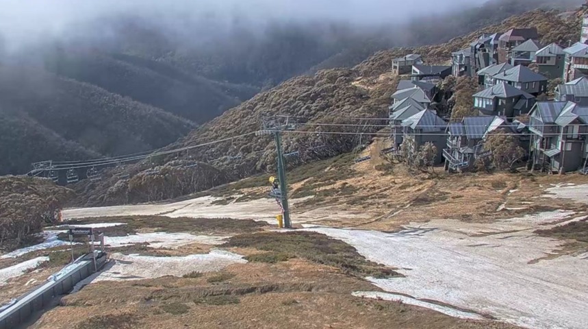
And this was the forlorn scene at Mt Hotham in Victoria this Monday morning.

Image: Hotham closed its lifts last Wednesday, September 4. Source: Ski.com.au.
At Thredbo on Monday morning, a little snow remained on the upper mountain with nothing lower down – although the Friday Flat beginner run at village level was still open on Monday with a thin cover of snow left over from snowmaking earlier this season.
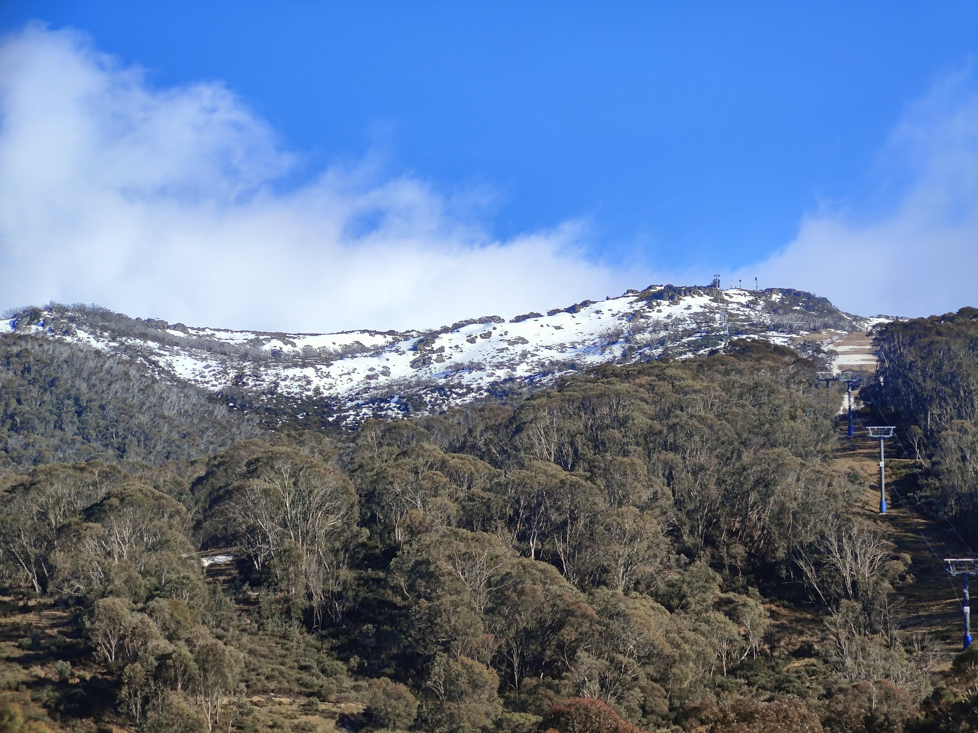
Image: Bring on mountain biking season. Source: Rusty J via ski.com.au.
READ MORE: ‘NEVER SEEN THE SNOW GO SO QUICKLY’
Australian snow seasons usually experience peak depth around this time of year, with snow sports often continuing at resorts through until the first weekend in October.
Not this year. Thredbo is slated to close this Sunday, September 15 (if it makes it), Falls Creek on Friday, September 13, while Perisher could remain open for another week or so.
The cause of the early season demise is no secret. Australia’s warmest August on record (by a huge margin) decimated the snowpack after things looked promising in the final week of July as depth topped a metre at Spencers Creek in NSW.
The graph below compares the 2022 (light blue line) and 2024 (dark blue line) seasons.
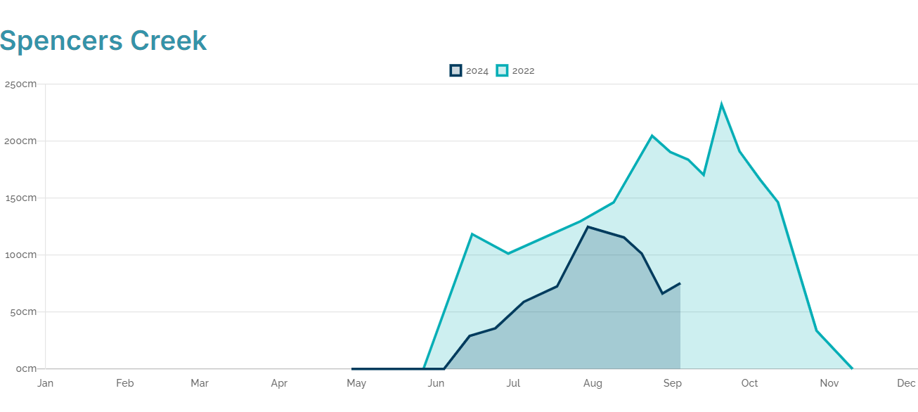
Image: Towards the end of July, the two seasons had similar depths, but while 2022 kicked on with a remarkably late season peak occurring on September 20, 2024 pretty much went off a cliff. Source: Snowy Hydro.
You might notice a brief upward tick in the dark blue line due to a quick snowfall last week. Unfortunately, locals say the snow from that event melted within a day, while huge snow loss has been recorded since then in two heavy rain events. The next official depth reading in a week or so will no doubt tell that tale.
The images below show the lake levels in Snowy Hydro’s scheme, with 2024 well below 2023 lake levels.

Image: Lake levels 2023 vs 2024 Source: Snowy Hydro.
Looking ahead, there are no significant snowfalls in the forecast, and while a few flakes will fall later this week, it’s safe to say that the 2024 season is pretty much dead over. While there will be some snow melt of the raining snowpack, the water flux into the lakes will not be at the volumes we usually expect in spring.
Hydropower
Using Opticast’s nowcasting and forecasting capabilities, you will have long-term outlook covering rainfall and extreme heat events out to 12 months. This can significantly improve your planning as you integrate the data with site-specific hydrological parameters.
With renewables making up more of Australia’s energy mix every year, we want to support your business to make informed critical decisions and improve your overall generation and safety. For more information, please contact us at apac.sales@dtn.com.


