Snow has fallen overnight in Australia’s alpine regions and continues to tumble down on Tuesday morning as a cold front sweeps across southeast Australia, kick starting the hydropower season.
As a heavy band of moisture crossed the alpine region just before 9 am Tuesday, this was the scene at Perisher in NSW, where the snow stake revealed accumulation of at least 5 cm of fluffy flakes.
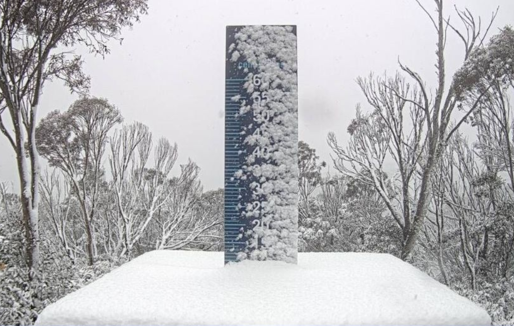
Image: Locals report between 5 and 10 cm, most of which fell in quick heavy burst. Source: Perisher.
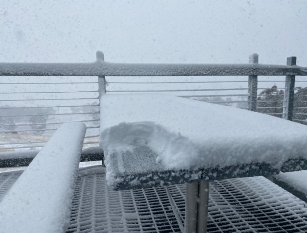
Intrepid Snowy Mountains local Steve Smith got out the winter boots and hiked up the slopes of Perisher on Tuesday morning, getting as far as the Mid-station restaurant, where the tables revealed about a beer can’s depth of accumulation.
Image: Snow was on the menu despite the Perisher Mid-Station restaurant being closed. Source: Steve Smith.
Snow also fell at the Victorian ski resorts, initially settling to about 1600 metres above sea level, as the distinct snowline on the image below shows.
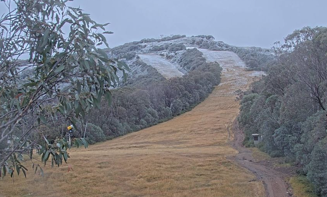
Image: Snow on the Little Buller Spur ski run from the initial moisture band. Source: Mt Buller.
In the colder air behind the front, snow is now falling to lower levels, with snow being reported on the road up to Mt Baw Baw, where the village sits on about 1460m.
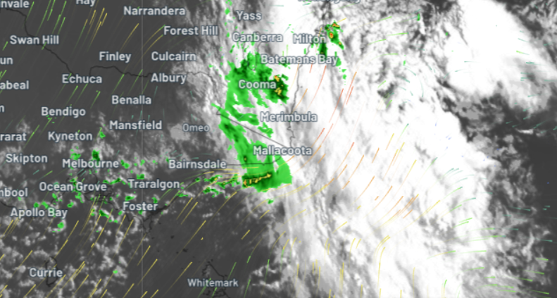
The image above shows the heavy moisture band crossing the Snowy Mountains of NSW just before 9 am. In Melbourne and surrounds, you can see the tell-tale speckled airmass associated with these sort of weather systems that bring the frequent heavy showers punctuated by brief sunny spells.
Melbourne is heading for a top of just 16°C today which would make it the coldest day of the year to date. The coldest air should reach Canberra before lunchtime while Sydney won’t feel the wintry blast until the early afternoon.
This system will bring a general drop in temperatures to southeastern Australia that will last most of the week. While occasional showers will persist for a few days in southern coastal Victoria, the moisture will clear out quite quickly in inland areas, with cold nights ahead.
As the low takes up residence over the southern Tasman Sea for the next couple of days, strong winds and big swells will lash the NSW coast with wave heights expected to reach 5-7 metres by Wednesday morning. A Severe Weather Warning for damaging winds for parts of the NSW coast has just been issued.
Hydropower
Using Opticast’s nowcasting and forecasting capabilities, you will have long-term outlook covering rainfall and extreme heat events out to 12 months. This can significantly improve your planning as you integrate the data with site-specific hydrological parameters.
With renewables making up more of Australia’s energy mix every year, we want to support your business to make informed critical decisions and improve your overall generation and safety. For more information, please contact us at apac.sales@dtn.com.


