A large pool of hot air will spread across Australia in the opening week of November, giving many parts of the country an early taste of summer.
A stubborn ridge of high pressure to the south of Australia has been allowing hot air to build over the country’s northwest in the final days of October. This weather pattern caused exceptionally high temperatures in WA’s Pilbara district last weekend.
On Saturday, the temperature reached 45.3°C in Roebourne, which was the highest October temperature observed anywhere in Australia for 15 years. Port Hedland also reached 44.9°C on Saturday and 44.3°C on Sunday, which was 9-10°C above average for this time of year.
The heat will continue to brew over northwestern Australia in the coming days before a cold front crossing southern Australia helps drag the hot air towards Australia’s southern states later this week.
The maps below show the forecast daily maximum temperatures over the next 10 days, according to one computer model.
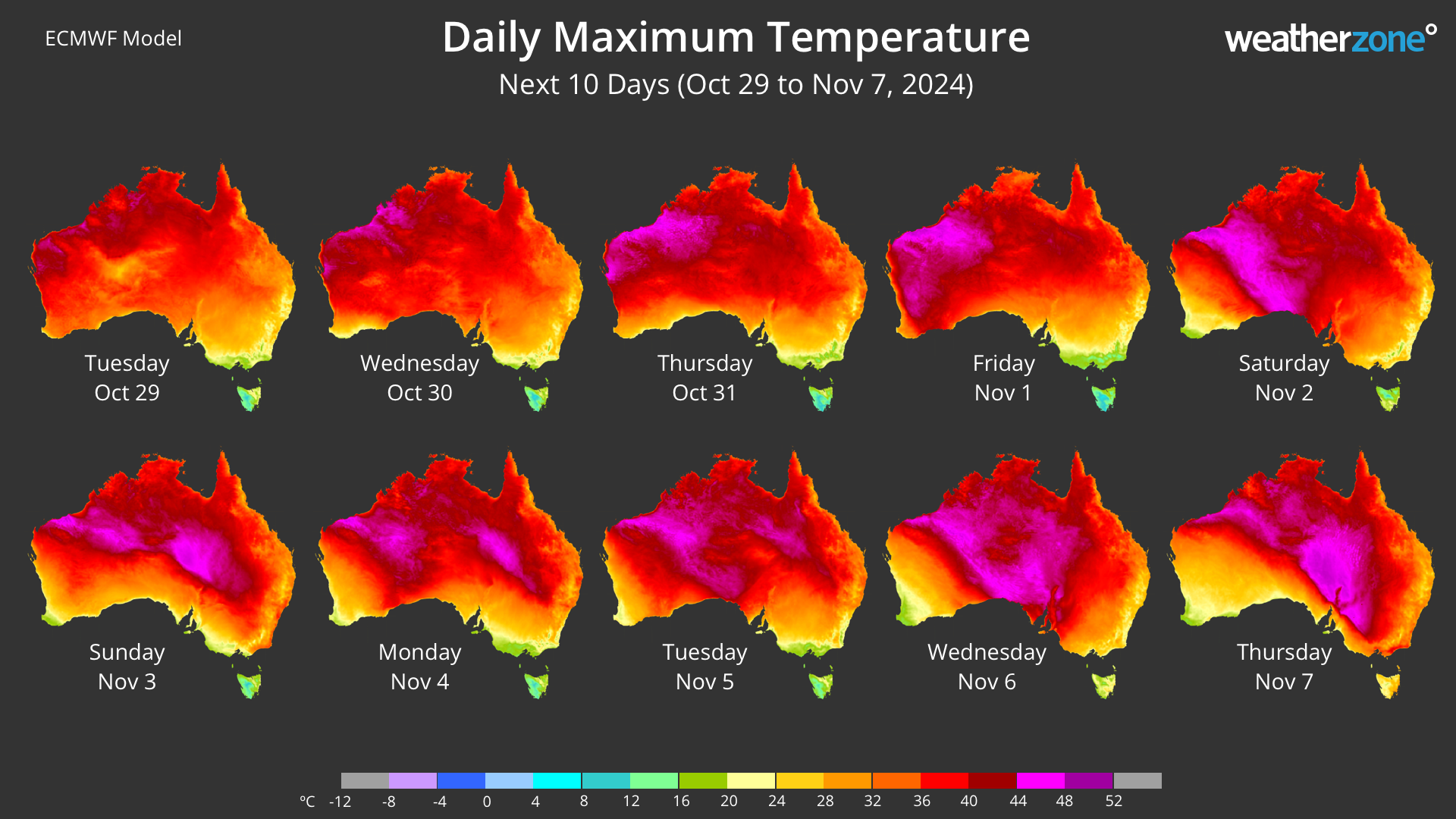
Image: Forecast daily maximum temperatures between October 29 and November 7, 2024, according to the ECMWF-HRES model.
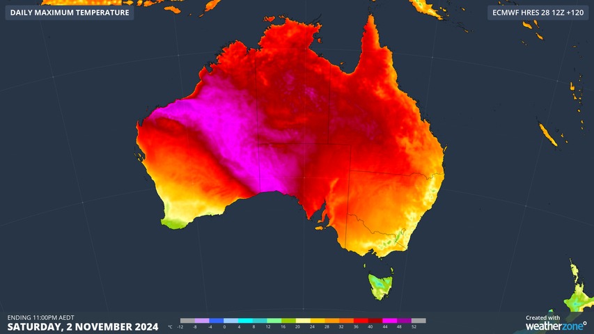
The image above shows a tongue of heat spreading over SA on Saturday and into eastern Australia from Sunday. A second wave of heat is then expected to drift across central and southern Australia next week.
The highest temperatures over the next 10 days are likely to occur in central and northwestern Australia, where some places could reach the mid-forties. Parts of NSW, Qld, SA, the NT and WA will exceed 40°C this week.
The late-spring heat will also be felt in some of Australia’s state capital cities, particularly in the southern and eastern states.
- Perth is forecast to exceed 30°C between now and Thursday.
- Adelaide should reach the high twenties on Wednesday and may approach the mid-thirties this Saturday.
- Melbourne could have a couple of days in the high twenties or low thirties this weekend.
- Canberra should reach about 25 to 27°C between Tuesday and Thursday and could nudge 30°C this Sunday.
- Sydney’s will most likely venture into the high-twenties on Sunday and Monday, although its western suburbs could have a few days above 30°C over the next week, possibly even reaching the mid-thirties this Sunday.
- Hobart could hit the mid-twenties this Sunday.
- Brisbane should have a few days near or above 30°C this week and early next week.
- Darwin will see maximum temperatures around 33 to 36°C over the coming week.
The impending heat is also likely to combine with strengthening winds to elevate fire danger ratings in parts of southern Australia, particularly in SA on Saturday and Vic on Sunday.
Weatherzone Business has grown to become the outright leader within the Australian energy market, serving wind, solar, hydro, trading, utilities and network companies.
You can’t control the weather, but you can gain precision insights to optimise your response. What lights us up is providing your energy business with tailored weather information to reduce your risk and keep you moving ahead of the curve.
Our services cover all aspects – from wind and solar generation to demand forecasts, wholesale markets to retail so, no matter where your company sits, we have solutions for you. We have worked closely with market participants to create products that meet the evolving needs of the sector, aiming to increase safety and profitability for our customers.
Benefit from the timely delivery of accurate weather information, allowing informed and effective decision-making. Please visit our website or email us at apac.sales@dtn.com.


