
Melbourne is shivering through its first extremely cold morning of the week, with the potential to see one of the coldest weeks in 11 years on the horizon.
The temperature at Olympic Park in Melbourne dropped to 3.8°C early Tuesday morning, July 2, which could be the first of many extremely cool nights.
As of 11am, the temperature in Melbourne just reached double digits and is only expected to climb to around 13°C this afternoon.
The cool days and nights are being caused by a very cool airmass sitting over southeastern Australia, under the influence of a stubborn high-pressure system which is not expected to move until late this week into next.
The image below shows that the extremely cold airmass that was forecast over southeastern Australia earlier this morning.
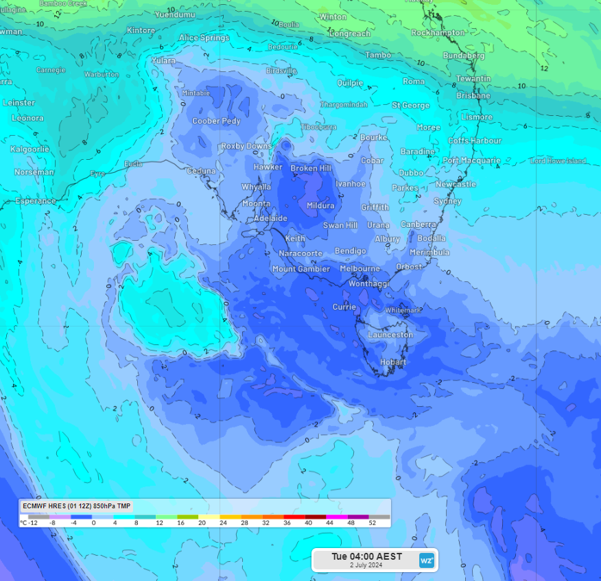
Image: 850 hPa temperature (1.5km above the surface) at 4am AEST on Tuesday, July 2, according to ECMWF
Thanks to this stagnant weather pattern, Melbourne could see a week-long run of mornings at or below 5°C. If this were to happen it would be the first time since June 2013, the coldest week in 11 years.
The coldest morning of the week is forecast for early Wednesday morning, with Melbourne’s minimum expected to drop to 1°C, which is 5°C below the July average.
To the west and southwest of Melbourne, along the gas distribution network, temperatures are forecast to be freezing.
Horsham, Bendigo, Ballarat are all forecast to drop to between –1°C and -3°C on Wednesday morning, which could affect gas distribution in the regions. Thursday morning looks slightly warmer with minimums around 0°C forecast.
The cool overnight temperatures come at a time of low wind power in Victoria which may also impact the energy grid.
The cool morning starts will mean that temperatures should remain around 2 to 3°C below average for much of this week.
So, when is it going to warm up and become windy again?
Temperatures will trend to slightly above average from Sunday into early next week as the stubborn high-pressure system slowly begins to move east directing northerly winds across Vic.
There are signs that we could finally see a cold front and strong winds move across Vic later next week, which should increase wind power in the region.
Weatherzone Business has grown to become the outright leader within the Australian energy market, serving wind, solar, hydro, trading, utilities and network companies.
You can’t control the weather, but you can gain precision insights to optimise your response. What lights us up is providing your energy business with tailored weather information to reduce your risk and keep you moving ahead of the curve.
Our services cover all aspects – from wind and solar generation to demand forecasts, wholesale markets to retail so, no matter where your company sits, we have solutions for you. We have worked closely with market participants to create products that meet the evolving needs of the sector, aiming to increase safety and profitability for our customers.
Benefit from the timely delivery of accurate weather information, allowing informed and effective decision-making. To find out more, please contact us at apac.sales@dtn.com.


