Prosper in a dynamic world
Search

Coldest morning in 5 years for parts of NSW, QLD, ACT

A large area of Australia’s southeast inland just shivered through the coldest morning in five years, with one location registering Australia’s lowest June temperature since 2019.

Wednesday morning was an icy affair across southeastern Australia as a slow-moving high pressure system caused clear skies and light winds to combine with a lingering cold and dry air mass. This wintry weather pattern resulted in widespread frost from Tasmania up to Queensland.

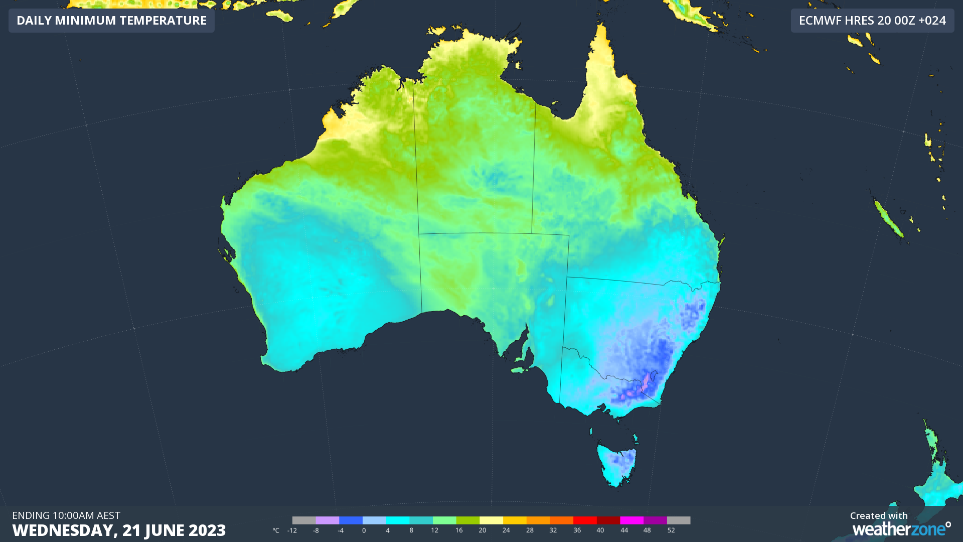
Image: Modelled minimum temperatures on Wednesday morning, according to the ECMWF-HRES model.

Here are some of the standout minimum temperatures from Wednesday morning:

  • Canberra’s low of -7.2ºC was its lowest temperature since 2018 and the lowest for June since 1986
  • Sydney’s 5.2ºC was the city’s coldest June morning since 2010
  • Newcastle (Nobbys Head) hit 4.3ºC shortly after 7:00 am, which was its coldest morning in 23 years
  • Bathurst (-7.5ºC), Mudgee (-6.9ºC), Orange (-6.6ºC), Dubbo (-4.7ºC), Campbelltown (-1.6ºC), Casino (-0.2ºC) and Gayndah (0.3ºC) all had their coldest morning in five years
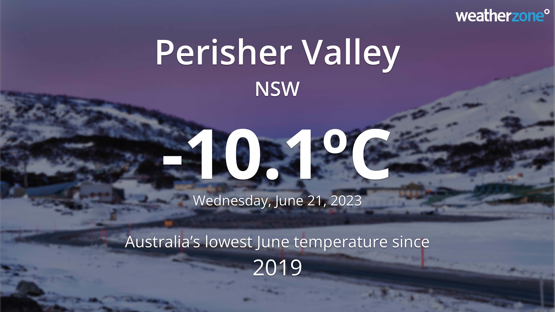
  • Perisher Valley’s -10.1ºC was Australia’s lowest June temperature since 2019
  • Tocal’s -0.3ºC was its lowest June temperature in records dating back to 1970

Temperatures also dropped as low as -7.2ºC in Victoria (Mount Hotham Airport) and -6.3ºC in Tasmania (Liawenee). Queensland’s lowest temperature on Wednesday morning was -3.5ºC at Applethorpe. The ACT’s lowest temperature was Canberra’s -7.2ºC.

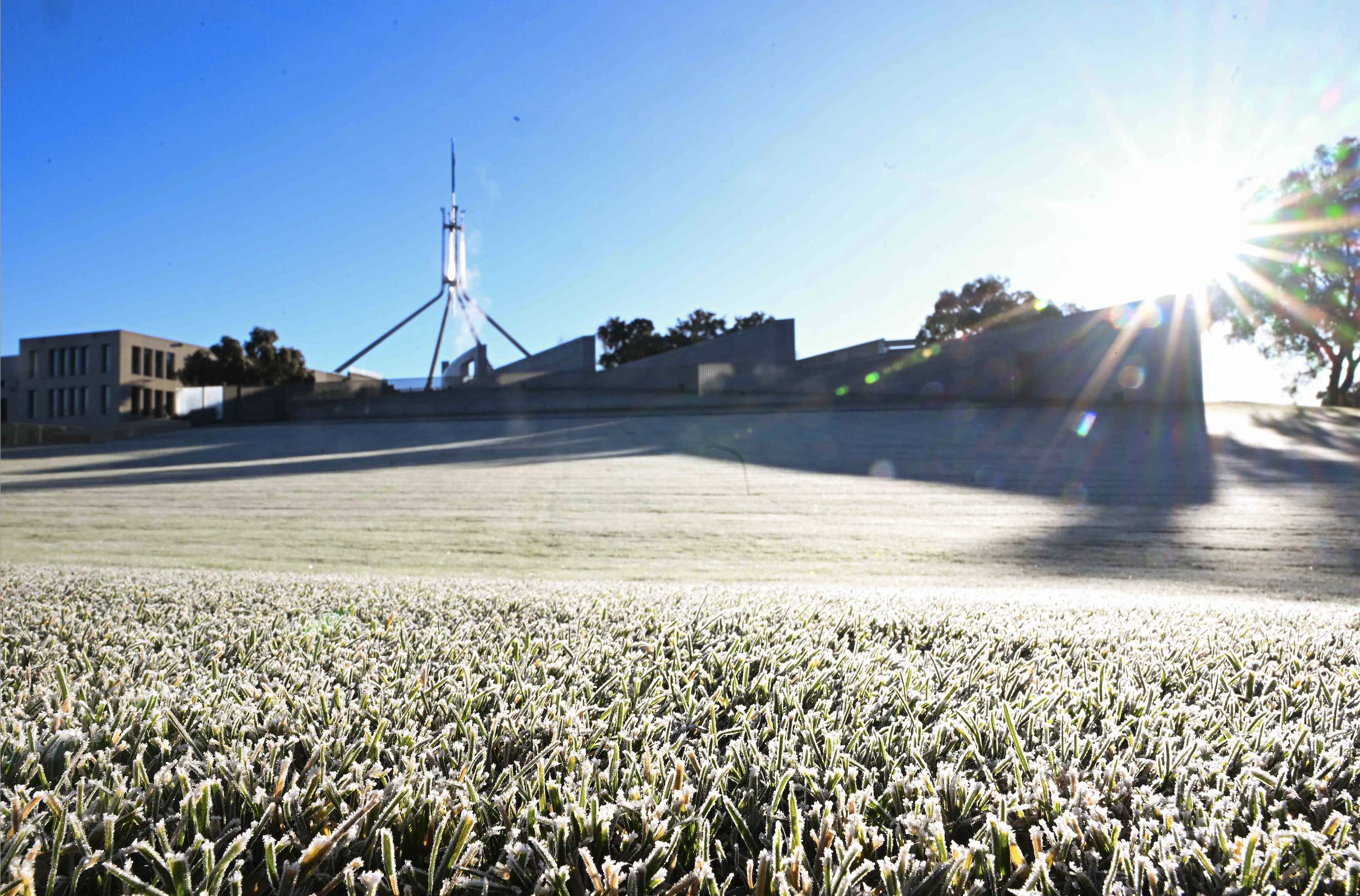
Image: Frost on Federation Mall in Canberra on Wednesday morning. Source: AAP / Mick Tsikas

DTN APAC can provide super-rapid forecast updates every 5 minutes so you can stay ahead of the competition. To find out more, please visit our website or email us at apac.sales@dtn.com.

Latest news

Satisfy your weather obsession with these news headlines from around the nation, and the world.

The 2026 Indian Southwest Monsoon onset is expected in the next two weeks

The Indian Southwest Monsoon will reach India in the next two weeks, but a developing El Niño could signal a drier than normal monsoon for businesses and major industries across the country. Southwest monsoon onset over southern India in the next two weeks The Indian Meteorological Department (IMD) is responsible for tracking the advance and […]

Rapid El Niño signal accelerating risk for Australian businesses

El Niño–favourable conditions are gathering pace across the tropical Pacific, with key ocean indicators approaching threshold levels and early atmospheric responses emerging.  While uncertainty remains around final El Niño strength, historical analogues show that even weak events can generate widespread impacts, including reduced rainfall, warmer daytime temperatures, increased frost risk, elevated fire danger, reduced tropical cyclone activity, and more. Industries including […]

Australia’s 2025–26 Cyclone Season: Slightly Above Average, Dominated by Severe Systems

Australia has just experienced a highly impactful tropical cyclone season, with more than 60% of systems reaching severe intensity, causing widespread disruption and damage to communities and multiple industries across northern Australia.  The 2025–26 Australian tropical cyclone season officially ran from 1 November 2025 to 30 April 2026. During this six-month period, Australia saw 11 tropical cyclones, with nine […]

What does a ‘super El Niño’ mean for Australia’s businesses?

There are signs that a very strong, or ‘super’ El Niño could develop in the tropical Pacific Ocean later this year. So, what does this mean for Australia’s weather during the second half of 2026? El Niño on the horizon The tropical Pacific Ocean is currently in a neutral state, meaning neither El Niño nor […]