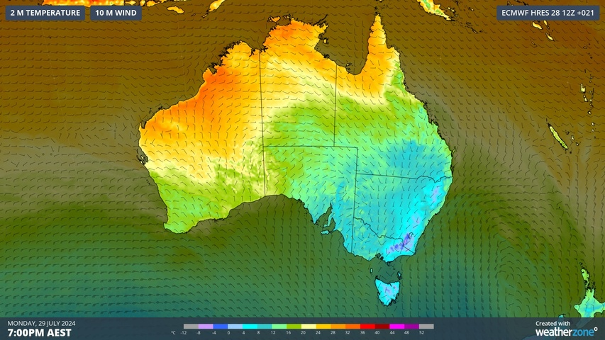
A wintry chill will grip parts of eastern and southeastern Australia this week as dry and cold air combines with blustery winds to cause the type of cold that cuts straight through a cardigan.
A cold air mass associated with a strong cold front caused temperatures to plummet across southeastern Australia late last week. This pulse of polar air delivered powder-like snow to the Australian Alps and even caused snow to reach unusually low levels outside the alpine regions.
The weekend’s cold weather is now spilling into the new week and looks set to stick around in parts of southeastern Australia for the next few days.
A low pressure system over the Tasman Sea and a high pressure ridge centred over southeastern Australia will allow the cold air mass to linger over parts of NSW, Vic, Qld, Tas and the ACT over the next few days and nights. A steep pressure gradient between these low and high pressure systems will also cause brisk southerly winds in some areas, exacerbating the cold weather.
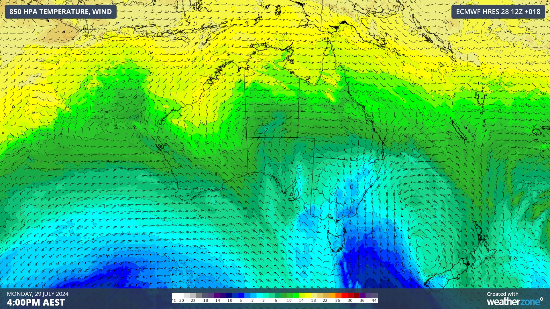
Image: Modelled 850 hPa air temperature and wind speed on Monday afternoon, showing a cold air mass being driven over southeastern Australia by southerly winds.
Sydney was one of the many places in southeastern Australia feeling the wintry chill on Monday. Shortly after 1pm AEST, the feels like temperature at Sydney Airport was sitting just above 1°C thanks to wind sustained speeds above 50 km/h and dew points below 4°C.
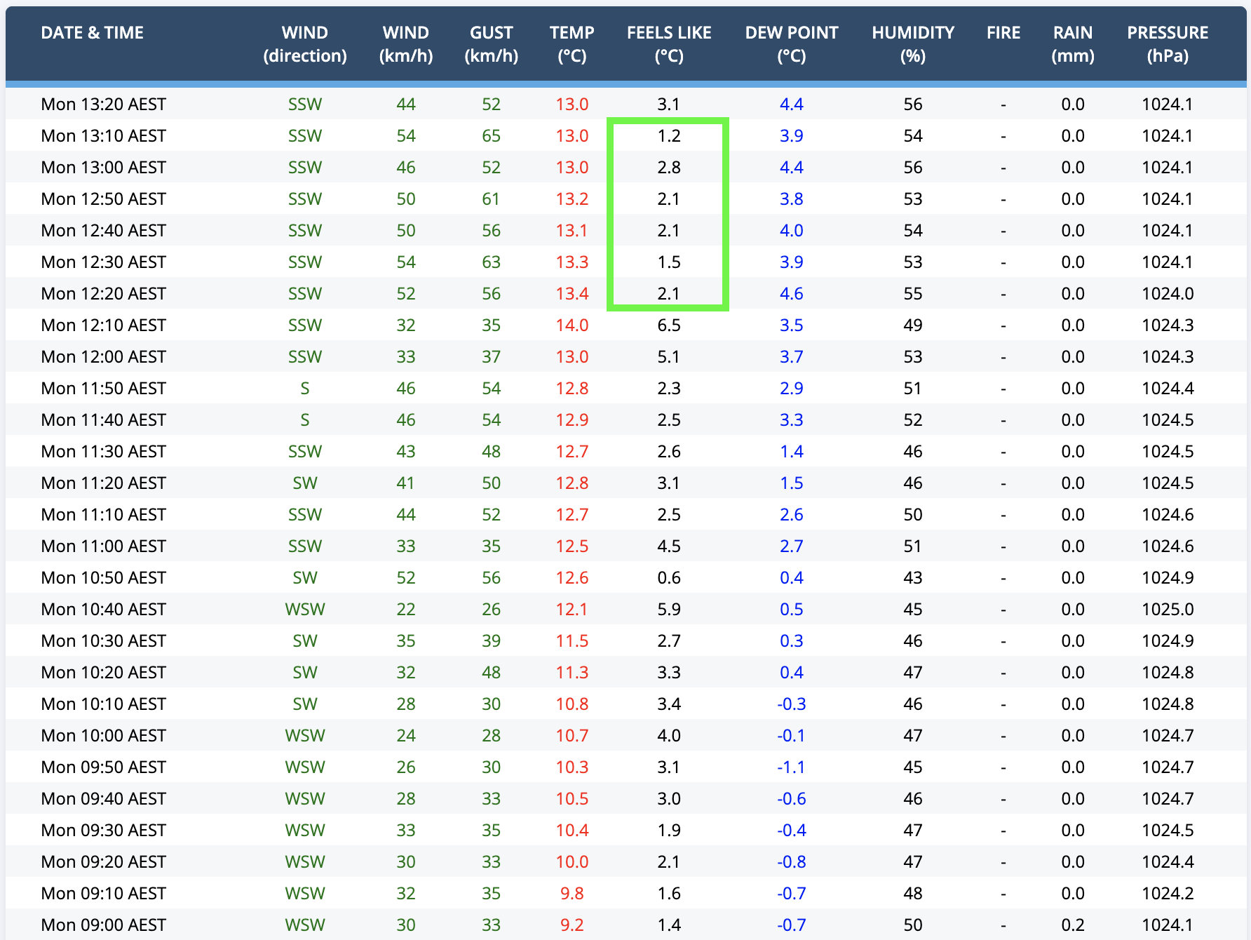
Image: Sydney Airport observations on Monday morning. The green box highlights ’feels like’ temperatures at lunchtime. Anyone enjoying the fresh snow in the mainland Alps on Monday was also contending with unfathomable wind chill. At Mount Hotham, 80 km/h wind speeds and air temperatures close to -9°C were making it feel like -27°C in the morning.
Other notable feels like temperatures in southeastern Australia on Monday morning included -8.8°C at Canberra and 3.7°C in Brisbane around 7am AEST.
Looking ahead, maximum and minimum temperatures will remain lower than average across a broad area of southeastern Australia for the next few days and nights. Amid this lingering wintry weather, Sydney might not feel warmer than 10°C until Thursday, so rug up!
Weatherzone Business has grown to become the outright leader within the Australian energy market, serving wind, solar, hydro, trading, utilities and network companies.
You can’t control the weather, but you can gain precision insights to optimise your response. What lights us up is providing your energy business with tailored weather information to reduce your risk and keep you moving ahead of the curve.
Our services cover all aspects – from wind and solar generation to demand forecasts, wholesale markets to retail so, no matter where your company sits, we have solutions for you. We have worked closely with market participants to create products that meet the evolving needs of the sector, aiming to increase safety and profitability for our customers.
Benefit from the timely delivery of accurate weather information, allowing informed and effective decision-making. To find out more, please visit our contact page or email us at apac.sales@dtn.com.


