A broad high pressure system and dry desert air have brought on a bitterly cold night across southeastern Australia, while NSW will be in for its big freeze on Thursday.
Temperatures fell four to nine degrees below the July average across large parts of eastern SA, northern and western Victoria, the ACT, and southern NSW on Wednesday morning.
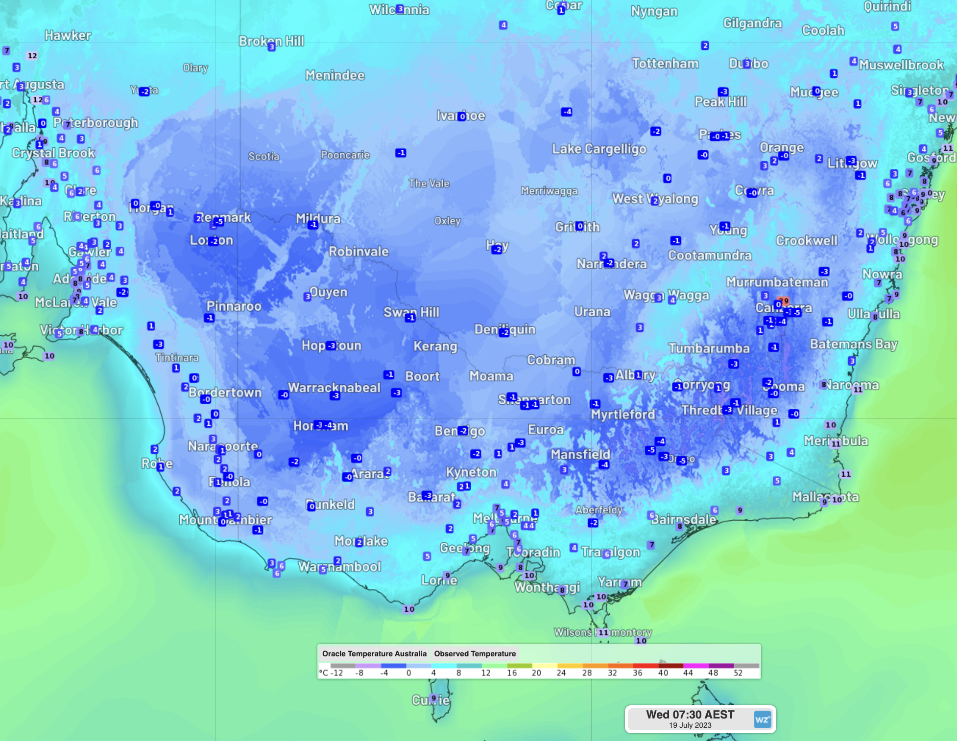
Image: Observed temperatures over the southeast at 7:30am EST Wednesday
Horsham was one of the coldest locations early Wednesday, falling to a crisp –4°C, while Nhill shivered at –3°C. Both locations had their coldest July morning in 25 years, and their coldest morning for any month since June 2006.
Over the border in SA, Remark (-5°C), Murray Bridge (-4°C), and Padthaway (-3°C) were some of the standout cold temperatures, with these and nearby locations all seeing their coldest July morning in eight years. Adelaide and surrounding suburbs were mostly too windy for a really cold night, but a break in the winds around 6am allowed the temperature to quickly fall by 5°C or so in about an hour.
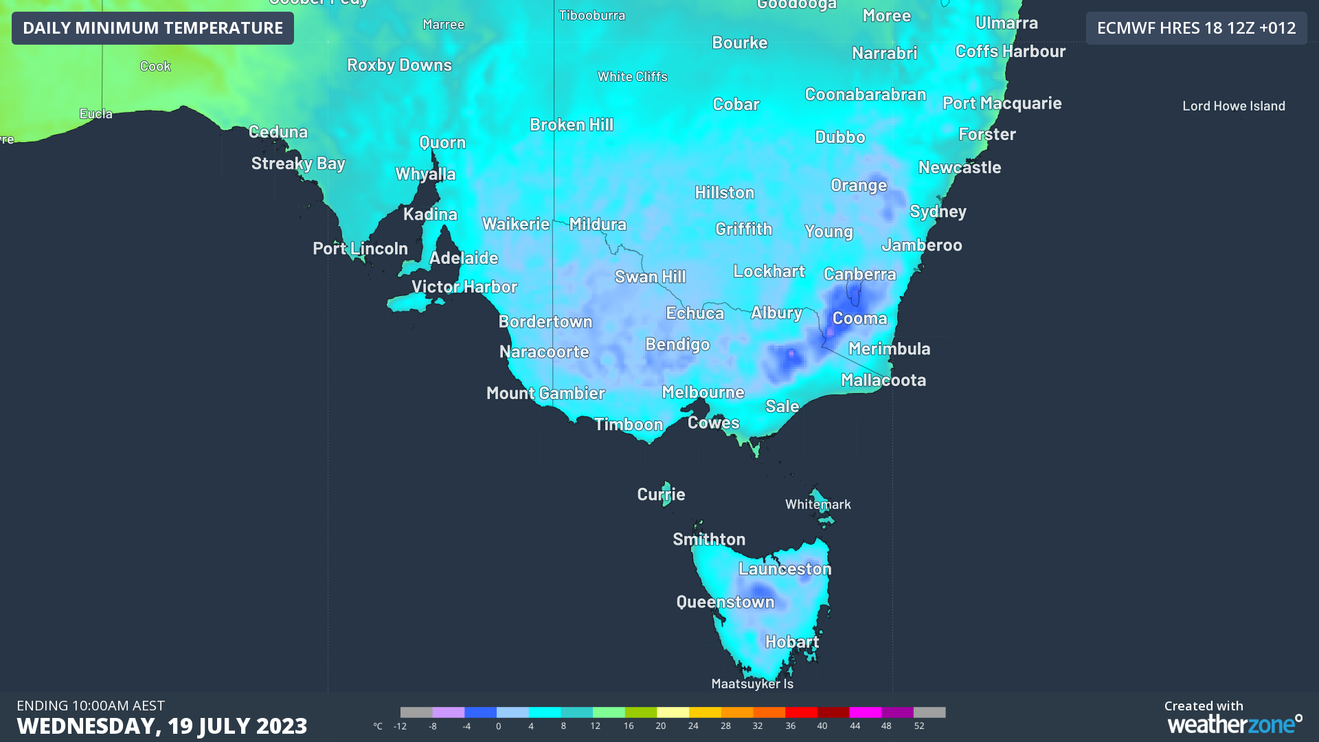
Southern NSW (like –6°C at Thredbo) and the ACT (-5°C at Canberra) had a cold one on Wednesday morning but will likely get even colder on Thursday when the high sits directly overhead.
While high pressure systems during winter often supply the clear skies and light winds necessary for these seriously cold nights, this particular system had the benefit of very dry desert air.
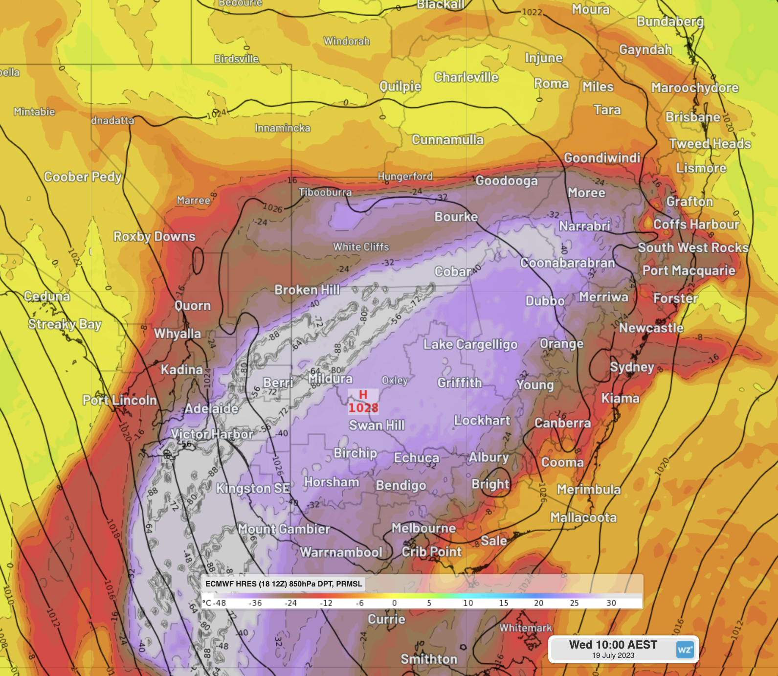
Image: Mean Sea Level Pressure and 850hPa (about 1.5km elevation) dew point temperatures on Wednesday. Areas in purple and white are exceptionally dry, containing virtually no moisture at all.
When the dry air sits just above the surface, it helps the air close to the ground dry out faster. By removing some of the ground moisture, it prevents or delays fog and dew formation, allowing the temperature to fall lower than it otherwise would have.
As alluded to earlier, NSW, the ACT and eastern Vic are likely to be even colder than this morning on Thursday. Large parts of the tablelands, slopes and plains are likely to see sub-zero temperatures, and several locations should see the mercury fall below -4°C.
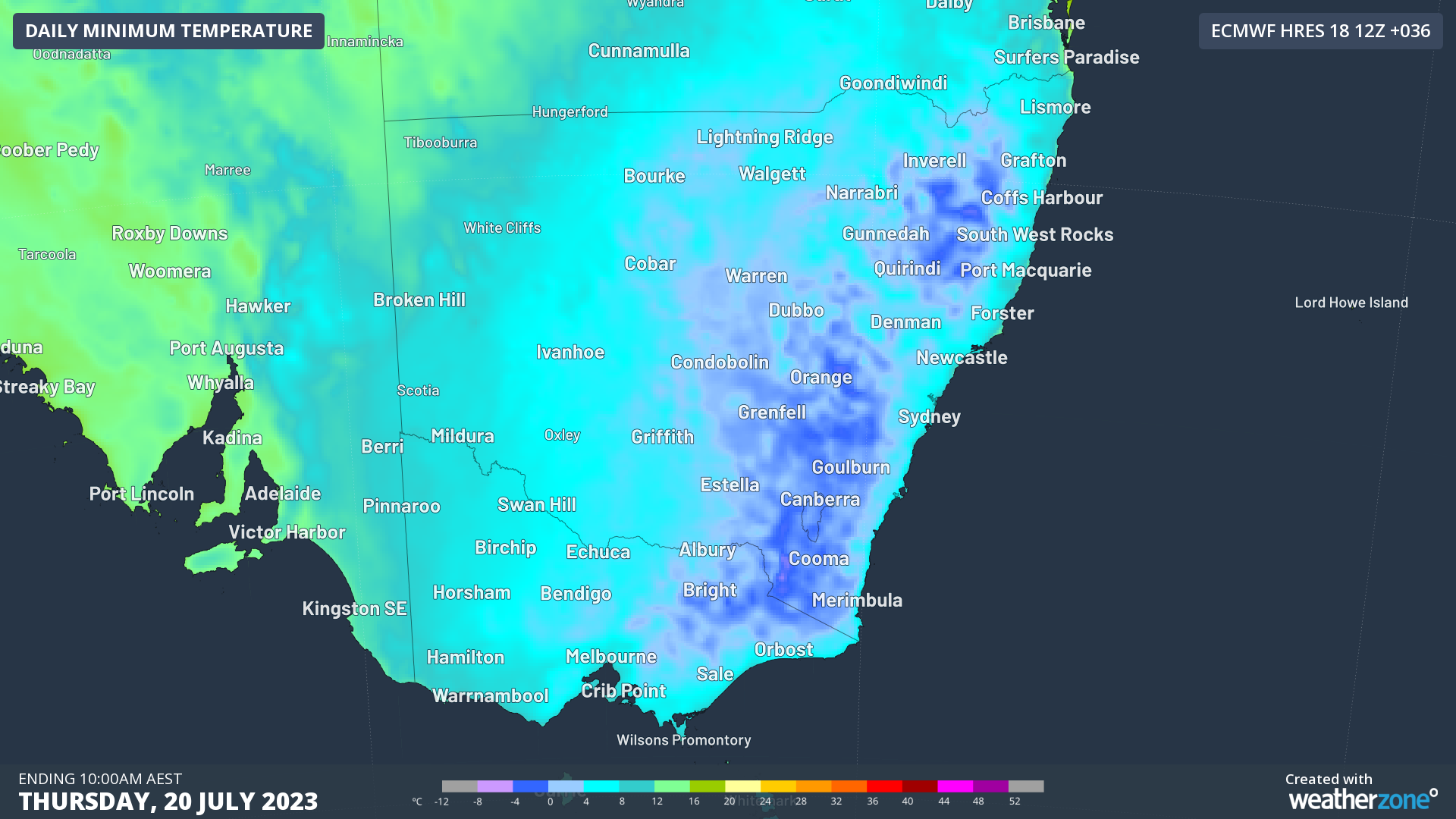
Image: Forecast minimum temperatures for Thursday morning. All the areas in dark blue are forecast to fall below zero.
Frost and Sheep Graziers’ warnings related to the cold are still present for the southeastern states, and will likely be reissued for tonight. Stay tuned tomorrow morning for some of the important stats on Thursday’s cold morning.
DTN APAC provides detailed wind, solar and energy forecasts to our energy clients across Australia. For more information, please visit our website or contact us at apac.sales@dtn.com.


