An unseasonably cold blast is sweeping across southeastern Australia, bringing a mixed bag of snow, hail, thunderstorms and rain to the region.
The cool air spread through the southeast on Wednesday behind a strong cold front that is now sitting in the Tasman Sea.
The image below shows forecast air temperatures around 1.5km above sea level on Wednesday night, showing the cool airmass moving over parts of SA, VIC, Tas, NSW, and the ACT.
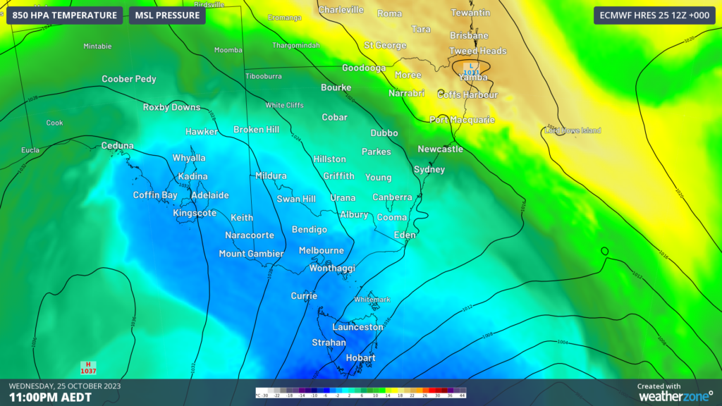
Image: 850 hPa temperature at 11pm AEDT on Wednesday, October 25.
The cool airmass caused temperatures to plummet overnight on Wednesday, with parts of SA, Vic and NSW recording the coolest late spring temperature in decades.
Here are some of the lowest minimum temperatures recorded last night;
- Keith West in SA recorded the lowest temperature on record this late in spring, with a minimum of -3.3°C
- Adelaide recorded the coolest morning this late in the year for 77 years, with the temperature plummeting to a chilly 5°C
- Ceduna’s temperature dropped to –0.1°C, which was its coolest October minimum temperature in 40 years.
- Goulburn, Cowra, Wagga Wagga, Cabramurra all recorded their coolest October overnight temperature in 10 years, with Goulburn’s temperature dropping to a freezing –4.7°C
- Hunter’s Hill in Victoria also saw their coolest morning in 10 years.
The temperatures were cool enough for snow to fall in Tas on Wednesday, with a dusting of snow at Mount Wellington pictured below.
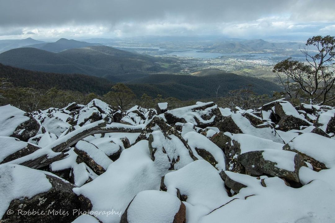
Image: Snow on Mount Wellington, Tas, Source: Robbie Moles Photography
Small hail also fell across parts of Victoria on Wednesday, with hail sighted in the Docklands in Melbourne and Bullengarook to the city’s northwest.
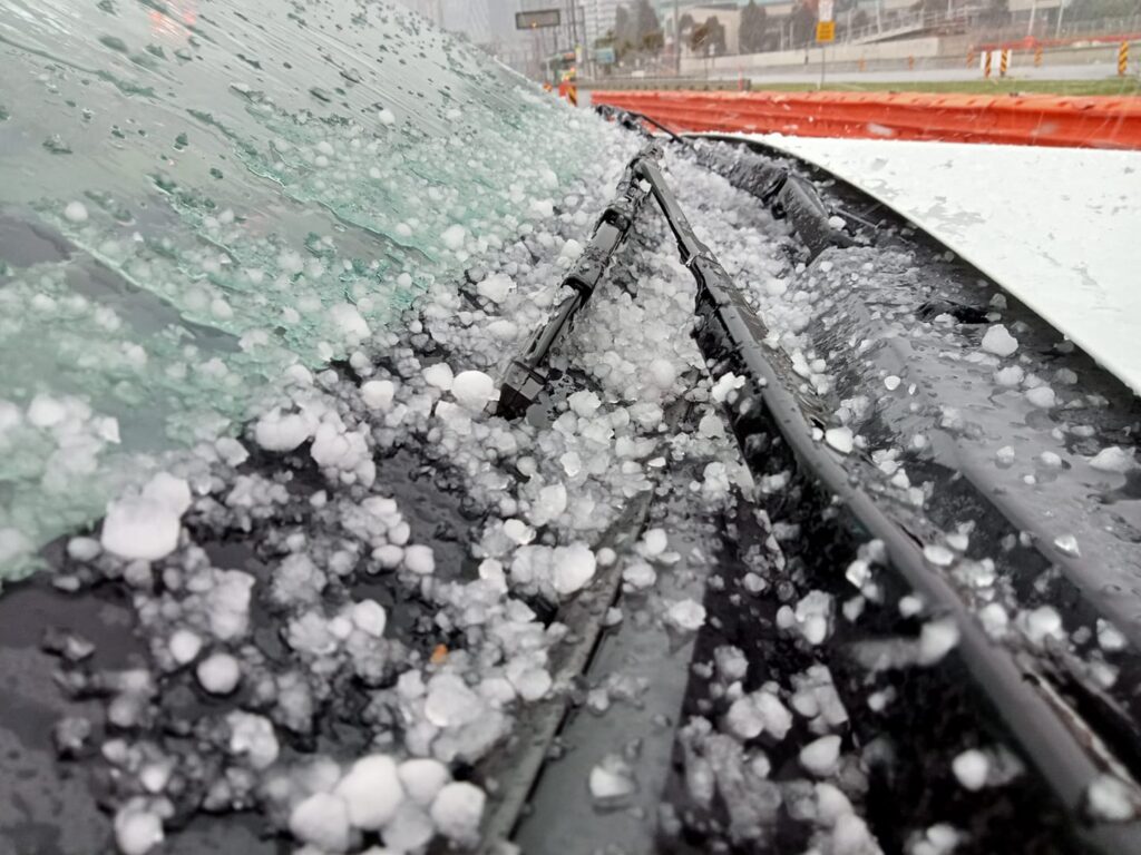
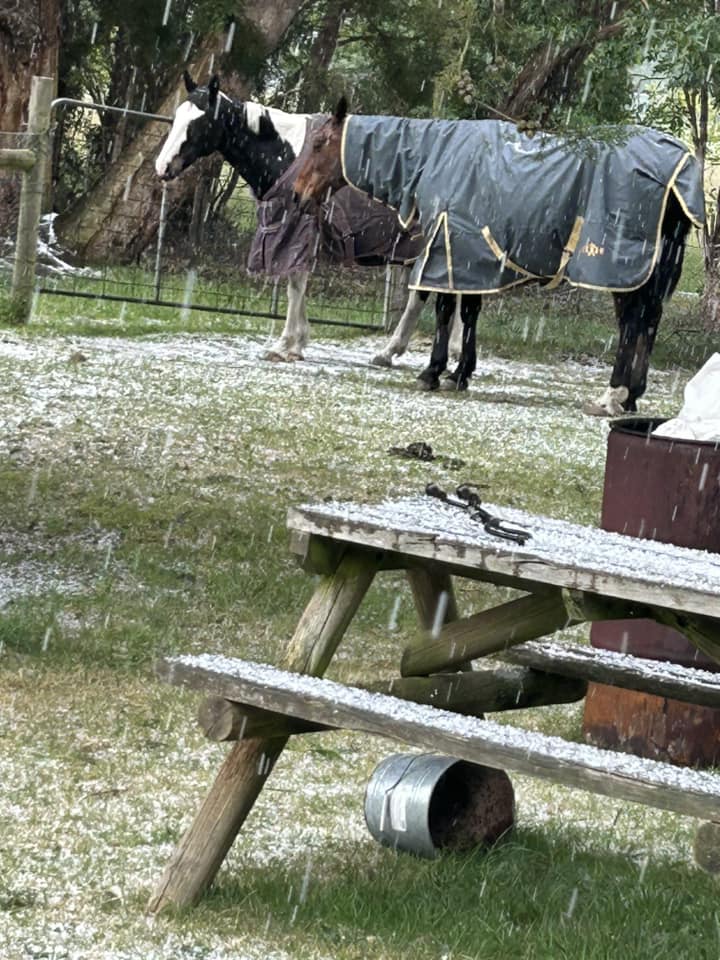
Images: Hail in Melbourne (top) and Bullengarook (bottom) on Wednesday, October 25, Sources: Matt Bradfield Photography (top) and FB Bronwyn West (bottom)
There will be little relief from the cold temperatures on Thursday, with daytime temperatures forecast to be 6-13°C below average for large areas of NSW, ACT, Vic, and southwest Qld.
Low-level snow is expected to fall in the Vic, Tas and NSW alps on Thursday, with snow expected down to 800 metres.
Severe thunderstorms will strike southeast Qld on Thursday afternoon and evening, with large hail, damaging winds and heavy rain all likely, as we mentioned here.
The system will also bring rainfall to parts of eastern NSW, which could help bring under control some of the fires burning in the region.
Sydney is also feeling the cold on Thursday with the city expected to top only 19°C, with showers, cloud and cool winds making it feel much cooler
Looking ahead, the southeast will warm up again later this weekend, as clear skies return to the region.


