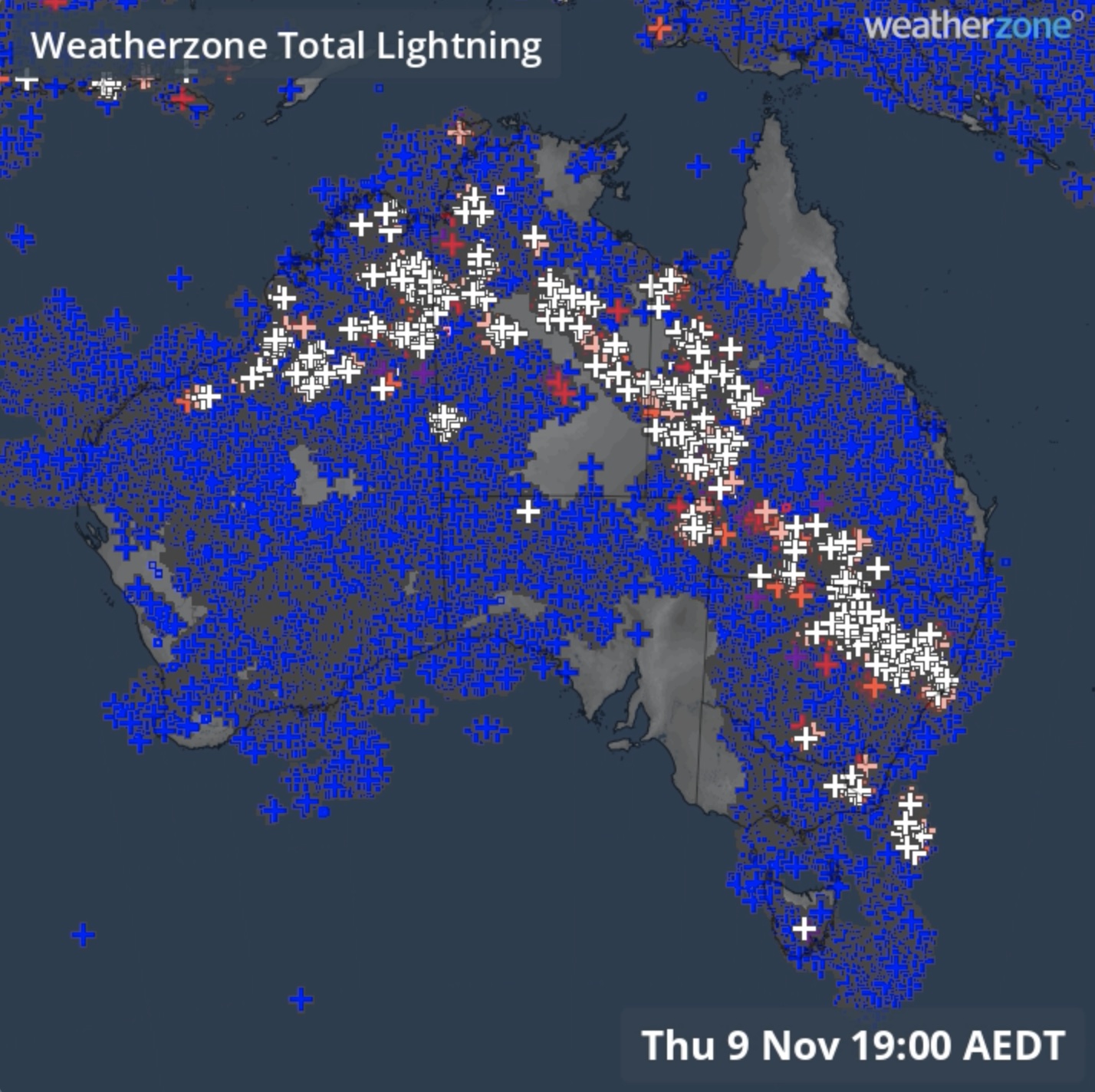
More than 8 million lightning strikes were detected over the Australian region in the past week during a prolonged outbreak of thunderstorms that will continue into the middle of November.
Late-spring is always a ripe time for thunderstorms in Australia. At this time of year, warm air over the Australian continent interacts with much colder air originating over the surrounding oceans. These contrasting air masses create an unstable atmosphere that can give rise to thunderstorms when moisture is added to the equation.
This week has featured an ideal mix of ingredients for thunderstorms over Australia, with an abundance of warm and moisture-laden air near the surface and waves of colder air higher elevations in the atmosphere.
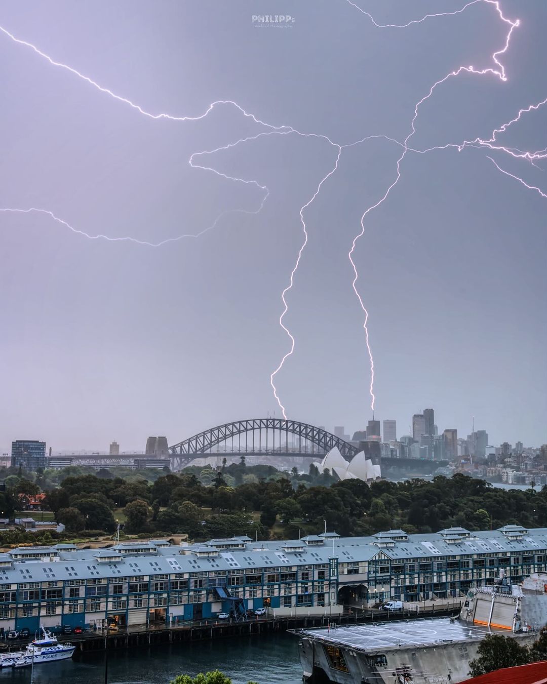
Image: Lightning over Sydney on Thursday, November 9, 2023. Source: @philipps.world.of.photography
The result of this volatile weather setup has been daily thunderstorm activity above Australia for the past seven days, with storms occurring above part of every state and territory at some point in the last week.
The animation below shows how the thunderstorm activity unfolded, with each white cross representing a cloud-to-ground lightning strike.
Video: Lightning strikes detected over Australia by the Total Lightning Network in the last seven days.
The past week’s prolific thunderstorm activity produced 8.25 million lightning pulses during the 7-day period starting at 9am, November 3 and ending at 9am, November 9.
Rain from these storms has been welcome in some areas but disruptive in others.
Parts of central and eastern Australia just had their driest August-to-October period on record, so this rain has delivered some useful water back into the landscape. However, for the farmers and primary producers were anticipating a dry end to spring under the influence of El Niño and a positive IOD, this week’s rain and storms may have been disruptive to on-farm operations, including harvesting.
The storms are also a double-edged sword for fire. While rain has helped reduce or extinguish bush and grass fires across Australia in the past week, it’s likely that lightning also started new fires in some areas.
Looking ahead, rain and thunderstorms will continue to develop over parts of Australia in the next 7 days as this stormy streak continues into the middle of November.
Our Total Lightning Network is the intelligent solution that goes above and beyond to increase your lead time before the storm hits.
We ultilise a vast global sensor network, created with our partner Earth Networks. Over 1200 sensors in 40+ countries provide a worldwide view of both intra-cloud (IC) and cloud-to-ground (CG) lightning strikes, enabling businesses to plan and respond with the most precise insight available.
Offering unsurpassed accuracy, with real-time detection to <200m, we integrate with your existing systems to keep your enterprise operating within your defined severe weather thresholds.
Leave nothing to chance. Be confident working outdoors with the most sophisticated lightning alerting system, delivering intelligence to any device across your business network. For more information please contact us at apac.sales@dtn.com


