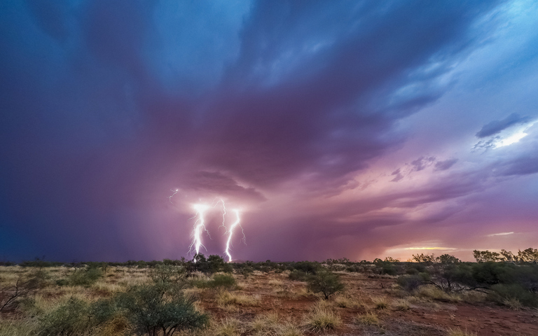
Australia’s southeastern states experienced an early glimpse of spring-like thunderstorms on the weekend, with destructive winds, huge hail and more than a quarter of a million lightning strikes.
The interaction between two contrasting cold and warm air masses created the perfect environment for prolific thunderstorm activity over southeastern Australia on the weekend.
While this type of weather pattern typically causes large outbreak of storms in Australia’s southeast during spring, it’s unusual to see such widespread and violent thunderstorms in winter.
Video: Unseasonable thunderstorms spreading over parts of southern and southeastern Australia on the weekend.
Some areas in southeastern Australia have now had thunderstorms on more than three days so far this month, which is well above average for this time of year.
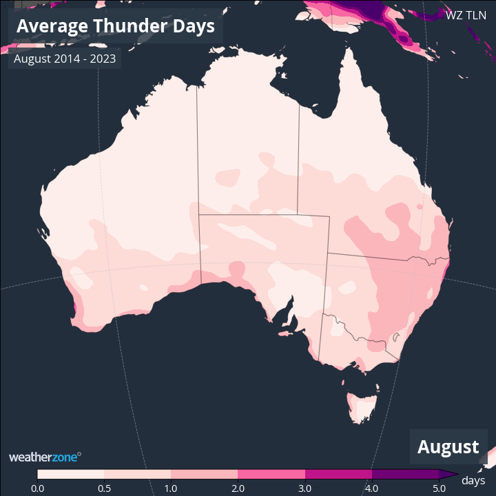
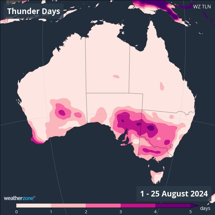
Images: The average number of thunderstorm days in Australia during August (top) and the number of storm days in the first 25 days of August this year (bottom).
Total Lightning Network detected more than 300,000 lightning strikes over southeastern Australia and surrounding waters on the weekend, with most of these occurring on Sunday. Impressively, lightning was detected above part of every Australian state and territory on the weekend.
Some of the thunderstorms that swept over southeastern Australia on the weekend were severe, producing large hail, damaging to destructive winds and large hail.
One storm in Vic dropped 3cm hail near Bendigo on Sunday afternoon, while another storm that evening generated a ferocious 150km/h wind gust at Mount Buller shortly after 6pm.
While the weekend’s thunderstorms have now cleared from southeastern Australia, further damaging winds are likely to develop on Tuesday and Wednesday with the passage of a strong cold front. Severe weather warnings have already been issued for parts of WA, Tas and Vic and will likely follow in some other states over the next 48 hours.
Another cold front later in the week may also bring another round of damaging winds to parts of southeastern Australia from Thursday or Friday.
DTN APAC, a DTN company, offers precise weather intelligence and alerting to protect your utilities network when severe weather, floods and fires threaten.
Over 80% of Australian transmission and distribution networks already rely on our proven nowcasting and forecasting out to 15 days. You can rest assured yours is protected by market-leading analysis. With this foresight you can gain lead time to prepare for possible outages, reduce risk and protect your people and profits.
You will never be left in the dark when conditions suddenly worsen. We deliver reliable, up-to-the-minute weather forecasts and analytical tools that give you the power to enhance your operational management and response to weather risk. Our Total Lightning Network is a globally proven solution that accurately identifies and alerts you to lightning strikes within your defined thresholds, supporting the safety of your team.
Your customisable interface has GIS mapping, showing multiple weather layers over your utilities network and offering full situational awareness. You can quickly recognise any threat to your assets in real time. 24-hour asset monitoring allows you to track lightning, bushfires and other severe weather systems that approach your service territory.
Advanced and actionable analytics allow you to act decisively and improve your planning and outage response strategy. Keep the power on this season with Storm Impact Analytics;
- Understand potential outage risk
- Learn from past events and provide accurate restoration timelines for customers
- Restore power faster by managing response teams
- Gain powerful decision-making support
Utilities that have installed Storm Impact Analytics have reported a 39% increase in customer satisfaction. To find out more visit our contact page or email us at apac.sales@dtn.com.


