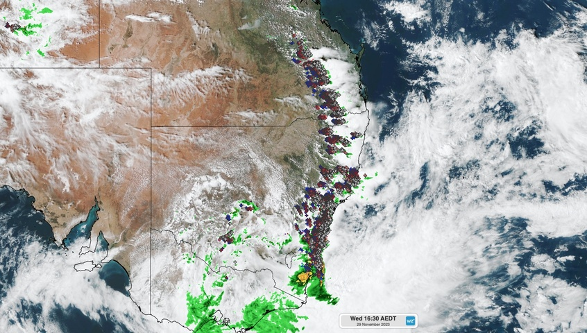
A broad arc of dangerous thunderstorms is moving over eastern Australia this afternoon, prompting severe storm warnings from central Qld to southern NSW.
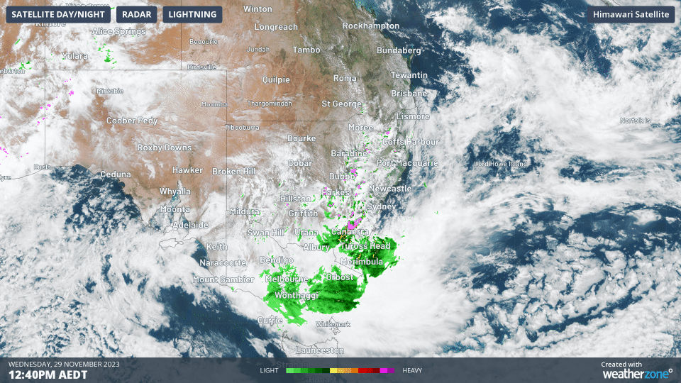
The animation below shows the massive band of storms, which has formed ahead of an approaching upper-level trough associated with an upper-level low centred over southern NSW.
At one stage on Wednesday afternoon, a bow echo formed as a line of intense storms tracked from the Southern Tableland towards the South Coast in NSW. This radar feature highlights the presence of powerful winds that are contorting the shape of storm’s precipitation band, which is a signature of a mature severe thunderstorm.
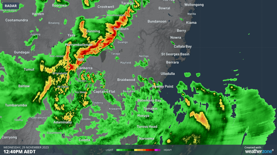
Video: Radar animation showing bow echo to the west of Ulladulla on Wednesday afternoon.
As of 4pm AEDT on Wednesday, the following storm warnings were in place:
- Severe thunderstorm warning for heavy rain, damaging winds and large hail in the Mid North Coast, Hunter, Illawarra, Southern Tablelands, Northern Tablelands and parts of Northern Rivers, Metropolitan, South Coast, Central Tablelands, North West Slopes and Plains, South West Slopes and Snowy Mountains Forecast Districts of NSW
- Detailed severe thunderstorm warning for damaging winds, large hail and heavy rain in the Greater Wollongong and parts of Maitland/Cessnock, Gosford/Wyong, Wollondilly/Wingecarribee, Greater Newcastle and Sydney areas of NSW
- Severe thunderstorm warning for people in parts of the Central Highlands and Coalfields, Capricornia, Wide Bay and Burnett, Darling Downs and Granite Belt and Southeast Coast Forecast Districts in Qld
Further south, heavy rain and powerful winds continue to plague southeastern NSW and eastern Vic on Tuesday afternoon. At 4pm AEDT, severe weather warnings were in place for heavy rain and damaging winds in the South Coast and parts of Snowy Mountains Forecast Districts in NSW, and parts of East Gippsland, West and South Gippsland, Central, South West and North East Forecast Districts in Vic.
The map below shows the areas covered by these warnings on Wednesday afternoon.
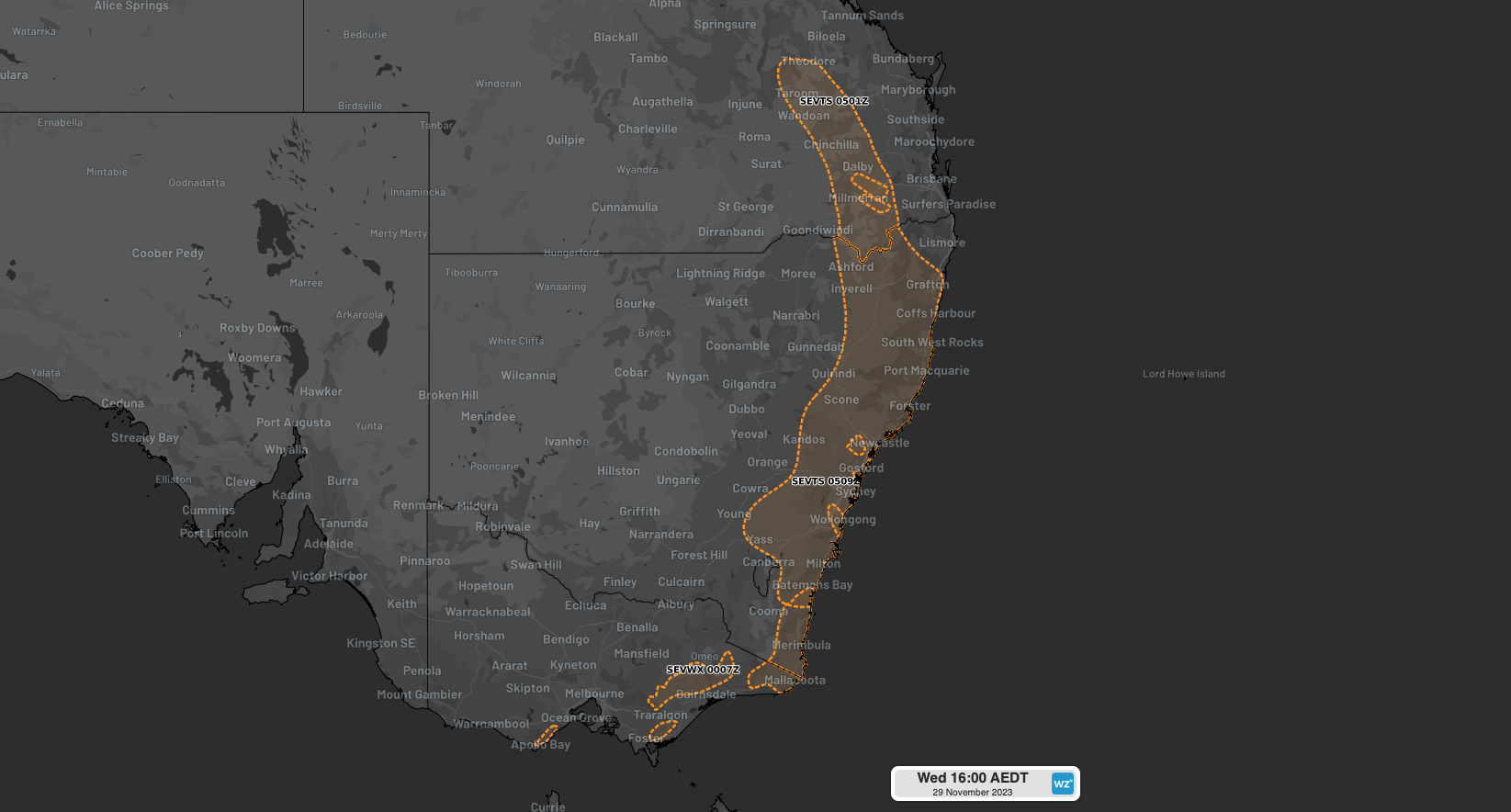
Image: Severe weather and severe thunderstorm warnings areas at 4pm AEDT on Wednesday, November 29, 2023.
Weatherzone’s Total Lightning Network detected more than 500,000 lightning strikes over NSW by 4:15pm on Wednesday.
Our Total Lightning Network is the intelligent solution that goes above and beyond to increase your lead time before the storm hits. We utilise a vast global sensor network, created with our partner Earth Networks. Offering unsurpassed accuracy, with real-time detection to <200m, we integrate with your existing systems to keep your enterprise operating within your defined severe weather thresholds. For more information, please contact us at apac.sales@dtn.com.


