
A pool of unusually cold water has appeared at the surface of the eastern tropical Pacific Ocean, hinting that the foundations of a La Niña event may be lurking beneath the surface.
The Pacific Ocean has been in an El Niño phase for the last 6 to 8 months. An El Niño is characterised by a large tongue of warmer-than-average water at the surface of the central and eastern tropical Pacific Ocean, which you can clearly see on the map below from mid-December 2023.
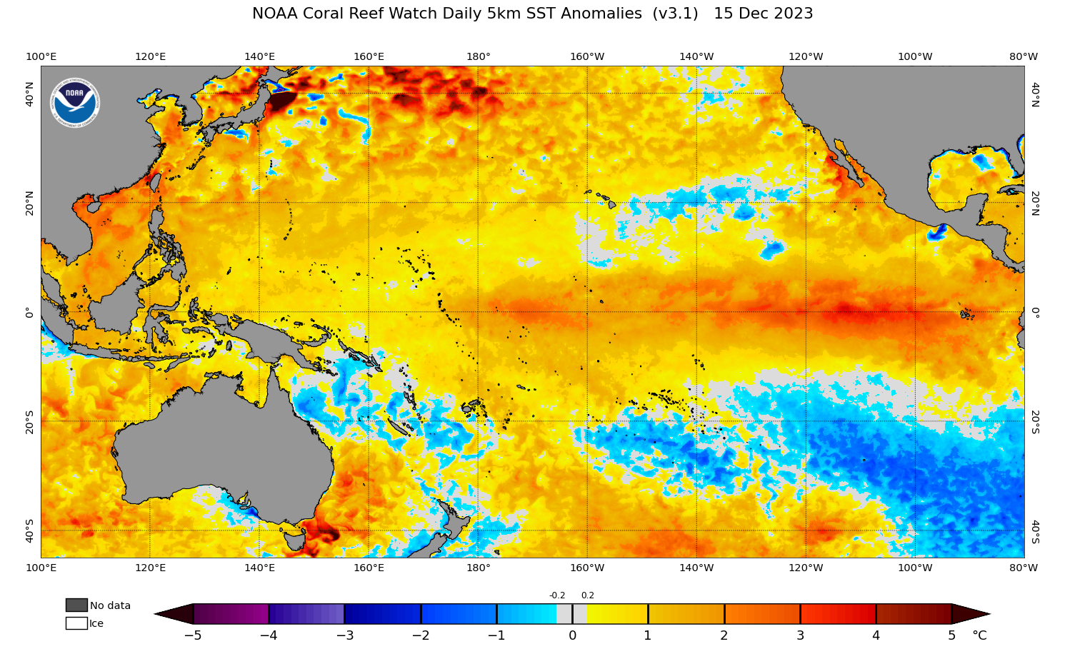
Image: Pacific Ocean sea surface temperature anomalies on December 15, 2023. Source NOAA
The current El Niño event peaked during the Southern Hemisphere’s summer and is now weakening, with forecast models suggesting the Pacific Ocean should return to a neutral state (neither El Niño nor La Niña) by the end of the Southern Hemisphere’s autumn.
What happens after that is difficult to predict. Some forecast models suggest the Pacific Ocean will remain in a neutral phase through the middle of the year, while others are more bullish with predictions of a rapid transition to La Niña in the Southern Hemisphere’s winter or spring.
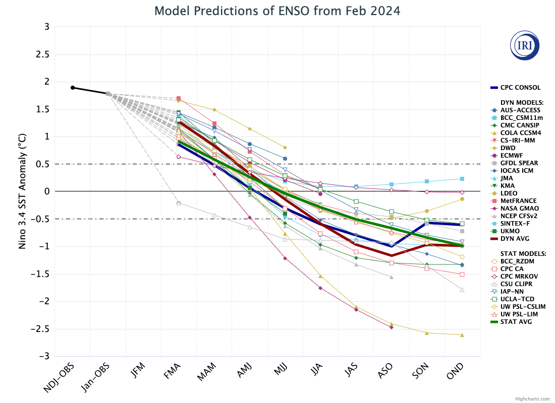
Image: Model predictions for the El Niño-Southern Oscillation (ENSO) during the next 9 overlapping 3-month periods, showing a trend towards neutral conditions in the coming months and an increasing possibility of La Niña later in the year. Source: IRI / CPC
This week’s sea surface temperature pattern in the tropical Pacific Ocean is indeed hinting at the early signs of an emerging La Niña.
While most of the tropical Pacific is currently much warmer than usual for this time of year, some cooler than average water has emerged in the eastern tropical Pacific over the past few days. The maps below show that this ‘cool blob’ was had not yet emerged on February 25 but was clearly visible by March 2.
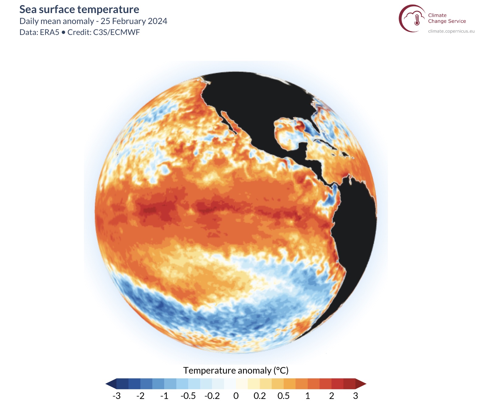
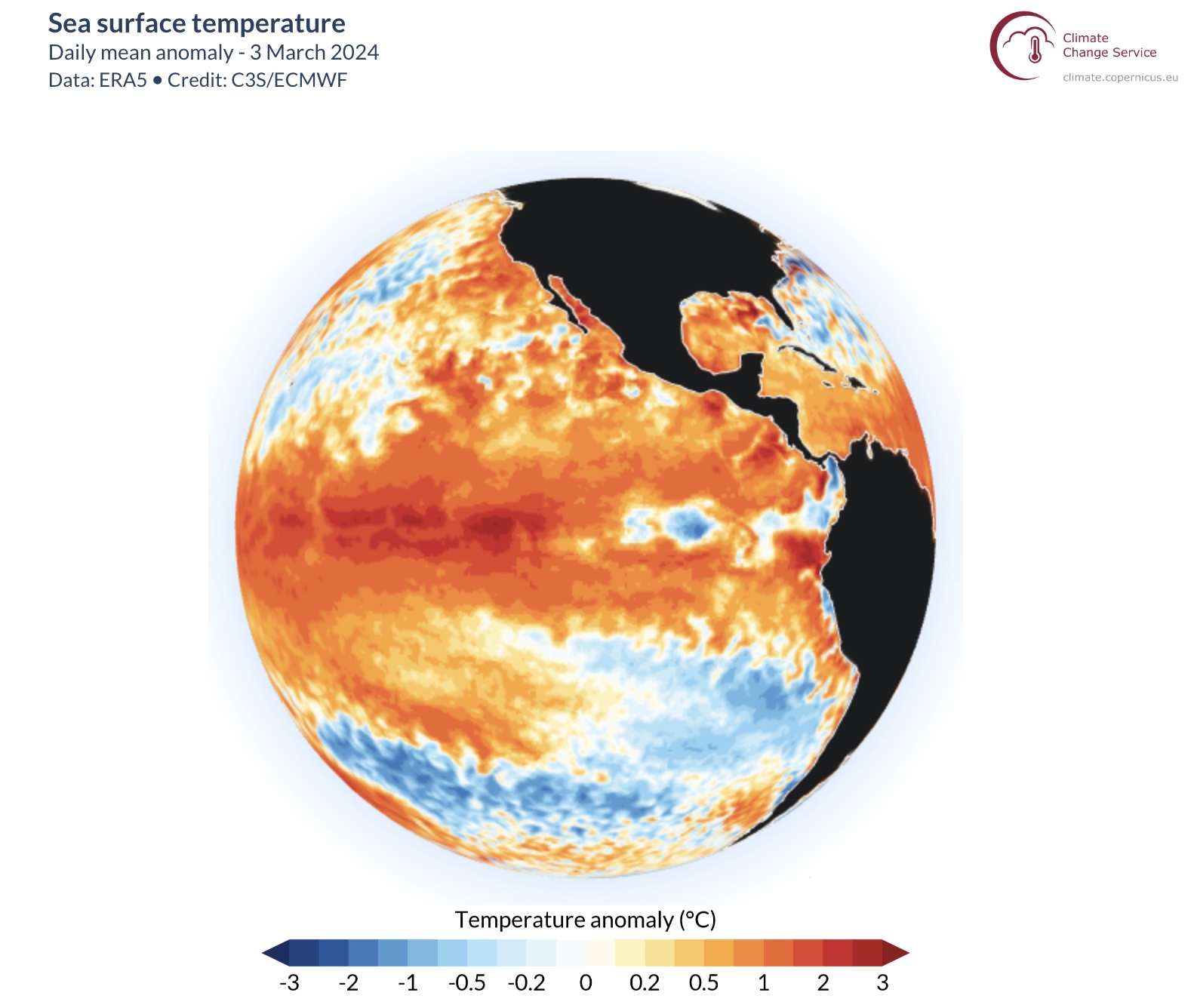
Images: Daily sea surface temperature anomalies for February 25 (top) and March 3 (bottom), according to the ECMWF’s ERA5 dataset. Source: ECMWF/Copernicus CS3
This pool of cool surface water is just the tip of the iceberg, so to speak, with a much larger mass of abnormally cool water lurking around 50 to 150 metres below the surface of the tropical Pacific Ocean.
Some seasonal forecast models, including the highly regarded SEAS5 model from the ECMWF, predict that the pool of cooler-than-average surface water will continue to grow across the surface of the tropical Pacific Ocean over the next few months. If this does happen, it may cause a rapid transition to La Niña in 2024.
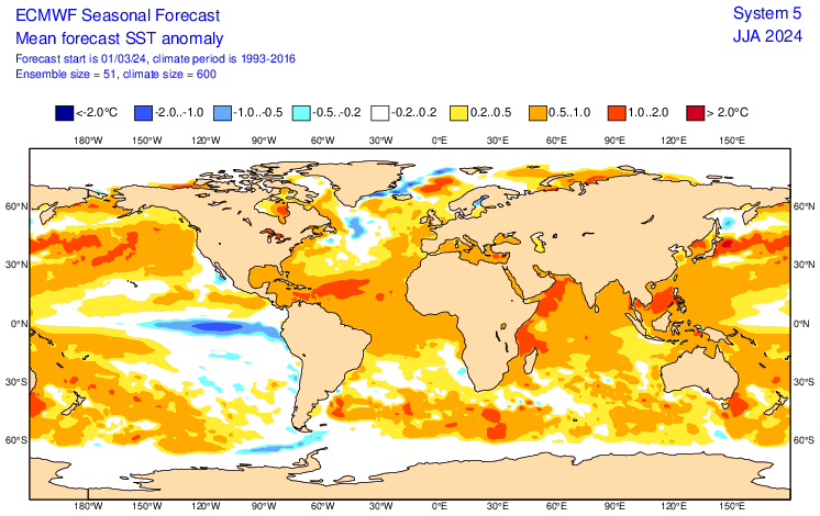
Image: Forecast sea surface temperature anomaly for June 2024, according to the SEAS5 model, showing a tongue of cooler-than-average water over the eastern tropical Pacific Ocean.
The large supply of abnormally cool water sitting beneath the surface of the tropical Pacific Ocean does add some weight to the possibility of La Niña returning this year. However, it is too early to know with much certainty whether this will happen or not.
An important caveat with any ENSO outlook made at this time of year is that predictions are less reliable prior to winter in the Southern Hemisphere. This seasonal dip in model reliability is called the autumn predictability barrier in the Southern Hemisphere (spring predictability barrier in the Northern Hemisphere) and means the current outlook should be treated with caution.
For now, all eyes are on the tropical Pacific Ocean to see how the cool blob behaves over the next few weeks and months, and if the atmosphere responds to these changes in ocean temperatures.
DTN APAC is now presenting climate forecasts for Winter and Spring. For more information or to book a climate presentation, please contact us at apac.sales@dtn.com.


