Prosper in a dynamic world
Search

Over one million lightning strikes hit WA

  Severe thunderstorms developed in the Gascoyne and Central West districts of WA on Sunday, lashing the region with fierce wind gusts and intense bursts of rain.   Over one million lightning strikes were detected in WA on Sunday and Monday morning along a low-pressure trough extending across large areas of the state.   The […]

8 million lightning strikes captured by our lightning network this week

  More than 8 million lightning strikes were detected over the Australian region in the past week during a prolonged outbreak of thunderstorms that will continue into the middle of November. Late-spring is always a ripe time for thunderstorms in Australia. At this time of year, warm air over the Australian continent interacts with much […]

Week-long soaking to hit fire-weary eastern Australia

Wet weather is about to return to parched and fire-weary areas of eastern Australia, with 7 to 10 days of rain and thunderstorms set to soak parts of Qld and NSW. A stationary low pressure trough being fed by persistent moisture-laden easterly winds will cause rain and thunderstorms over parts of eastern Australia each day […]

‘Australia’s hottest place’ almost 6 degrees above average in October

  Onslow, a coastal town in Western Australia’s Pilbara region with a population of around 900, holds half of a significant Australian heat record – equalling Australia’s highest recorded temperature when the mercury reached a searing 50.7°C in January 2022. On average, Onslow is not quite as hot as several other WA towns such as Marble […]

Extreme fire danger returns to NSW, Qld

  Firefighters in Qld and NSW will continue to face challenging conditions over the next two days amid another burst of hot, dry and windy weather. A cold front crossing southeastern Australia on Monday and Tuesday will cause a tongue of hot and dry air to sweep across NSW and Qld. This heat will be […]

WA skies sizzle with quarter of a million lightning strikes

  There were “striking” scenes in the skies above the southwest of Western Australia on Sunday afternoon, as a quarter of a million lightning strikes sparked a spectacular sky show. The awesome natural fireworks display was caused by a trough moving through the area, with significantly cooler air behind the warm airmass east of the […]

Bone dry air to increase fire danger in the east

  A remarkably dry airmass over central Australia will move east over the next 72 hours, bringing dangerous fire weather to NSW over the weekend.   The map below shows the parched air sitting over parts of WA, the NT, SA and Qld on Thursday morning.  Image: 2m Dewpoint and 10 metre wind observations at 9:30am […]

How wind changes grow bushfires

Winds are a key component to understanding the behaviour of bushfires. But what happens when the wind suddenly changes direction? Typically, a fire will tend to spread along the same direction as the prevailing winds. In a strong wind, this allows the fire front to follow the wind very quickly and can exceed 50km/h in […]

Southerly buster and large swell hitting NSW

  A strong southerly change will move up the NSW coast on Monday, whipping up a large southerly swell in its wake.  The fierce winds are associated with a low-pressure system sitting in the Tasman Sea which is extending a cold front along the NSW coast.   The southerly buster has already hit far eastern […]

Latest news

Satisfy your weather obsession with these news headlines from around the nation, and the world.

How El Niño will shape Australian port operations this winter spring

Australian ports and marine pilots can expect a season of shifting wind and swell patterns through winter and spring 2026, as a developing El Niño brings the likelihood of drier conditions and more variable operating windows across the country’s coastline.  Will El Niño develop in 2026?  There are clear signs that an El Niño pattern is becoming […]

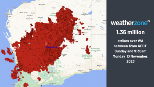
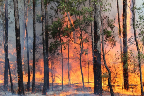
From Kimberley to northern NSW: Bushfire outlook flags risk for resources sector this winter

Bushfire risk doesn’t usually make headlines in June, but AFAC’s winter seasonal outlook is putting mining and resources operators on alert from the Kimberley to the NSW.  Australia’s official seasonal bushfire outlook for winter 2026 was released by AFAC on Thursday, May 28. The outlook predicts increased fire risk across the northern parts of the Great Sandy Desert and surrounds […]

The signal was there weeks earlier: forecasting one of the year’s biggest wind events

In mid-May 2026, DTN APAC meteorologists flagged a strengthening Southern Ocean pattern in model guidance, signalling an extended run of record-challenging wind conditions across the NEM.  Nearly three weeks later, NEM wind generation climbed from around 1.5GW to more than 9GW, supplying roughly one-third of the grid and coming within 1GW of the all-time generation record.  The event highlighted […]

The 2026 Indian Southwest Monsoon onset is expected in the next two weeks

The Indian Southwest Monsoon will reach India in the next two weeks, but a developing El Niño could signal a drier than normal monsoon for businesses and major industries across the country. Southwest monsoon onset over southern India in the next two weeks The Indian Meteorological Department (IMD) is responsible for tracking the advance and […]