Severe thunderstorms developed in the Gascoyne and Central West districts of WA on Sunday, lashing the region with fierce wind gusts and intense bursts of rain.
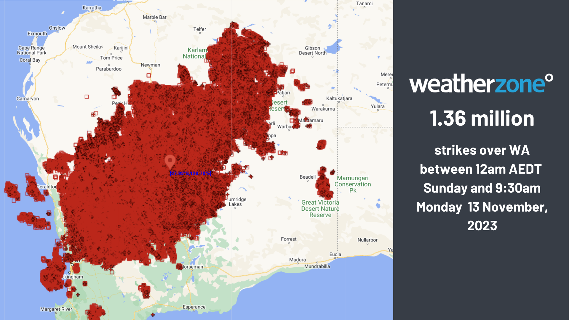
Over one million lightning strikes were detected in WA on Sunday and Monday morning along a low-pressure trough extending across large areas of the state.
The unstable weather proved difficult for firefighters on Sunday with several fires burning across the state, including an out-of-control fire near Mount Sheila in the Pilbara region that broke containment lines.
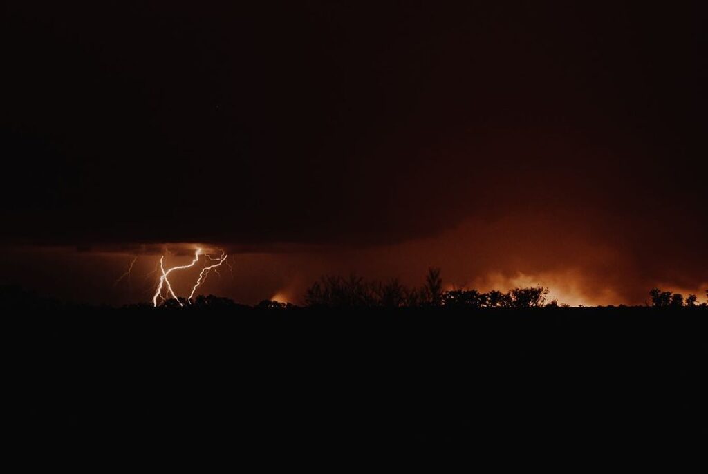
Image: @jaz.stewart.photography lightning fire Flora Valley WA on Sunday, October 12
Strong wind gusts and heavy rain were recorded in thunderstorms across central WA on Sunday, with Mount Keith recording a 87km/h wind gust at 6pm WST. The storm that passed over the town brought also brought 7mm of rain in just 7 minutes on Sunday evening.
The thunderstorm activity has continued on Monday morning as the stationary low pressure trough continues to trigger storms across parts of the NT, SA and WA.
The satellite image below shows the thunderstorm activity near Perth and extending into the Central Wheat Belt district on Monday morning.
Image: Satellite and lightning data for the 3 hours leading up to 8:30am WST on Monday, October 13.
Widespread thunderstorms are expected to continue for the next 72 hours extending from the western Top End in the NT to western SA and southern WA.
Rainfall should be heaviest in the northwest Top End and southern inland areas of WA, where 30-60mm could fall in 24 hours under thunderstorms.
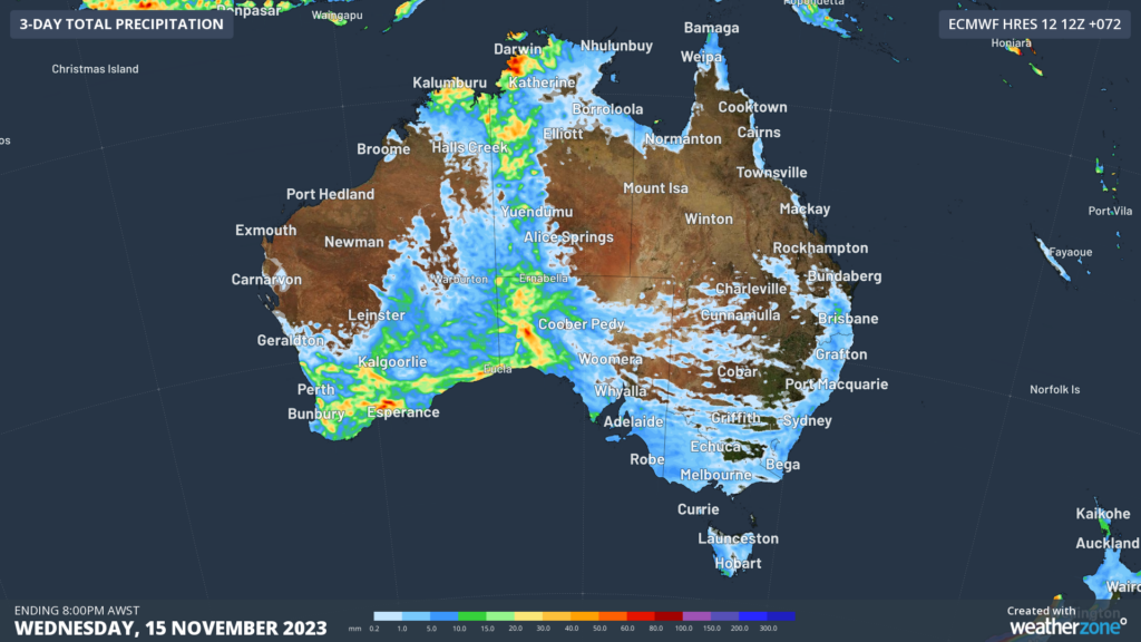
Image: ECMWF accumulated rainfall in the 72 hours leading up to 8pm on Wednesday, October 15
Within the trough, severe thunderstorms are forecast to develop, so please keep an eye out for the latest warnings here.
StormQuery is DTN APAC’ historical lightning and severe weather reporting tool. It’s an easy-to-use solution, designed to facilitate quick and complete insurance claim management and weather event analysis.
StormQuery maps storms that have affected your business or clients, offering key, time-stamped data to aid in processing insurance claims.
You can produce weather reports in a PDF format for detailed investigation and analysis. This in-depth reporting can assist whether you’re looking at lodging or investigating insurance claims, analysing the effects of storms on your business, or planning future operational responses to weather.
You have the capacity to view specific severe weather incidents with mapped and time-stamped lightning strike data. Choose your location of interest, time and date and you have complete visibility of individual strikes, enabling you to pin-point the exact catalyst for damage or ignition of fire.
Gain the benefit of hindsight and comprehensive analysis of severe weather events. StormQuery is the solution that collates and delivers the most accurate, hyper-local data, exactly when you need it. For more information, please contact us at apac.sales@dtn.com


