A cold front is about to cause damaging winds, showers and thunderstorms in parts of Victoria, NSW and the ACT.
The satellite images below show a cold front and associated low pressure system moving over the Great Australian Bight on Wednesday morning.
.gif)
This system will continue to move towards the east over the next 48 hours, crossing southeastern Australia between Wednesday evening and Friday morning.
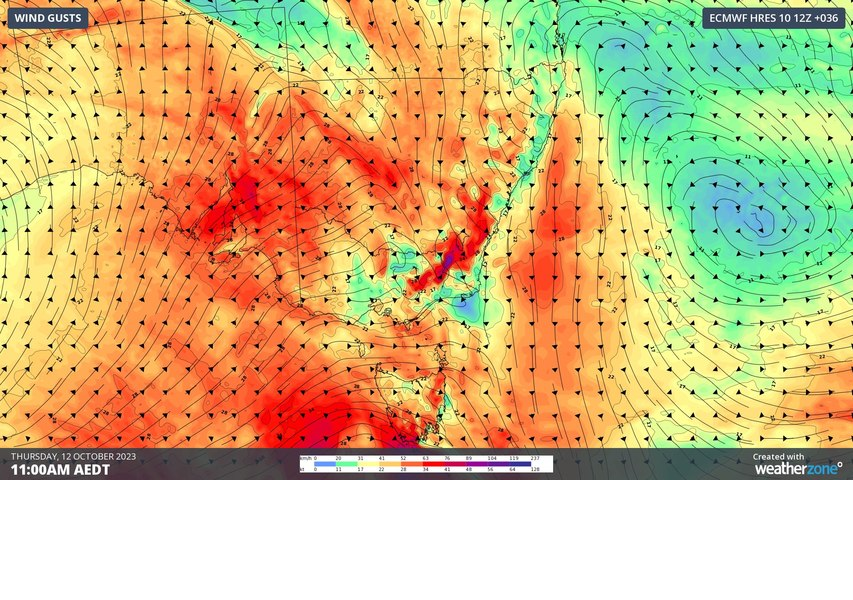
One of the main threats with this system will be the wind, with damaging gusts likely in several states. North to northwesterly winds will start to increase ahead of the approaching front, before blustery west to southwesterly winds sweep through with and behind the front.
Damaging winds gusts are likely to develop in elevated parts of Victoria from late Wednesday into Thursday, and in southern NSW and the ACT on Thursday. Some exposed areas in Tasmania may also see gusts above 90 km/h on Thursday or Friday.
Showers will also spread over parts of SA, Vic, Tas, the ACT and southern NSW between Wednesday night and Friday morning. Some of these showers will be accompanied by thunderstorms, most likely in Vic and southern and central NSW. Most storms from this system will not be severe, although a few severe cells are possible in Vic and inland NSW, with damaging winds the main threat.
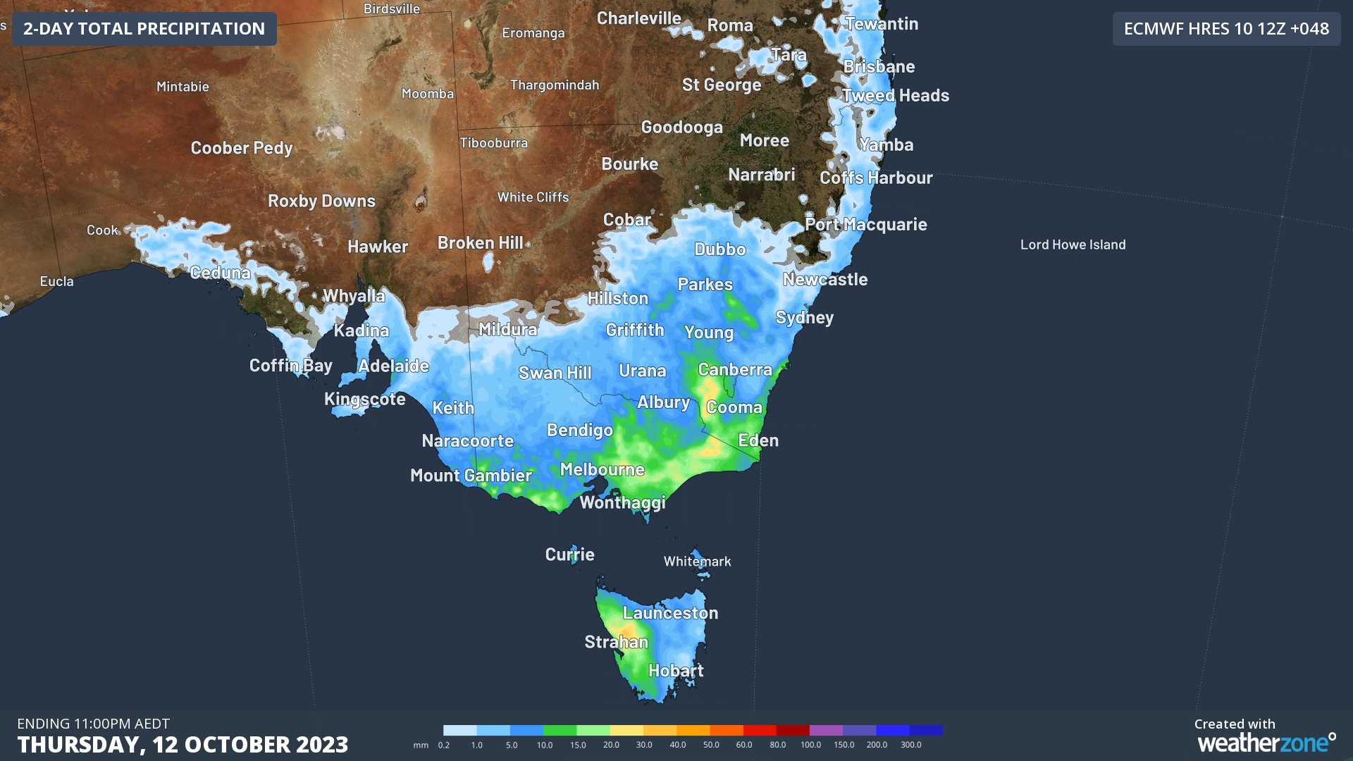
Image: Forecast accumulated rain on Wednesday and Thursday combined, according to the ECMWF model.
Be sure to check the latest warnings and forecasts in your area to stay up to date with the most accurate information over the next few days.
Stormtracker is a severe weather solution that can assist you in observing, in real-time, any storm or event that has the potential to impact your business.
Embedded in DTN APAC’ industry interfaces, the system gives you a time advantage when monitoring conditions developing over your infrastructure and location.
Stormtracker is our Global Information System (GIS) tracking tool, providing multiple weather layers and zoom controls overlaid on a map of your location and infrastructure. You can choose a snapshot or full screen view, depending on your requirements. The maps allow you to monitor all weather, and specifically any systems likely to cause risk for your business. You also have the capacity to observe:
- real time lightning and thunderstorm alerts
- localised lightning strike frequency
- official warnings for storm, cyclone, wind, flood and fire
- sentinel hotspot fires and fire agency current incidents
Stormtracker’s radar imagery updates every 10 minutes, so you are always able to respond rapidly to changing conditions. You can customise alerting to notify you when your staff or infrastructure are under threat. With increased situational awareness, your ability to make informed decisions quickly is optimised.
DTN APAC’ experience and intelligence gives you a clear path through complex situations. Let us assist you, offering actionable insight when extreme weather poses risk to your business. For more information, please contact us at apac.sales@dtn.com


