Extremely heavy rain has fallen in parts of Victoria overnight, with a top fall of a mind-boggling 198.8 mm at Mt Hotham to 9 am Wednesday, and numerous flood warnings already in place.
This was Mt Hotham’s wettest day in any month in at least 46 years of records.
You always expect the high country to receive the heaviest rainfall totals in a moist northwesterly flow like we’ve seen over the past day or so. This is due to the orographic effect, where moist air is lifted as it passes over a mountain range, forming moisture-laden clouds as the air cools.
But heavy falls in excess of 100 mm were also experienced west of the mountains across large low-lying parts of northern and central Victoria.
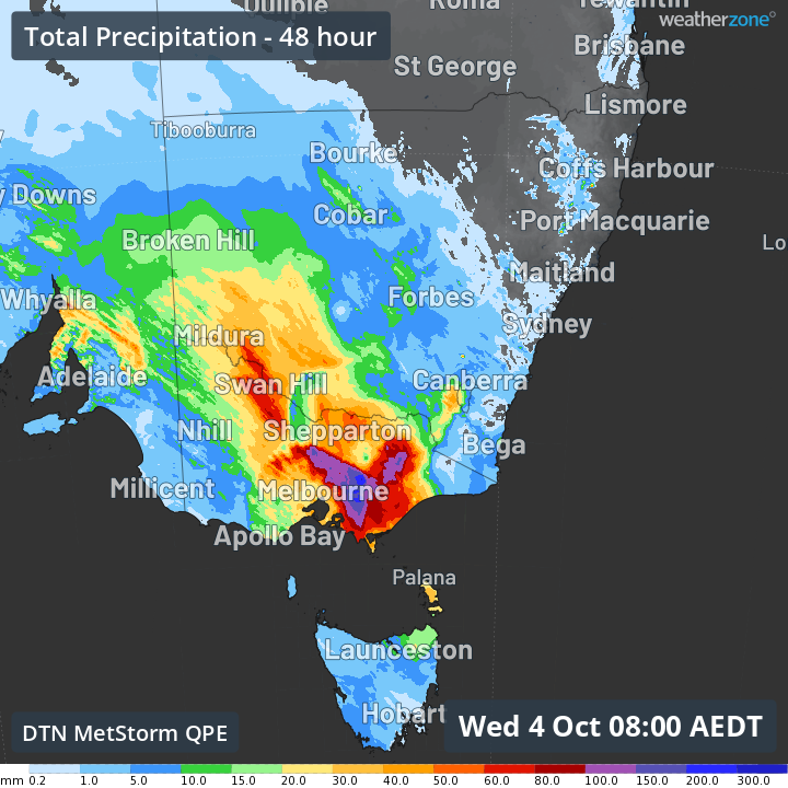
- Lake Eildon, which sits in low hilly country east of Mt Buller saw its heaviest October day of rainfall in 135 years of records, with 106 mm.
- Shepparton saw 67 mm in the 24 hours to 9 am, which was almost as much as it received in the whole of winter 2023.
We mention Shepparton not because it had even close to the heaviest Victorian rainfall overnight, but because it was the town on the Goulburn River that experienced devastating floods in October 2022.
Then, as now, the town itself saw heavy rain, but the Goulburn River catchment received extremely heavy rainfall. (Lake Eildon dams the Goulburn River.)
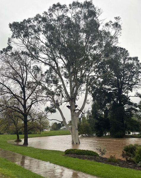
Image: Fords Creek in Mansfield, Vic, where 105 mm fell in the 24 hours to 9 am Wed. Source: Mansfield Bushwalks on Instagram.
Meanwhile Melbourne just missed the heaviest stuff, although its 22.8 mm was still very welcome after the city’s driest September on record, but areas just east of the city received plenty more, with 63 mm to 9 am at Mt Dandenong.
Rain will increase in much of eastern Victoria throughout Wednesday, with winds having swung to the south in the wake of the cold front. Light snow is also already falling in parts of the Vic Alps.
Rain will also persist in northeast Victoria and large parts of NSW as the relatively slow-moving cold front and associated rainband tracks east.
Storms could be a feature of the weather in NSW on Wednesday afternoon, and the BoM has even mentioned that tornadoes cannot entirely be ruled out. We’ll keep you updated as a very active day of weather progresses.


