

Parts of Western Queensland are already having their wettest July on record after copping 10 to 15 times their monthly average rainfall in the last 24 hours.
A northwest cloudband has been causing rain in far Western Qld since Friday, although the heaviest falls in most areas have been occurring from Sunday into Monday morning.
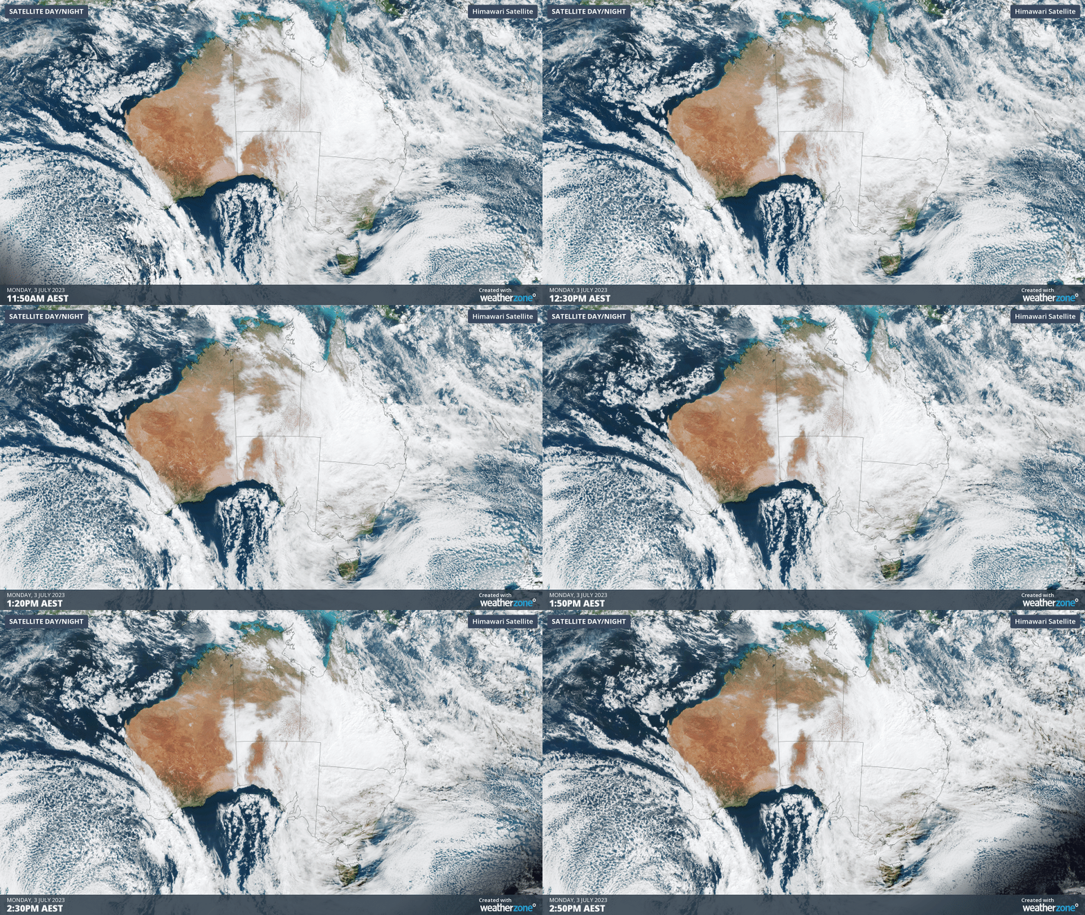
Video: Visible true-colour satellite images showing a northwest cloudband over Qld on Monday.
Some of the most notable rainfall totals during the 24 hours to 9am on Monday included:
- 64.4 mm at Cloncurry Airport, which is about 15 times the site’s July monthly average of 4.3 mm. This is also Cloncurry’s wettest July day since at least 1978
- Mount Isa Airport’s 78.4 mm is 13 times their July monthly average. It’s also the wettest July day observed at either the Airport or old Post Office weather stations in records dating back to 1926
- Birdsville 15.8mm, its heaviest July rain since 1998
Daytime temperatures have also been suppressed by the widespread cloud cover. As of 4pm AEST on Monday, maximum temperatures were running around 8 to 12ºC below average in parts of the Gulf Country, Northern Goldfields, Central West, Northwest and Channel Country Districts.
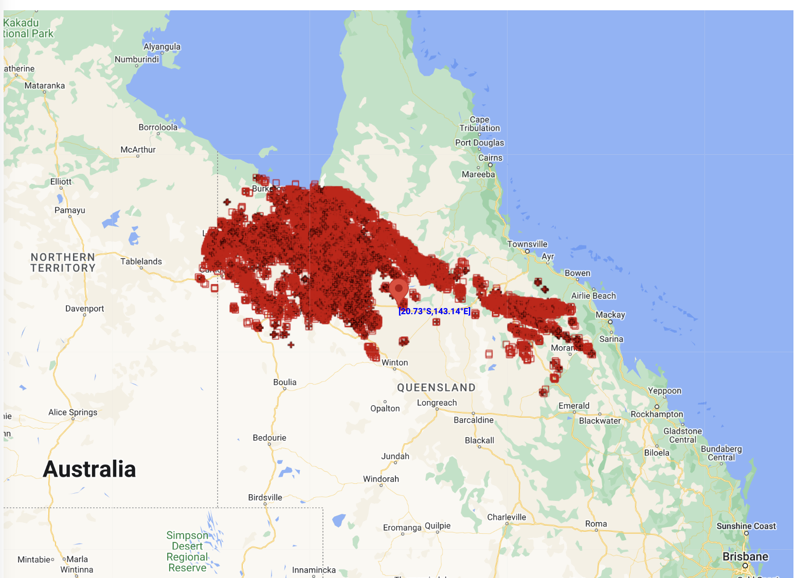
Image: 44,644 lightning strikes were detected within 600km of Richmond, Qld by the Total Lightning Network (WZTLN) on Sunday and Monday
Looking ahead, cloud and rain will continue to spread across most of Qld from west to east on Monday night and throughout Tuesday, before clearer weather returns to most areas from Wednesday.
The map below shows how much rain one forecast model is predicting on Monday and Tuesday combined.
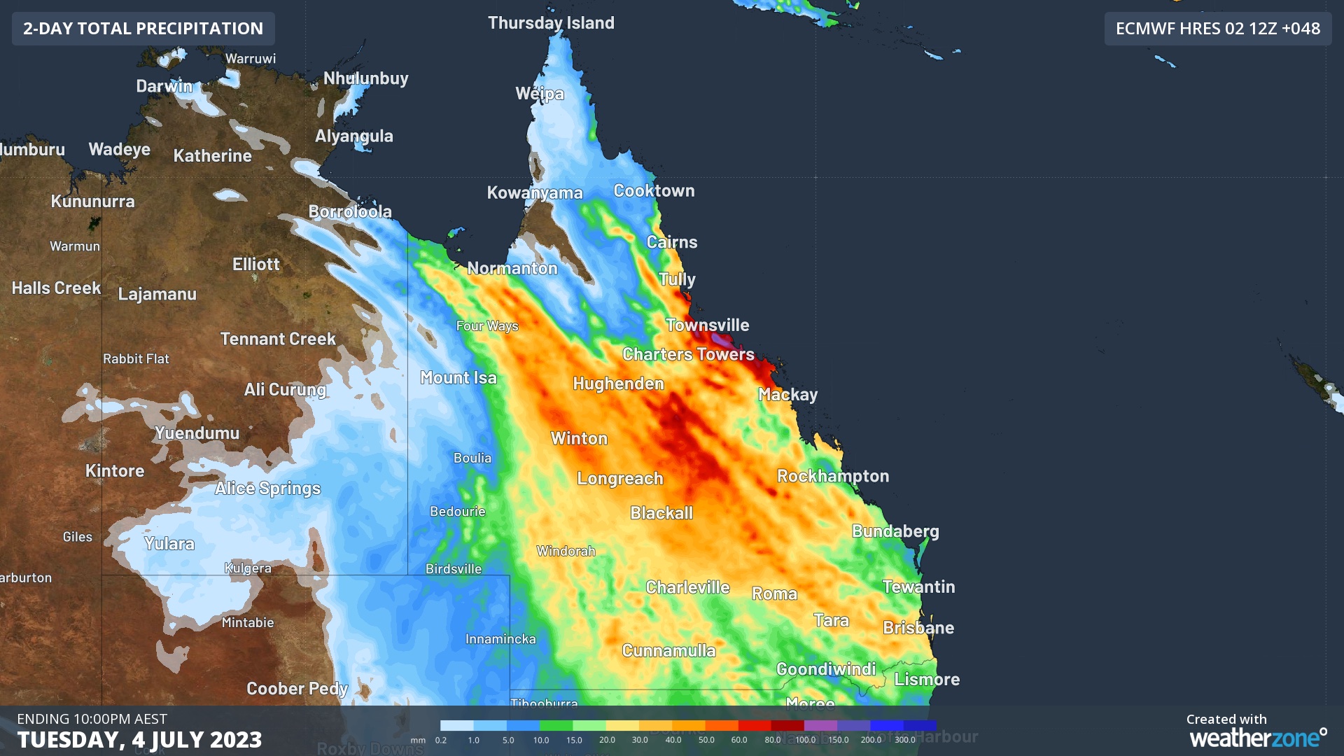
Image: Forecast accumulated rain during the 48 hours ending at 10pm AEST on Tuesday, July 4, 2023, according to the ECMWF-HRES model.
The recent rain has closed a number of roads in Western Qld. You can check the latest road closures here.
How Weatherzone can prepare you for Thunderstorms
DTN APAC can help your business deal with thunderstorms through:
- Accurate and easy to understand forecasts beforehand
- Thunderstorm tracking and Lightning Alerting during a storm
- Event and Lightning reporting afterwards.
Our colossal influx of data from all the worlds leading weather forecast models and the Total Lightning Network gives us a unique ability to prepare your business for thunderstorms like no other. To find out more, please email us at apac.sales@dtn.com.




