Prosper in a dynamic world
Search

Lowest temps of 2023 in parts of NSW, QLD, NT

Parts of central and eastern Australia experienced their coldest morning so far this year on Monday, with more wintry temperatures on the way later this week.

The first morning of May was a fittingly cold start to the final month of autumn for large areas of NSW, Qld and the NT.

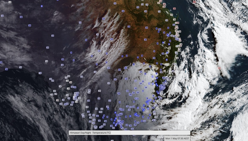
The cold morning was caused by a combination of clear skies, relatively light winds and lingering cool air mass, which allowed temperatures to drop steadily throughout Sunday night into the early hours of Monday morning.

Lowest temps of 2023 in parts of NSW. QLD. NT

Image: Observed surface air temperature and cloud cover at 7:30am AEST on Monday.

Sydney cooled to a minimum temperature of 10.6ºC at 7:00 am on Monday, making it the city’s coldest morning since November 2022. Further inland, Moree (3.7ºC) and Bourke (4.5ºC) both had their coldest morning since last September.

A few places in Qld registered their lowest temperature in nine months on Monday, including Thargomindah (8.1ºC), Emerald (9.7ºC) and Oakey (2.1ºC).

In the NT, the temperature at Alice Springs dropped to 4.9ºC just before 7:00 am on Monday, its coldest morning since September.

Monday’s cold start came a day after Melbourne cooled to 5.0ºC on Sunday morning, its lowest temperature in seven months.

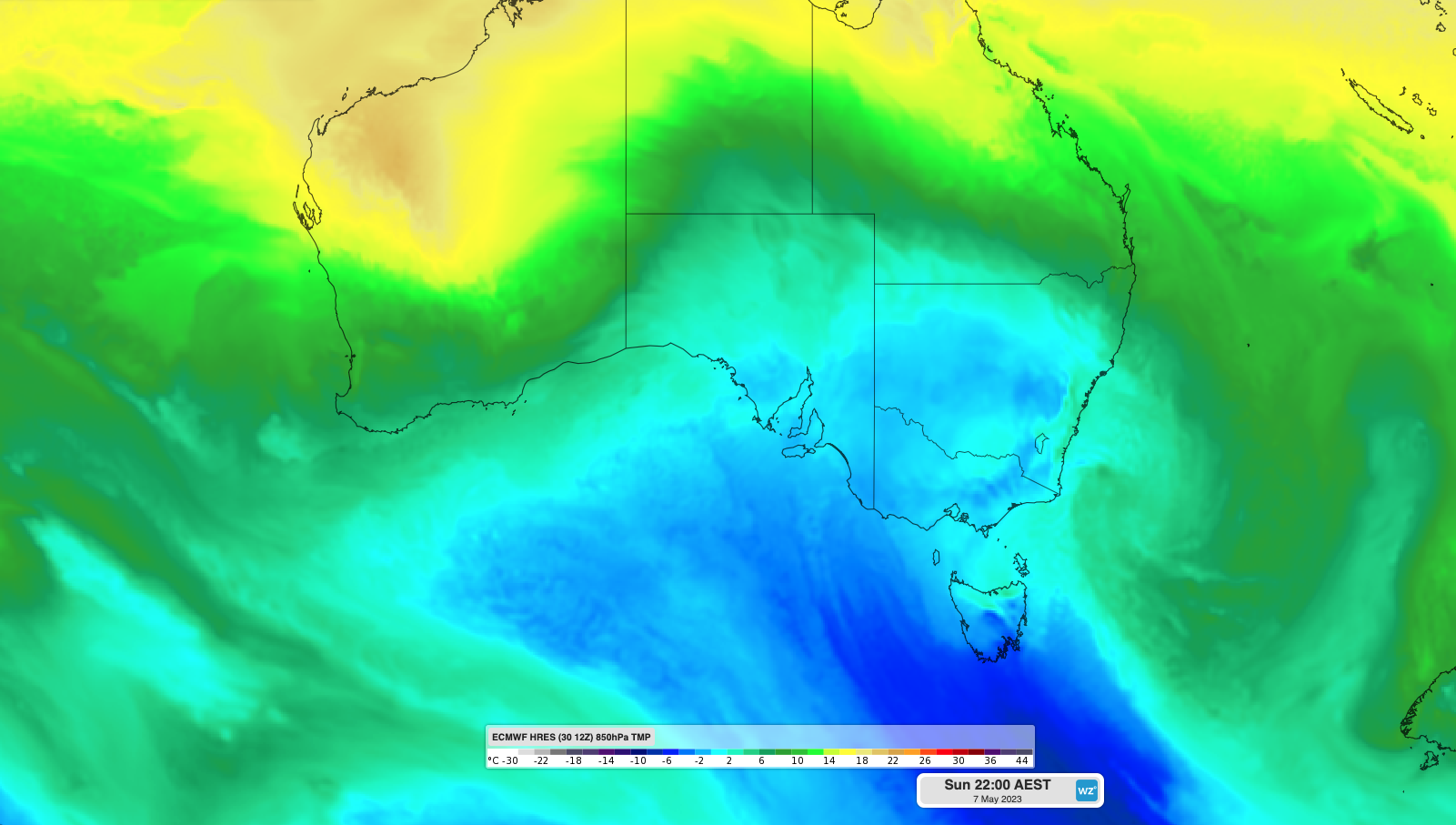
Looking ahead, a pair of cold fronts will bring more cold weather to a broad area of southeastern Australia later this week. This is likely to include more lowest temperatures of the year, along with a wintry mix of blustery winds, rain, hail and snow.
Lowest temps of 2023 in parts of NSW. QLD. NT

Image: Forecast 850 hPa temperature this Sunday night, showing a large cold air mass over southeastern Australia.

To find out about Weatherzones temperature forecasts, visit our website or email us at apac.sales@dtn.com.

Latest news

Satisfy your weather obsession with these news headlines from around the nation, and the world.

Another burst of heat looming for southeastern Australia

The first week of summer is set to arrive with a bang, with hot and humid conditions expected for at least five states and territories next week.   A blocking high pressure system in the Tasman Sea will direct hot northerly winds across southeastern Australia for much of next week.   This slow pattern will […]

Stormy start to summer looms for Australia

A volatile weather pattern is set to cause widespread thunderstorm activity over Australia throughout the first week of summer, with severe storms likely to hit multiple states and territories. The last week of spring is featuring prolific rain and thunderstorm activity over large areas of northern and eastern Australia. This wet and stormy weather will […]

Tropical Cyclone Robyn forms in Australian region

Tropical Cyclone Robyn has formed inside Australia’s area of responsibility, becoming the first named cyclone of the 2024-25 season. Robyn became a category one tropical cyclone over the eastern Indian Ocean on Thursday afternoon, forming roughly 740 km to the west southwest of the Cocos (Keeling) Islands at about 2pm AWST. Image: Visible satellite images […]

Colossal conveyor belt of tropical moisture

A vast area of northern and eastern Australia is set to see persistent rainfall and thunderstorm activity in coming days, with the potential for flooding in many areas. If you want to understand why, the image at the top of this story explains all. The image shows the amount of “precipitable water” in the atmosphere, […]