The negative Indian Ocean Dipole, one of the main climate drivers that underpinned Australia’s second wettest October on record, is likely nearing its end.
The Indian Ocean Dipole (IOD) is an index that measures sea surface temperature anomalies in the tropical Indian Ocean.
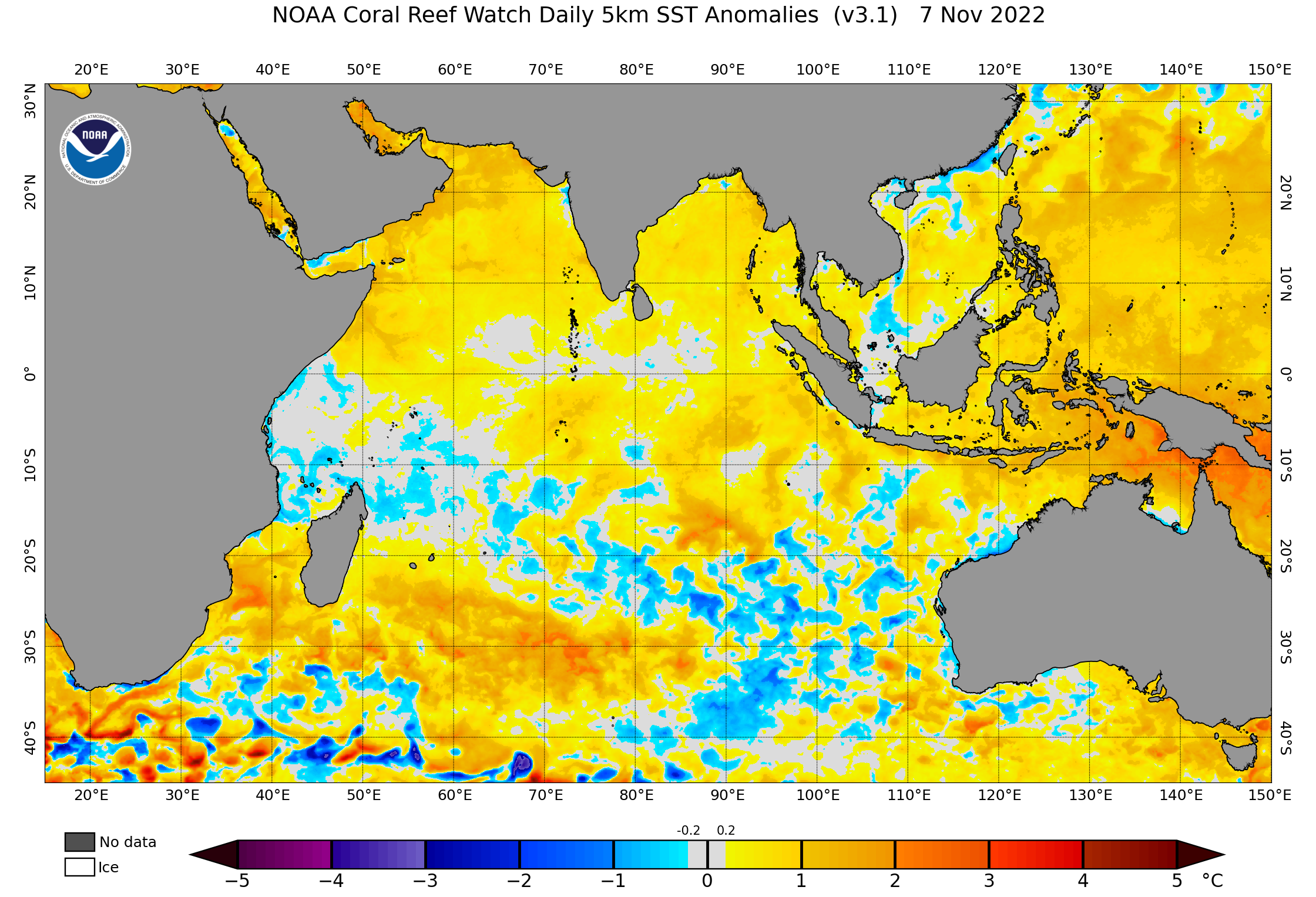
A negative IOD occurs when warmer-than-average water builds up to the northwest of Australia, near Indonesia, and cooler-than-average water lies in the western tropical Indian Ocean, near the Horn of Africa.
This contrast in sea surface temperatures across the tropical Indian Ocean causes more moisture-laden air to flow towards Australia, which fuels above-average rainfall.
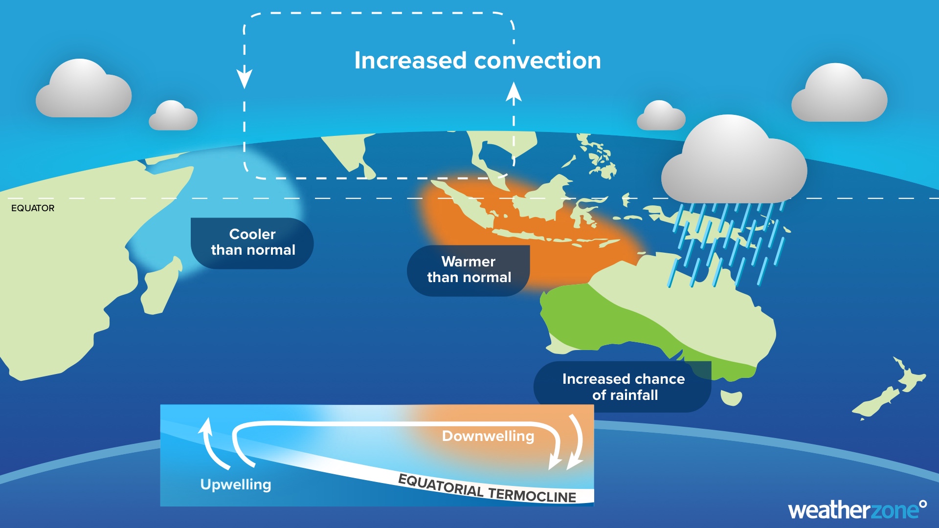
Image: The typical ocean and atmospheric states during a Negative Indian Ocean Dipole (IOD).
This year’s negative IOD was officially declared in August and is still underway, according to the Bureau of Meteorology. During this time, Australia has registered its 2nd wettest October and 5th wettest September in 123 years of records.
However, the IOD has shown signs of weakening over the past few weeks, with the latest weekly IOD index value returning to the neutral range (between –0.4ºC and +0.4ºC) for the first time in five months.
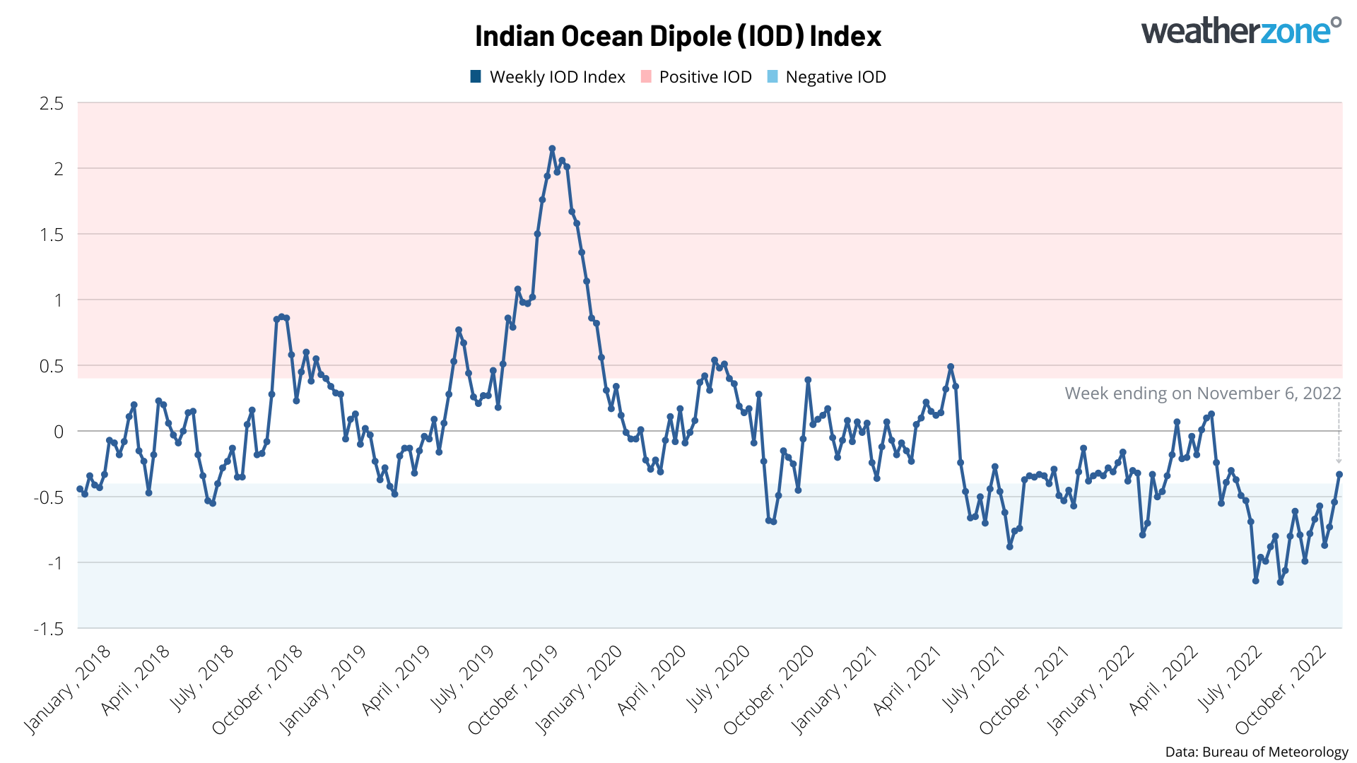
Image: Weekly IOD index values during the past few years.
This weakening of the IOD index over the past few weeks is a clear sign that the 2022 negative IOD episode is nearing its end, despite the atmosphere above the Indian Ocean remaining in a negative IOD-like state. All forecast models surveyed by the Bureau predict that the IOD will be in a neutral state by December.
In the absence of the negative IOD, the likelihood of above-average rain will lessen from December over parts of western and southern Australia. However, wetter-than-average conditions will remain an elevated risk in eastern Australia, due to the ongoing influence of La Niña and a predominantly positive Southern Annular Mode (SAM).
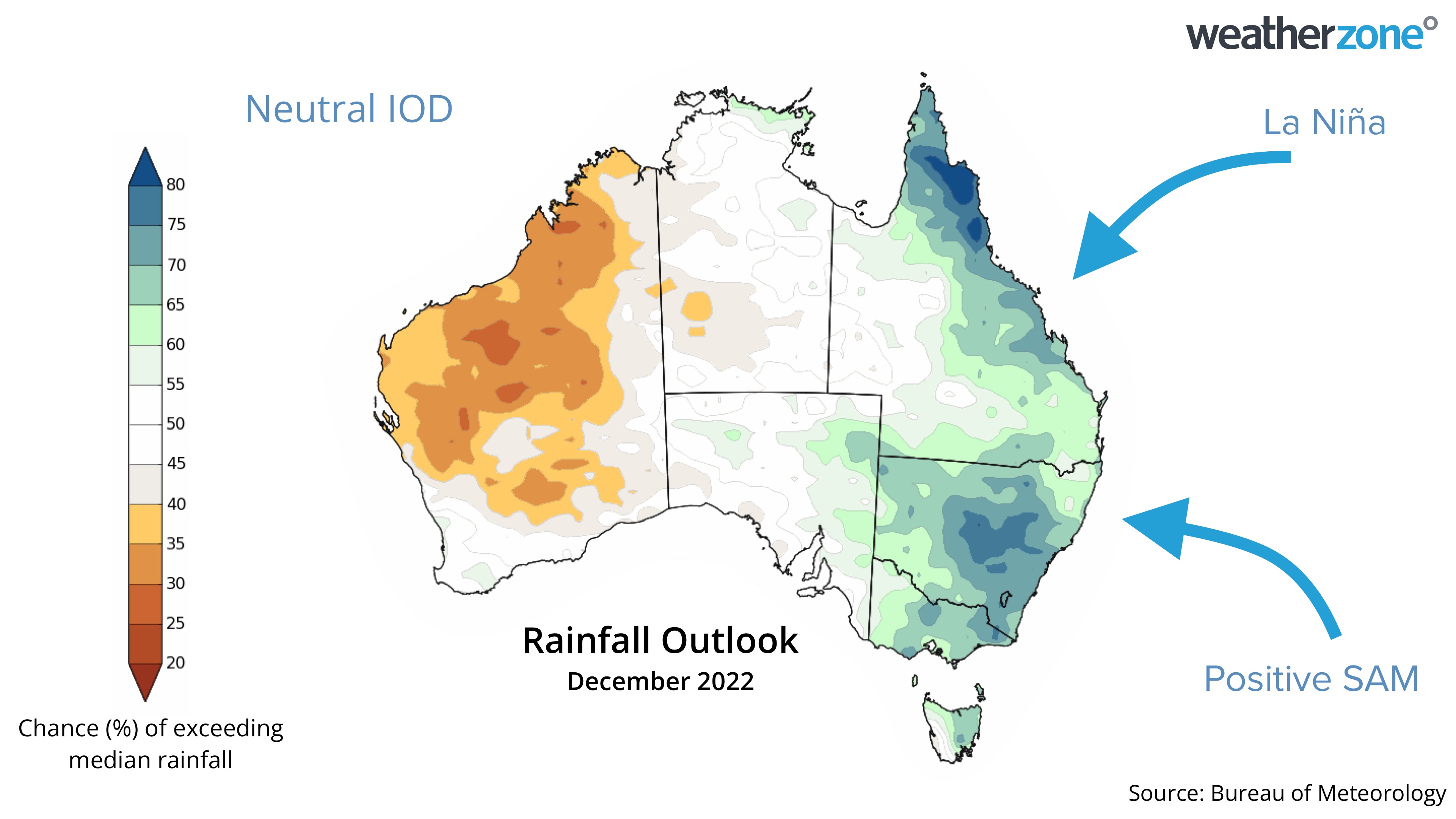
Image: Rainfall outlook for December 2022. Source: Bureau of Meteorology.


