
Six days of heavy rain and thunderstorms are on the cards for parts of the northern and western QLD as a burst of late wet-season rain targets northeastern Australia.
A low pressure trough and embedded tropical low are currently located over the northwestern Coral Sea. These systems will slowly drift further west in the coming days, causing a prolonged period of heavy rain and thunderstorms over Queensland’s eastern tropical coast and adjacent hinterland.
The moisture feeding this coastal rain event will also spread further west and interact with a low pressure trough deepening across Australia’s eastern inland. This inland system is expected to produce widespread rain and thunderstorms across parts of western, central and southern QLD from this weekend into next week.
The combined influence of these rain-bearing troughs will likely see a broad area of northern and western QLD picking up some decent rain over the coming week.
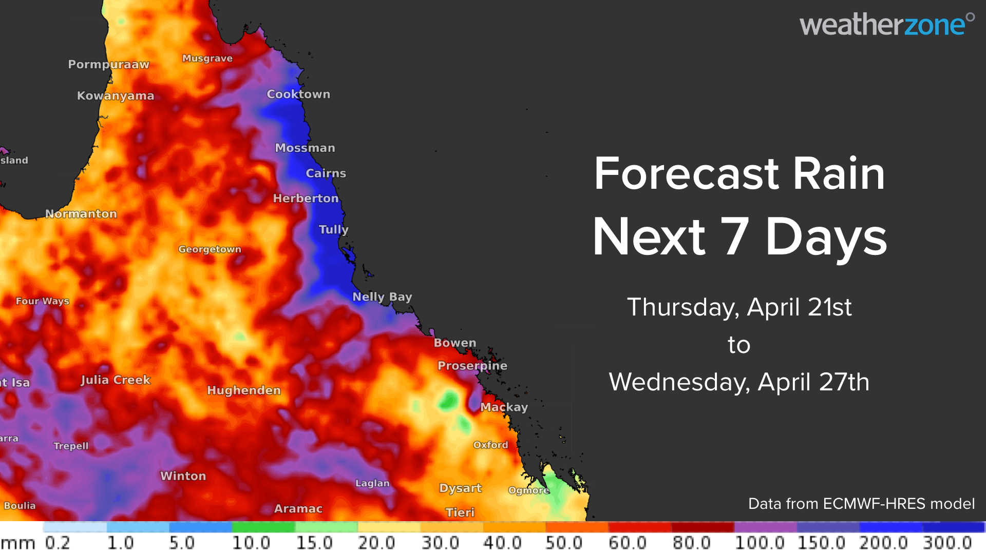
The heaviest falls will occur along parts of the eastern tropical coast and nearby hinterland, where accumulated rainfall totals should reach 150-400mm during the next seven days, with isolated areas possibly reaching around 700mm. The heaviest rain will most likely fall between about Cooktown and Townsville.
The bulk of this rain will fall between Thursday and Sunday, although some models suggest that heavy rain could linger on Monday and Tuesday as well.

Image: Forecast accumulated rain during the next four days (Thursday to Sunday), according to the ECMWF model.
Accumulated rainfall totals of 50 to 150 mm are also possible across parts of western and central QLD between this weekend and the middle of next week.
The map below shows the forecast accumulated rain during the week ending on Wednesday, April 27. While much of the Bowen Basin will most likely miss the heaviest rain from this system, parts of the basin could still see 100 to 150 mm during the next week.

Image: Forecast accumulated rain during the seven days ending on April 27, according to the ECMWF model.
Weatherzone will be watching closely as this system evolves over the coming days, for more information, please contact us at apac.sales@dtn.com.




