
Australia set to see active thunderstorm week
Australia is set to see a very active thunderstorm week as the monsoon trough deepens over northern QLD.
During this week’s monsoon, severe thunderstorms are likely to impact parts of NT, northern WA and QLD. These storms have the potential to produce heavy rain, flooding, lightning and damaging wind in these regions.
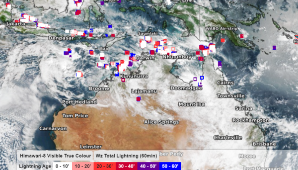
Visible satellite images and Weatherzone’s total lightning network captured lightning strikes at 11:10am Tuesday, January 25
Meanwhile the southern states are enduring hot and sticky weather which will trigger thunderstorms for several days this week. Severe thunderstorms are also likely across southern Australia, with more heavy rainfall on the cards for SA, VIC and NSW.
Weatherzone’s total lightning Network is driven by Earth Networks Total Lightning Network®. This network delivers the most reliable and precise lightning detection in the world, so you can make better decisions, protect property, minimize downtime, and safeguard lives when and where it matters most.
Our expansive network provides the most reliable, high-quality data in real time to help you quickly evaluate risk and act when dangerous weather threatens.
We are excited to announce an upgrade to our customers’ lighting detection service has been deployed recently.
We have been working closely with our lightning detection partner, Earth Networks for some time who have made significant improvements to their detection algorithms.
Key Improvements
- Improved location accuracy. By prioritising higher performing sensors and improving distance calculation the location accuracy has been significantly improved.
- Increased detection. We have seen increased detection of 20% – 25%. You will notice a greater volume of data coming through.
- Improved classification. Better classification of Cloud to Cloud and Cloud to Ground strikes.
Both WZTLN (Australia) and ENGLN (Global) feeds will greatly benefit from these upgrades.
This upgrade has been deployed today, for more information, please contact us at business@weatherone.com.au.




