Prosper in a dynamic world
Search

Cool, wet and windy weather impacting the WEM


A strong cold front passing through WA today will cause temperatures to plummet across southwestern WA today. The front will also elevate winds, and bring large surf to the western coastline during the next few days.

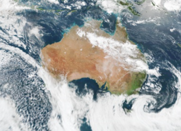
The satellite image below shows the cold front crossing the nation’s southwest on Monday morning. The front is marked by the thick band of cloud over southwestern WA.

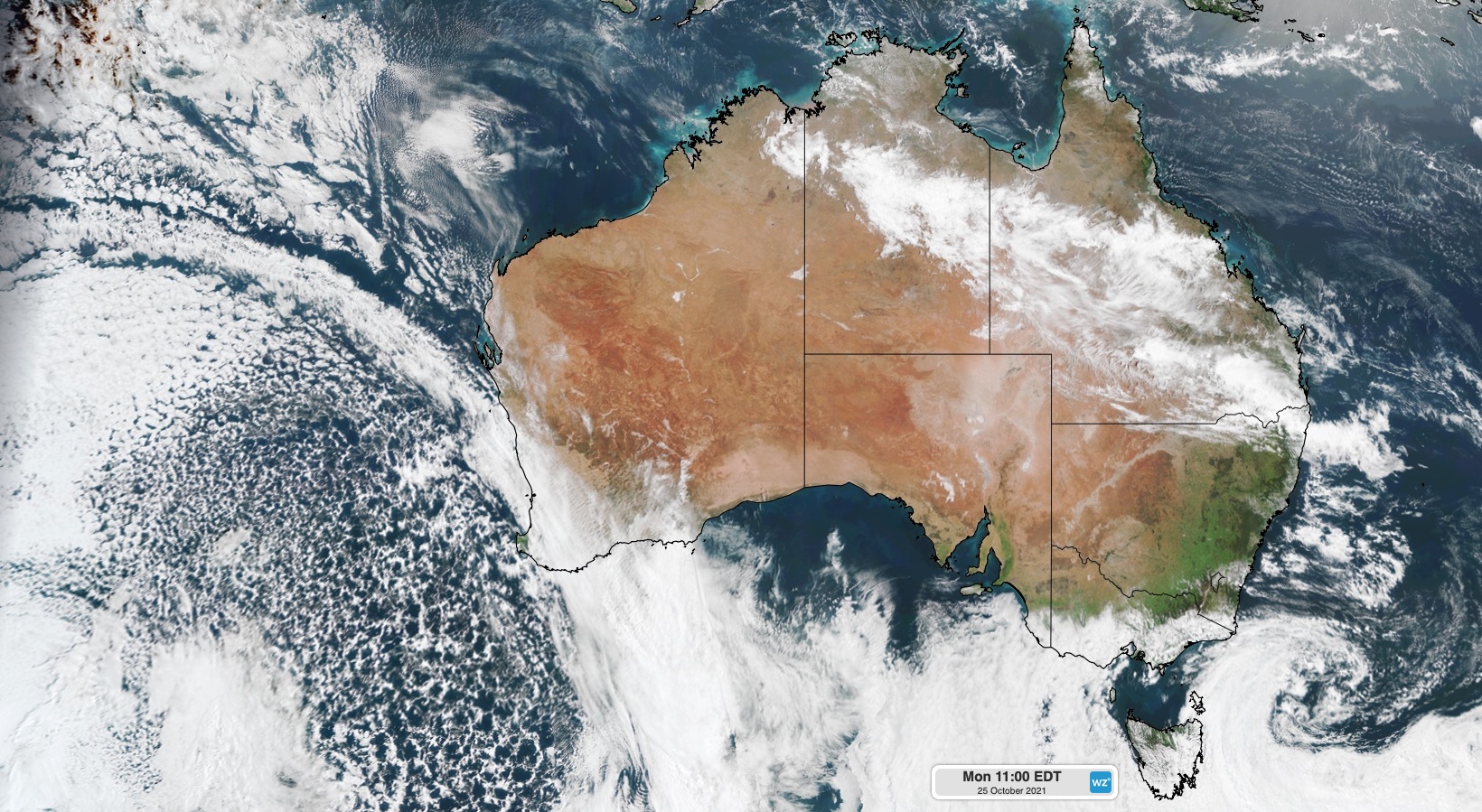
Image: Visible true-colour satellite image captured at 8am AWST on Monday by the Himawari-8 satellite.

To the south of this front is a large mass of speckled clouds, which is an indication of the very cool air on its way to WA.

The image below shows the stark contrast in airmass temperatures to the east and west of the front, with temperatures behind the front plummeting for a number of days.

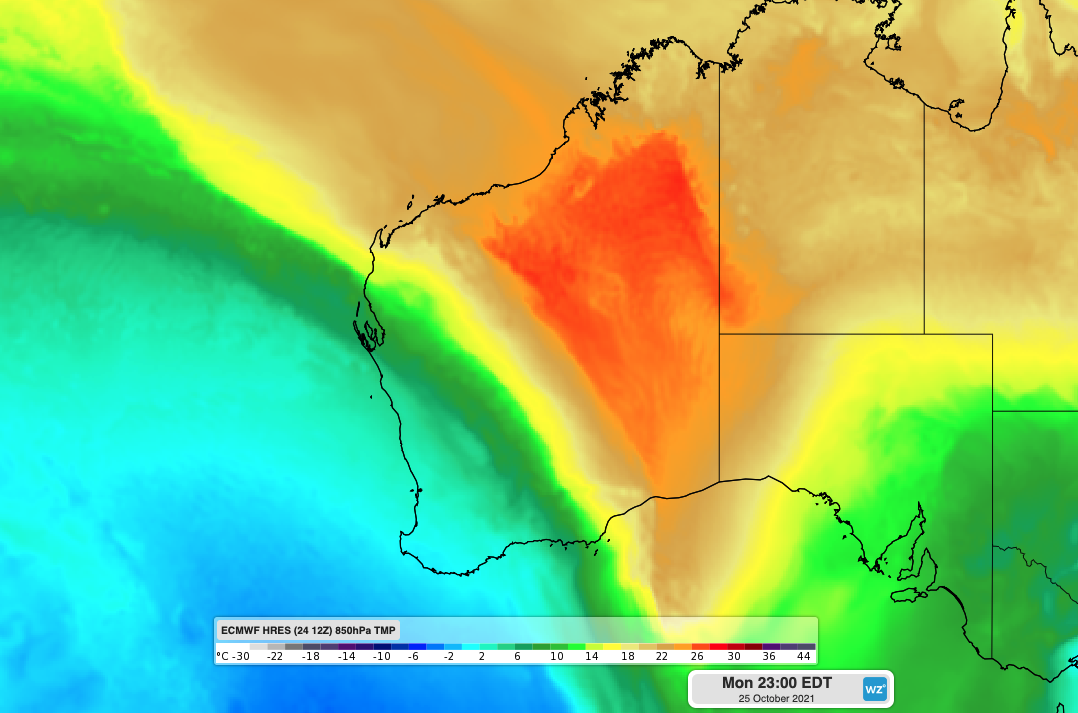
Image: Cool airmass entering southwestern WA at 8pm AWST on Monday.

Perth’s maximum temperature during the next 3 days will fail to exceed 18 degrees, with temperatures 5-6 degrees cooler than the October average.

Moderate to strong west to southwesterly winds will also increase the wind chill early this week, making these temperatures feel even colder. Temperatures are set to warm up just in time for the weekend after a very cool week for the west coast.

A very long fetch of west to southwesterly winds moving over the ocean for a number of days is set to bring large waves to the southern coastline of WA. Waves of 3-4 metres are predicted for the next 2-3 days along the coastline south of Carnarvon.

In contrast to the cold air heading towards WA from the south, the state’s north if experiencing hot, dry and windy conditions that are bringing Severe top Catastrophic fire danger to the states north and interior.

Severe to catastrophic fire danger is forecast for the East Pilbara Coast, West Pilbara Coast, East Pilbara Inland, Ashburton Inland, Gascoyne Inland, Goldfields, Eucla, South Interior and Esperance Shire Inland fire weather districts today.

For more information on Weatherzone’s 14 day temperature, wind, cloud and rain forecasting, please contact us at apac.sales@dtn.com.

Latest news

Satisfy your weather obsession with these news headlines from around the nation, and the world.

How does DTN help businesses monitor bushfire induced pyrocumulonimbus thunderstorms that ignite more fires?

Intense heat from bushfires during elevated fire danger days can trigger fire-induced pyrocumulonimbus thunderstorms that ignite additional fires. In early January 2026, an extreme heatwave sweeping over southeastern Australia brought catastrophic fire danger to Victoria. Intensely hot bush and grass fires spread erratically and quickly in hot, dry and gusty winds, with pyrocumulonimbus generating lightning, […]

Active seas to the north and east of Australia disrupting port and maritime operations

Seas to the north and east of Australia are experiencing periods of increased activity this week, leading to disruptions to port, maritime and offshore operations. Intense and hazardous Tasman Sea Ocean conditions across NSW’s South Coast rapidly deteriorated last Friday as a deep feed of easterly winds whipped up large and dangerous seas. The Batemans […]

Transport, emergency and energy industries flooded across Greater Sydney with weekend deluges

Transport, emergency, energy and port industries in eastern NSW and Sydney were impacted by significant flash flooding with intense and heavy rainfall this weekend. Rainfall rates between 80 and 140mm in one to three hours were registered across parts of Sydney’s Northern Beaches and Central Coast on Saturday afternoon and evening. In some areas, these […]

DTN Dangerous Thunderstorm Alerts in action with severe thunderstorms disrupting Perth industries

Severe thunderstorms impacted southwest WA and the Perth region on Sunday, December 14, 2025, triggering Dangerous Thunderstorm Alerts (DTA) by DTN for industries and businesses in the region. DTN operates Dangerous Thunderstorm Alerts (DTA) which alert businesses and industries to thunderstorms based on intensity and movement. These alerts provide advanced notice of thunderstorms moving into […]