After a well sought after monsoon break, northern Australia may see an increase in rain and thunderstorm activity, as well as an elevated risk of tropical cyclone development.
There are three systems that we are keeping a close eye on, the first low pressure system that is forecast to develop tomorrow in the northwestern Coral Sea (East Region). There is a risk of the low pressure system deepening into a cyclone later this week into early next week, however there is a lot of discrepancy between the models (high uncertainty). This system has a chance of making landfall, however uncertainty is high.
Over to the west of the country (West Region) a second low pressure system in the Christmas Island area is expected to track to the west and gradually deepen. There is a high chance that this low will deepen to a cyclone by Friday. This system poses no threat to the mainland.
A third low to the west of the country (Western Region) may form across the Timor Sea. The system may intensify into a tropical cyclone as it moves south. The low only has a small chance of directly impacting mainland WA as a cyclone. Model uncertainty is high at this stage.
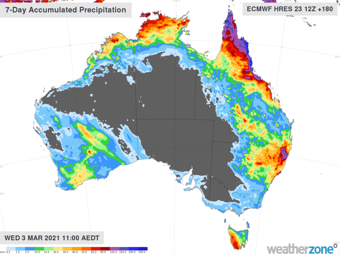
During the next week to Wednesday the 3rd of March widespread rainfall is forecast for the Top End and far northern Queensland, in association with the low pressure systems (figure 1). Of course rainfall totals will depend on if the systems make landfall and how strong the systems are.
Our Meteorologists send a 7-day tropical cyclone forecast daily, indicating the tropical cyclone probability for your area, indicating a very low, low, moderate or high probability of a cyclone. The meteorologists will also summarise any system, their movement, strength and the likelihood of landfall.
The first 3 days of the forecast are consistent with the Bureau of Meteorology, however the next 4 days are added by our Weatherzone Meteorologists. Bureau of Meteorology track maps and warnings are added to the Weatherzone tropical cyclone forecasts, to provide a complete and comprehensive tailored product.
Of course on the dashboard, the cyclone’s hazards and their duration will be described. For example, Heavy rainfall of the order of 50-100mm with isolated falls above 100mm is possible in Kimberley from Friday the 25th, easing on Sunday the 26th .
If you would like to receive more information on the upcoming events, please contact us at apac.sales@dtn.com.


