Australia’s tropical cyclone season is officially underway, but we may not see much activity for few months yet.
The season runs from November to April, and for mining operators and businesses across northern Australia, 2026-27 is shaping up to be a season where the headline numbers and the real risk may not line up.
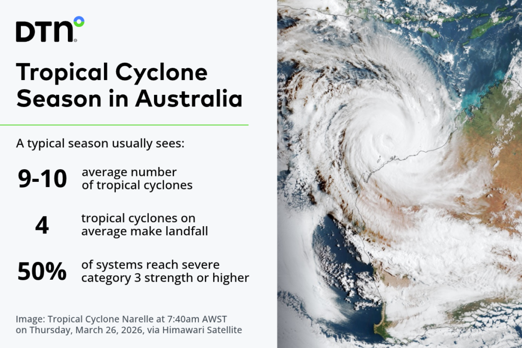
On average, the Australian region sees 9 to 10 tropical cyclones a season. About 4 of those cross the coast, and about 50% reach severe category 3 strength or higher, although recent years have seen a higher proportion of severe cyclones at around 60-70%. The first coastal crossing typically arrives in late December.
The climate drivers have a large influence on those numbers. Looking back at Bureau of Meteorology records since 1980, the busiest seasons tend to come in La Niña years (blue), and the quietest in El Niño years (red). Season totals have also drifted lower over time, by around one less tropical cyclone every 11 years.
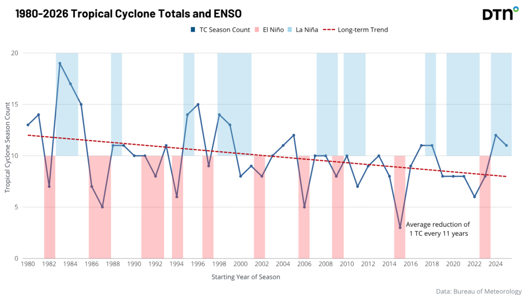
This year the setup points to the quieter end. A record breaking El Niño is in place, along with a positive Indian Ocean Dipole. Together, these create an atmospheric pattern that normally means below-average cyclone numbers.
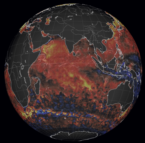
But the oceans are not following the usual script. Sea surface temperatures across the Indian Ocean basin and around much of Australia are running well above average, when an El Niño year would normally bring cooler water.
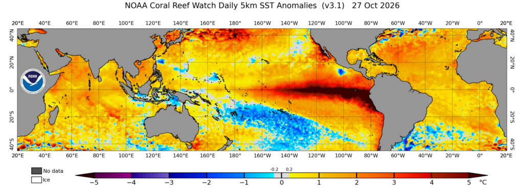
Image: Daily Sea Surface Temperatures (SSTs) on October, 27 2026. Source: NOAA Coral Reef Watch
Warm water is the fuel for tropical cyclones. A season with fewer systems can still produce stronger ones, and we would expect a higher proportion of the cyclones that do form to reach severe intensity.
Timing matters too. Both El Niño and a positive IOD can delay the arrival of the monsoon, and a later monsoon tends to push cyclone activity later into the season. For the parts of the Pilbara and Gascoyne, Top End and Cape York, that makes the late-season period, rather than the traditional late December start, the time to watch most closely.
Below-Average Cyclone Count Does Not Mean Below-Average Risk To Operations
For mining and resources operators, ports, energy providers and other businesses in the north, the message is simple: a below-average count is not a below-average risk. A single severe system can close a port, shut down a site and cut road and rail access for days. Shutdown and restart plans, supply stockpiles and crew arrangements should not be relaxed because the early weeks look quiet.
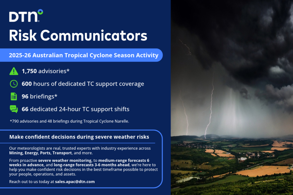
This is where DTN can help. Our meteorologists are tracking the season closely and can provide more detailed briefings, including expected cyclone numbers for individual regions, so your team can plan for the areas that matter to your operations rather than a national average. Our 7-Day Tropical Cyclone Service gives early guidance on developing and active systems, and our Risk Communicators can brief your leadership and site teams in clear, decision-ready terms.
Get in touch to book a regional briefing for your operations at sales.apac@dtn.com