NSW hydropower generation is climbing again after a soft beginning to the year, ahead of the biggest snowfall event this season with the potential for more than half a metre of snow forecast from late this week.
A strong cold front with a freezing airmass is set to sweep across southeastern Australia late this week into next week, likely bringing snow to not only the high terrain but also possibly extending to the Central Tablelands in NSW.
The map below shows the sub-zero temperatures extending over parts of NSW, Vic and Tas on Sunday evening, August 9, and another cold airmass sweeping across southwestern WA, which could impact southeastern Aus mid next week.
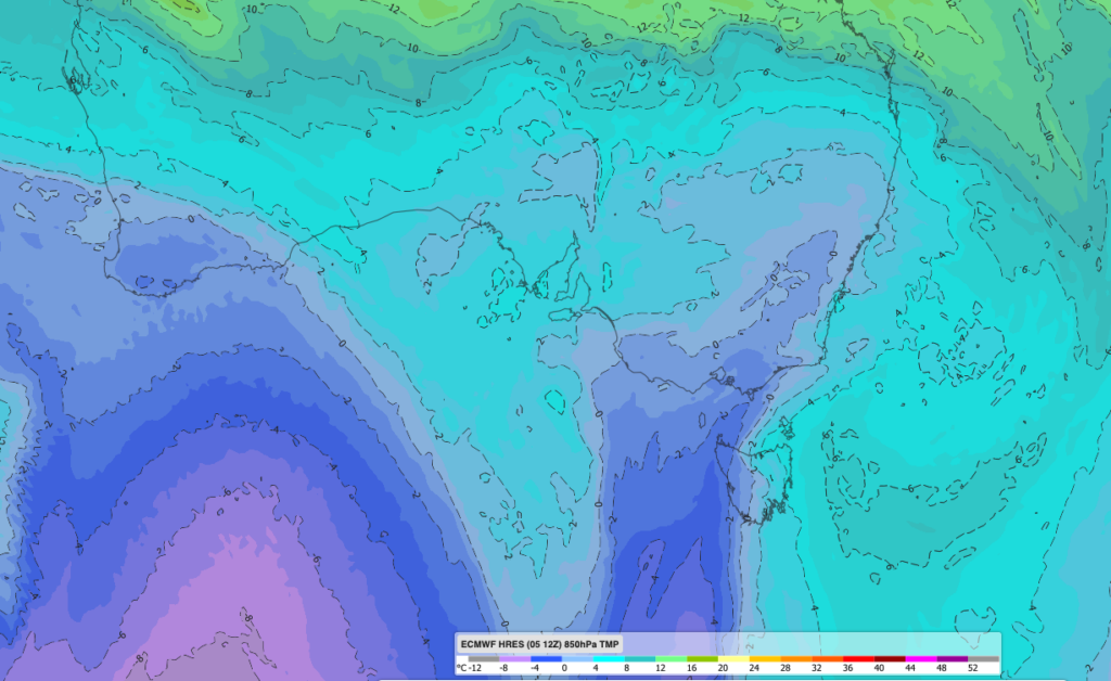
Image: ECMWF 850 hPa temperatures and wind forecast for 7pm on Sunday, August 9, 2026, showing the cold pool over southeastern Australia. Source: DTN
A soft 12 months, but the last two months have turned
Over the past year, NSW hydro generation totalled 2,342 GWh, which was down 14.7% on the 2,747 GWh generated in the prior 12 months. The drop in hydropower production over the past year, is linked to a mediocre beginning to the snow season, with a strongly positive Southern Annular Mode (SAM) dominating from late May to early July. The positive SAM meant that cold fronts and their associated cool air and moisture were further south than normal keeping conditions milder and drier over the alps than a typical winter.
The chart below shows that the last two months have broken that pattern. NSW hydropower generation in June and July were the first months this year to exceed the generation of 2025-the first back-to-back months in over a year where the output has exceeded the same month in the previous year.
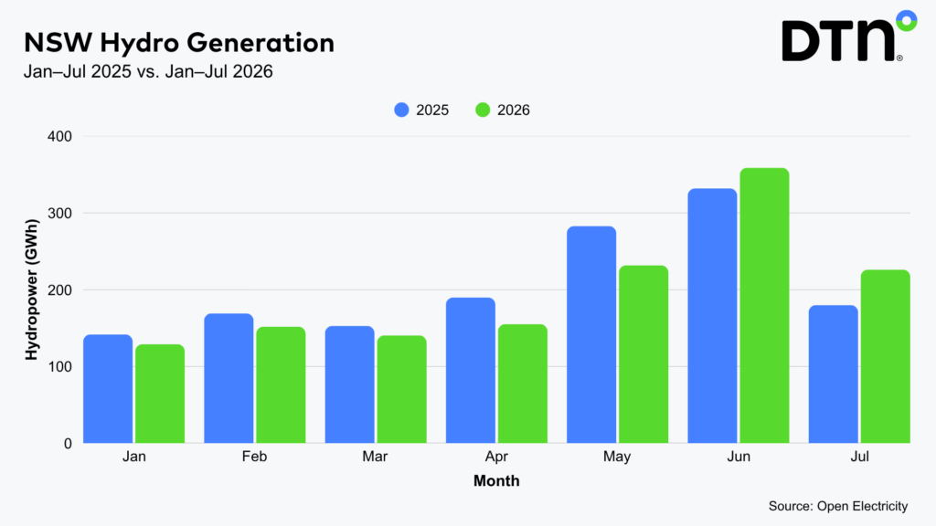 Image: NSW monthly hydro generation, January – July 2025 vs. 2026. Source: Open Electricity
The dramatic uptick in snow depth and hydro generation in NSW is linked to a negative SAM which developed from July into August, which meant that more snow bearing cold fronts extended further north into the Australian alpine region than normal.
Biggest snowfall of the season developing this weekend
The upcoming significant snowfall is also being driven by the negative SAM and increased frontal activity moving over southern Australia. The cold pool moving over the Alps by Sunday night is the ingredient that turns Sunday’s rain into heavy, sustained snowfall through the evening and into Monday. If it delivers as forecast, it should add to hydro generation over the weeks ahead.
The heaviest snow falls are expected Sunday into Monday and again on Wednesday, with 15-30cm of snow forecast on these days, with 5-10cm forecast in between the two systems. Snow levels are expected to drop as low as 900 metres at the peak of the event. During the next week there is potential for over half a metre of fresh snow at the higher resorts and potentially more. The second major snowfall forecast mid next week remains uncertain, with ECMWF’s 72- hour snow total to Thursday, August 13 peaking at around 65cm while GFS is predicting 29cm in the same window.
Snow depths nearing a metre
Snow depth records during the 2026 season so far have been lagging well behind the 2025 season. Spencers creek located at an elevation of 1,830 metres between Perisher and Thredbo with long standing records since 1954 is a good indication of the Australian snowpack. On Wednesday, hydro-electric operator Snowy Hydro released its latest measurement at Spencers creek of 87.1 centimetres, which is below the long-term average of 120cm and below what was observed in 2025.
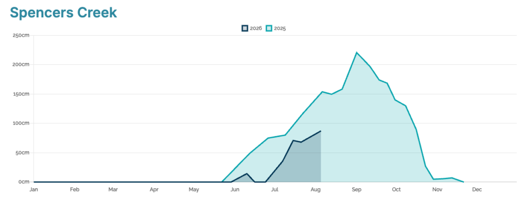
Image: Spencers Creek snow depth 2026 vs 2025. Source: SnowyHydro
August’s reading means that 2026 has now exceeded the peak depth of 85.1 cm in 2006 – the worst season on record.
The snowfall forecast over the coming week is not only great news for skiers, but also for hydropower generation in the National Electricity Market (NEM). As the snowpack builds across the Snowy catchments, it stores water that is gradually released through winter and spring as temperatures rise and snow melts, helping sustain inflows into the Snowy Scheme’s reservoirs. With a strong El Niño forecast to bring a drier-than-average spring and summer, this additional snowpack provides a valuable boost to water availability heading into the warmer months.
DTN APAC offers weather intelligence and analytics to support all aspects of your renewables business, with a wide range of specialised services covering energy generation and weather forecasting, to site-specific severe weather alerting and historical reporting. Learn more
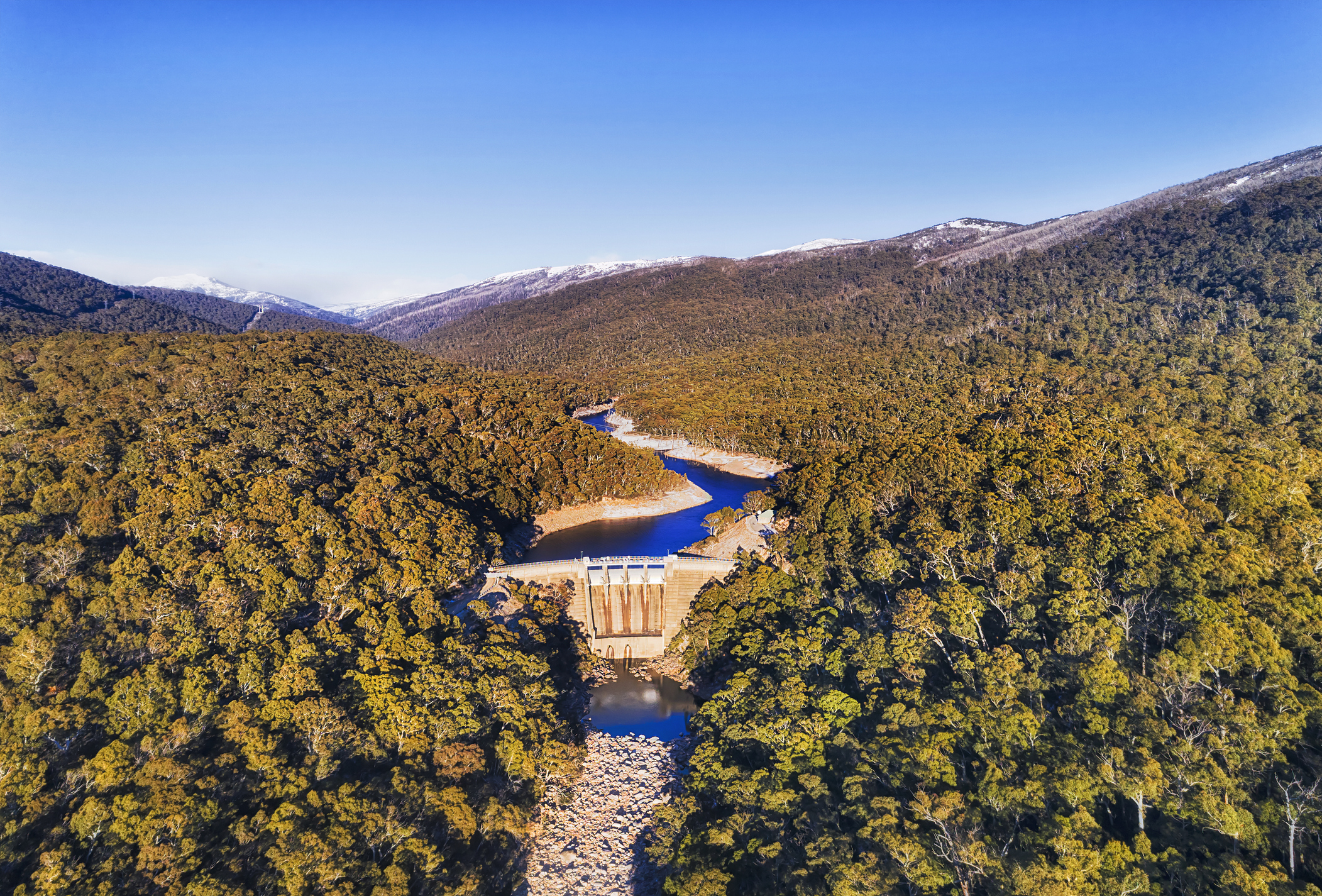
Thumbnail image: Snowy Mountains Snowy river blocked by Guthega dam in thick evergreen snow-gum woods seen from above. Source: iStock/zetter