A series of swells generated from powerful storms south of Australia are impacting coastal NSW ports on Thursday and Friday.
Large waves peak on Thursday morning
A large southerly swell moved into coastal NSW overnight into Thursday morning. Significant wave heights off Sydney’s coast can be seen rapidly increasing late on Wednesday and early on Thursday, reaching a peak just above the 3-metre mark (red line below). The maximum wave height (blue line below) at this time was just shy of 6 metres.
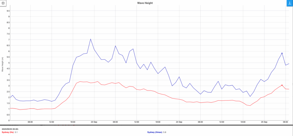
Image: Significant and maximum wave heights recorded at Sydney’s offshore buoy over the past few days. Source: Manly Hydraulics Laboratory
This initial burst of wave energy comes from a short distance away with a cold front clipping the lower Tasman Sea, generating strong-to-gale force winds some 125 to 250 nautical miles south of Sydney. The proximity of the fetch of winds means that the swell period of 10 to 12 seconds is relatively short – but still impactful to port operations including pilot transfers off the coast where large and chaotic waves can be very dangerous. While these waves are strong, longer wave periods and higher energy are coming.
Long period swell on the way
Wave height is decreasing this morning following the pre-dawn peak, but a series of longer period swells will move in throughout Thursday and Friday.
Video: DTN OneFX peak wave period forecast across the Australian region between Tuesday and Monday, September 23-29, 2025.
These longer period swells have been generated by powerful storms crossing to the south of Australia over the past few days. The storm force winds near the core of each system whipped up very large seas exceeding 10 metres to the southwest of Tasmania on Wednesday, over 1,000 nautical miles from Sydney.
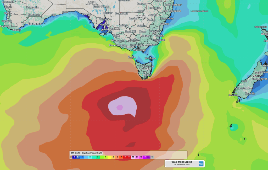
Image: OneFX significant wave heights around southern Australia on the evening of Wednesday, September 24, 2025.
As these waves propagate into the Tasman Sea, much of the wave height will be shed, but the period will increase greatly. The first of these longer period swells is expected to start impacting the coast later this morning, with more energy pushing into the afternoon. A peak wave height of around 1 metre is expected, but the much longer period of 15 to 17 seconds will bring deceptively powerful wave energy in the ocean.
Surges of energy will ebb and flow into the NSW coastline, reaching further into ports than shorter period swell do. The “waves” of deep water energy surging into ports can cause ships to drag on their moorings and anchors. Seiching can also amplify this water movement as the energy sloshes within the port boundaries, increasing horizontal and vertical ship movements.
The longest wave periods are expected to move into coastal NSW early on Friday morning, peaking around 19 or 20 seconds before gradually shortening to 16 to 17 seconds throughout the day. Once again, wave heights should be limited to around a metre or less, but large amounts of energy will be gracing the coastline and ports through the very long wave period, before gradually easing further into the weekend.
How DTN APAC assists marine, ports and offshore industries
DTN APAC offers a comprehensive suite of services, refined through years of collaboration with the marine, ports and offshore industries, to optimise the safety and efficiency of your operations.
We work with you to understand your intrinsic operational challenges and customise high-precision forecasting, metocean and aviation services to your exact location and operational scope.
When working offshore, our solutions can underpin planning and safe execution for offshore oil and gas enterprises and wind farms. Our data can support your exploration, development, rig moving, shuttle tanker operations, and production and decommissioning phases. Whether your crews are on-site, being transported to shore, or diving to perform maintenance, we deliver tailored weather risk briefings to ensure you choose the optimal time to proceed.
DTN APAC’s trusted nowcasting and forecasting system, OpticastTM, allows you to rapidly respond to changing conditions offshore, en route and in port. We take your port topography and berth orientation into account, ensuring site-specific forecasts. For offshore oil & gas, wind farms, ports and logistics, we have your weather situational awareness covered, no matter where you are. We deliver real-time severe weather and lightning alerts to your team via your integrated dashboard: Portzone, and our Weatherguard app.
DTN APAC’s Total Lightning Network (TLN) ensures you avoid hours of unnecessary downtime by providing the most accurate technology in lightning detection and alerting. Safeguard your teams and assets with lighting and Dangerous Thunderstorm Alerts (DTAs), customised to your existing parameters and delivered in real-time across all devices in your network. You gain full spatial awareness of developing severe weather systems, allowing you to plan ahead and, where needed, execute your shutdown and evacuation procedures.
With extreme conditions slowing production and affecting infrastructure, safety and transport, trust us to deliver Australia’s most precise weather data and tailored insights, giving you decisive confidence when it’s most needed.
Learn more about our large range of industry leading products and services or email us at sales.apac@dtn.com
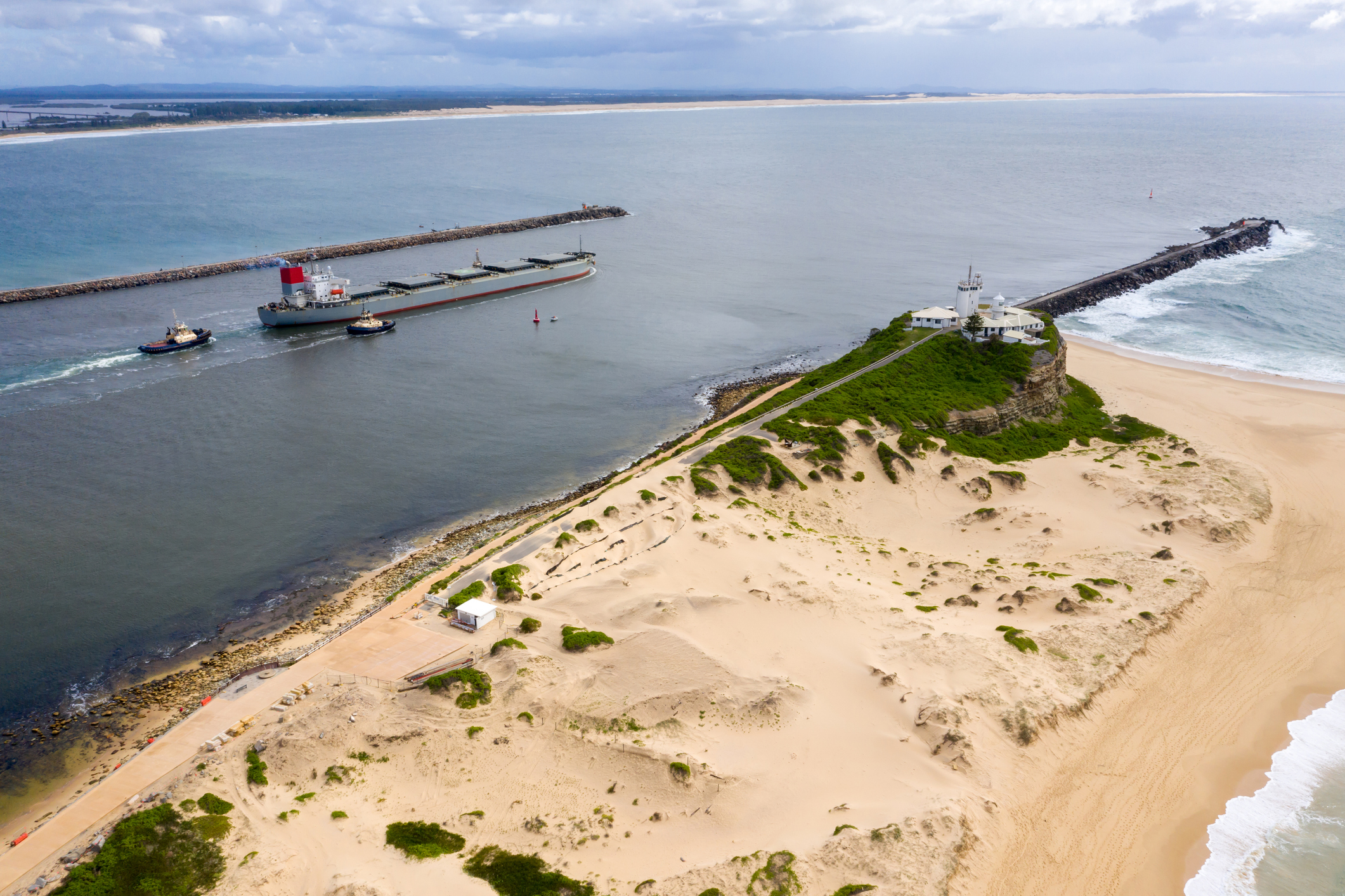
Thumbnail image source: iStock / bjeayes


