A broad cloudband of tropical origins is stretching across much of NSW, bringing chilly daytime temperatures and low solar energy generation.
The satellite imagery below shows a broad area of cloud extending across much of NSW on Tuesday. The temperature observation overlaid shows the mercury struggling to exceed the low-teens, with alpine and tableland areas struggling to reach the double digits.
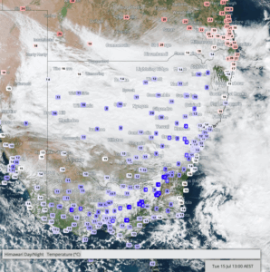
Image: Visible satellite imagery and temperature observations at 1pm on Tuesday, July 15, 2025.
This cloud mass comes from moisture that has slowly crept east across the continent after having been drawn south from the Indian Ocean over the weekend.
Video: Water vapour satellite imagery showing moisture streaming from the Indian Ocean across Australia on Monday, July 14, 2025.
As this moisture moved over the Australian continent, it formed into a broad band of thick cloud. This cloudband has thickened enough to significantly reduce the incoming solar radiation coming into NSW, leading to the chilly day.
The extensive cloud cover has also led to low solar energy generation output, compared to previous days. At 12pm across NSW, solar production accounted for 26.5% of the total energy output of the state, less than half the proportion at the same time on Sunday and Monday, when solar accounted for 57.2% and 62.6%, respectively, according to OpenNEM.
Sydney has slowly crept up to the mid-teens this afternoon under the persistent cloud cover, but should start cooling down into the evening now. With a maximum of 14.6°C reached, this makes it Sydney’s coldest July day in 3 years.
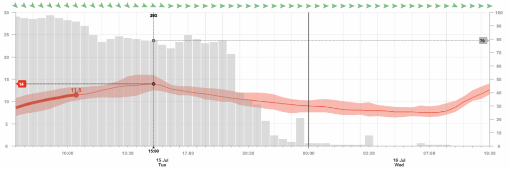
Image: Hourly Opticast temperature and cloud cover forecast for Sydney on Tuesday, July 15, 2025.
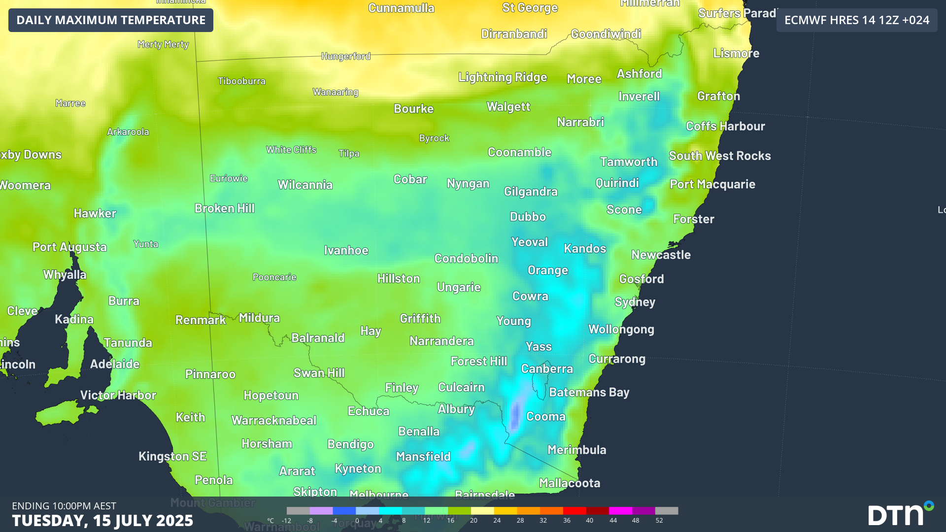
Elsewhere across the state, broad swaths of western, central and northern NSW have been limited to the low-teens. As of 3pm on Tuesday, these western NSW locations are currently experiencing their coldest day in:
- 9 years at Wilcannia Ap with a running maximum of 10.4°C
- 5 years at Ivanhoe Ap with a running maximum of 9.5°C
- 4 years at White Cliffs with a running maximum of 11.5°C

Image: Maximum temperature across NSW on Tuesday, July 15, 2025.
The cloudband will dissipate and move off the NSW coast late tonight, allowing the temperature to drop into a chilly start to Wednesday. Moisture left from inland rain across western and central NSW, combined with the cold early morning temperatures will lead to areas of fog tomorrow morning as well.
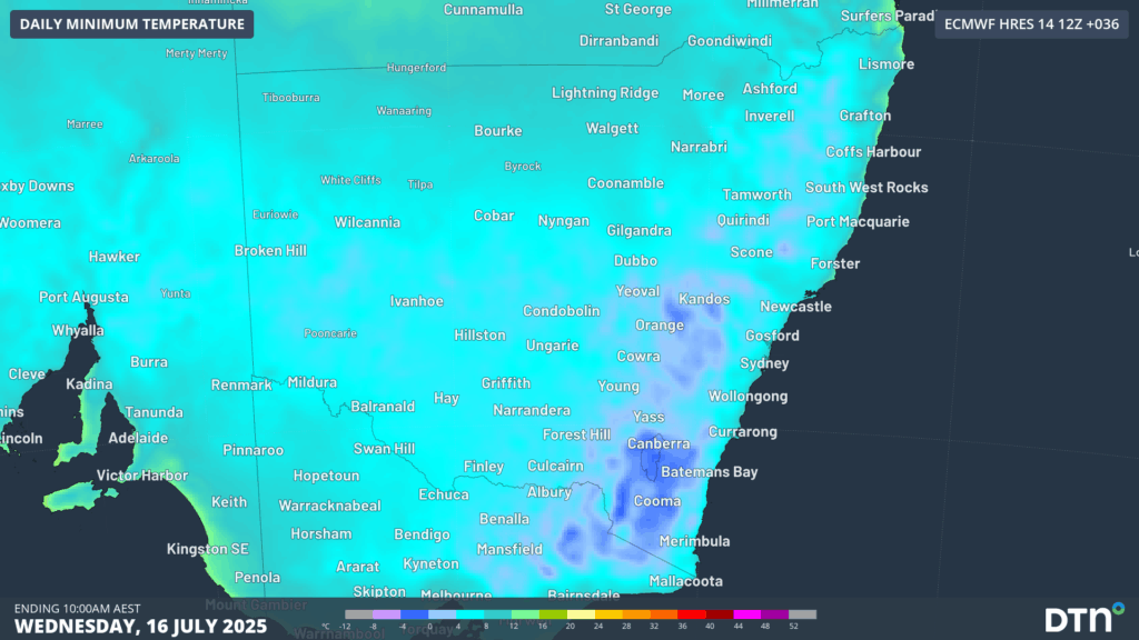
Image: Forecast minimum temperatures across NSW on Wednesday, July 16, 2025.
DTN APAC has grown to become the outright leader within the Australian energy market, serving wind, solar, hydro, trading, utilities and network companies.
You can’t control the weather, but you can gain precision insights to optimise your response. What lights us up is providing your energy business with tailored weather information to reduce your risk and keep you moving ahead of the curve.
Our services cover all aspects – from wind and solar generation to demand forecasts, wholesale markets to retail so, no matter where your company sits, we have solutions for you. We have worked closely with market participants to create products that meet the evolving needs of the sector, aiming to increase safety and profitability for our customers.
Your customisable Energyzone interface can assess heat/heatwave potential from 14 days out to 12 months. It allows you to benefit from specialised indices for CDD/HDD/apparent temperature/sunshine hours to help accurately predict the demand for electricity. This, along with high-resolution modelling and local knowledge, gives you the most precise information available to make the critical decisions that bolster your production.
Benefit from the timely delivery of accurate weather information, allowing informed and effective decision-making.
Learn more about our large range of industry leading products and services or email us at sales.apac@dtn.com


