Snow has fallen across Australia’s alpine region, and while it’s only a moderate amount, it’s a start for the peak hydropower season.
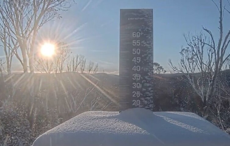
Australia’s largest resort Perisher was claiming 15cm of settled snow on its snow stake, with slightly lower totals reported at other resorts, after a polar airmass briefly whipped through southeastern Australia on Tuesday before clearing on Wednesday morning.
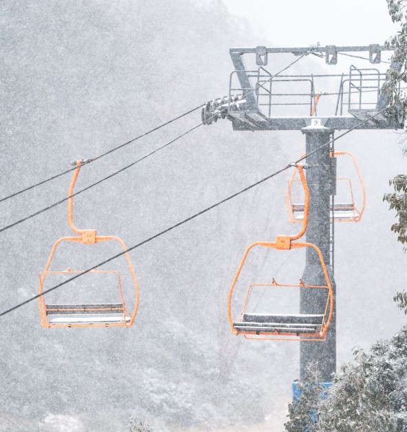
Image: Blizzard conditions were welcome albeit short-lived at Falls Creek in Victoria. Source: Falls Creek.
For keen snow watchers, this was a somewhat disappointing event, after models earlier this week had suggested the possibility of heavier snowfalls.
Unfortunately, most of the moisture arrived as rain in a warm northwesterly flow ahead of the front, after a cold pool of air wrapped around the low pressure system but didn’t surge across the Alps like a classic winter system.
While the rain that came ahead of the cold air was great news for parts of South Australia, Victoria, New South Wales and Tasmania, it wasn’t quite what the ski resorts ordered.
The good news for our ski resorts – and for anyone hoping for a slide on at least the beginner slopes on the King’s Birthday Long Weekend – is that a period of dry, sub-zero nights is now upon us. These conditions are ideal for snowmaking.
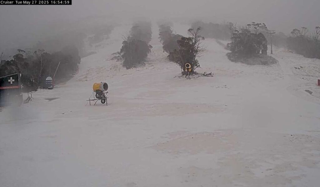
Image: Dust from the huge dust cloud that moved across SE Australia could be seen mixed with freshly fallen snow at Thredbo. Source: Thredbo.com.au.
How DTN APAC services the hydropower industry
Using Opticast’s nowcasting and forecasting capabilities, you will have long-term outlook covering rainfall and extreme heat events out to 12 months. This can significantly improve your planning as you integrate the data with site-specific hydrological parameters.
DTN APAC’s Opticast is an ultra-local forecasting system, independently proven to be the best performing of its type in Australia. Providing an unprecedented level of accuracy and precision, Opticast rapidly updates every 10 minutes, intelligently adapting to local observations, and corrects forecasts based on historical evidence. Wherever you are based, we can provide you with the most accurate nowcasting and forecasting data out to 14 days so that you can mitigate operational and safety risks, and plan to make the most of severe weather windows.
With renewables making up more of Australia’s energy mix every year, we want to support your business to make informed critical decisions and improve your overall generation and safety.
Learn more about our large range of industry leading products and services or email us at sales.apac@dtn.com


