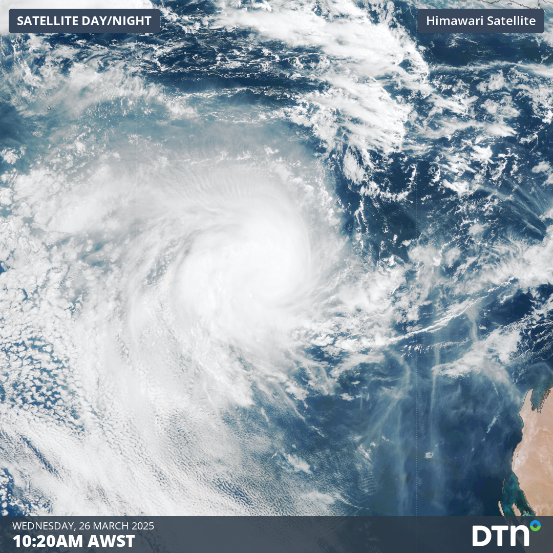
Tropical Cyclone Courtney, currently a Category 1 system, developed in the early morning of Wednesday, March 26, marking the eighth tropical cyclone of the Australian season.
Tropical Cyclone Courtney was slow to develop from a tropical low located south of Bali over the weekend, gradually tracking west-southwest over the past few days. Early on Wednesday, March 26, Tropical Cyclone Courtney was named by the Bureau of Meteorology as a Category 1 system. As of early Wednesday morning, Courtney was located nearly 900 kilometres northwest of Exmouth.
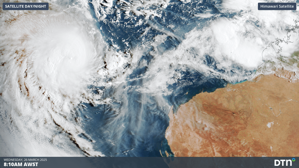
Image: Satellite loop showing Tropical Cyclone Courtney on the morning of Wednesday, March 26.
The forecast tropical cyclone track map below shows that Courtney will be whisked away to the west quite quickly, steered by a high pressure ridge to the south. Courtney may pass within 500 kilometres to the south of the Cocos (Keeling) Islands on Friday but is unlikely to directly impact the island communities and Australian mainland.
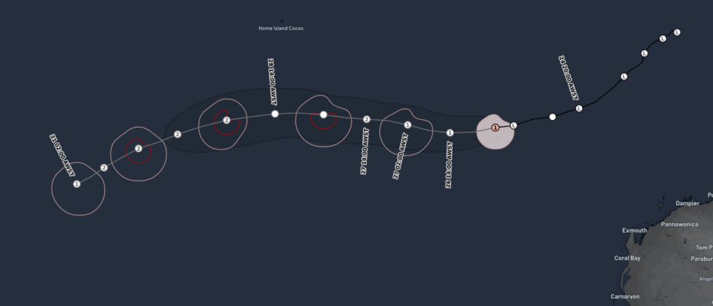
Image: Forecast track map for Tropical Cyclone Courtney, as of 9am AWST Wednesday, March 26.
The 2024-25 Australian tropical cyclone season so far
Even with Tropical Cyclone Robyn starting the season in a timely fashion in late November, the remainder of 2024 was slow with only a handful of tropical lows struggling to intensify significantly.
Between mid-January and early April, the tropics came alive with six out of the current total of eight tropical cyclones forming. Even more notably, all tropical cyclones during this period reached category 3 or higher, meaning that 75% of tropical cyclones throughout the entire season reached severe intensity. This is about double the typical proportion of tropical cyclones to become severe each season. This included the devastating and costly severe tropical cyclones Zelia and Alfred. Combined, these systems have likely cost more than 2 billion dollars (source: Australian Broadcast Corporation for Zelia and Alfred).
![]()
Image: current 2024-25 tropical system tracker.
The surge of very intense tropical cyclones came at the most active time of year for the Australian tropical cyclone season, but also combined with phenomenally warm waters around Australia, particularly in the north. Sea surface temperatures around Australia have been at record warm levels each month between October 2024 and February 2025. The image below shows the record warm summer sea surface temperatures which have helped fuel the intense tropical cyclone activity over the past summer.
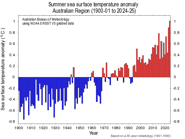
Image: Summer sea surface temperature anomalies in the Australian region between 1900 and 2025. Source: Bureau of Meteorology.
Increased tropical activity over the coming week
An active monsoon over the north of Australia, triggered by a strong burst of the Madden-Julian Oscillation (MJO), is bringing an increased risk of seeing other systems developing around northern Australia.
A mass of convective clouds off the northwest Kimberley coast should become increasingly organised in the next 24-36 hours, forming tropical low 28U. This system currently has a moderate chance of intensifying into a tropical cyclone between Friday and Sunday. The proximity to land will, however, make it difficult for the system to intensify before it crosses over land, most likely on Saturday, limiting any further intensification.
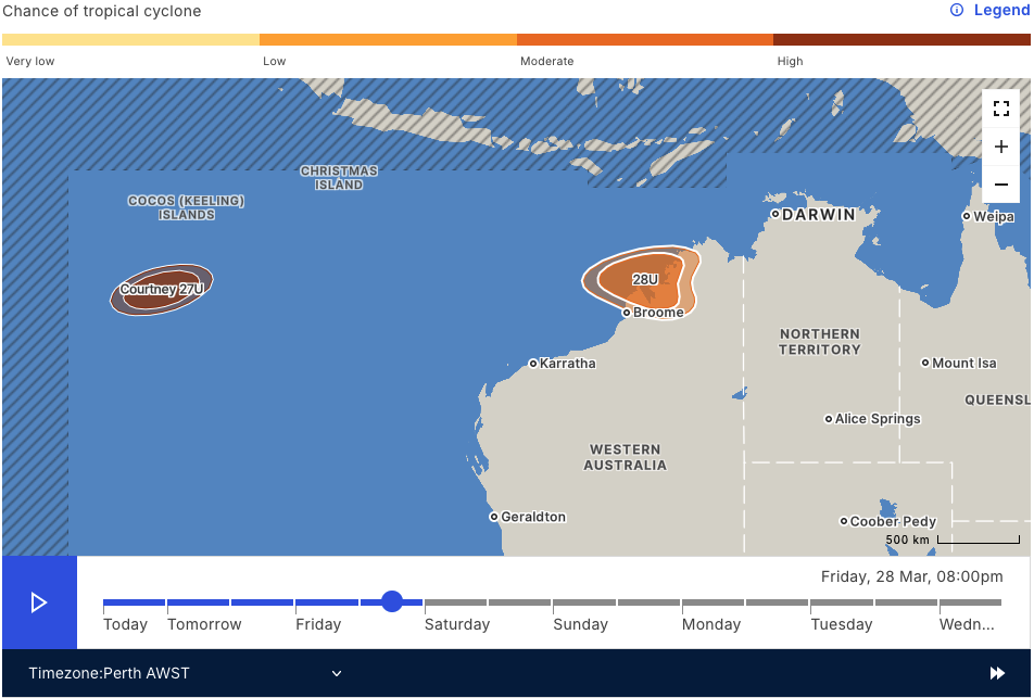
Image: Chance of tropical cyclone formation near Australia on Friday evening. Source: Bureau of Meteorology.
Regardless of whether tropical low 28U becomes a tropical cyclone, a deep stream of moist monsoonal winds drawn over the Kimberley by the tropical low and monsoon trough will lead to heavy rainfall and flooding. The image below shows accumulated rainfall totals of 100-200mm across most of the Kimberley, with areas in excess of 300-400mm possible.
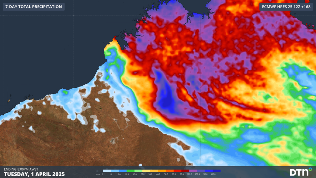
Image: Accumulated rainfall over WA’s Kimberley and Northern Interior in the week to Tuesday, April 1.
The MJO should weaken as it tracks northeast to the north of Australia in the first week of April, most likely limiting the potential for further significant tropical cyclone development. The next MJO burst looks to come later in April but should coincide with the start of the dry season across northern Australia. This monsoon outburst will likely be the last significant burst of heavy rain of the season for northern Australia, but tropical cyclones can form at any time of year in the Australian region.
How DTN APAC can help
As the climate delivers increasingly severe weather events, their potential to impact your business operations grows.
DTN APAC specialises in industry-leading forecast, alerting and threat analysis of tropical cyclones, offering you expert, customised solutions when the weather turns wild.
Providing rapid-update forecast information, we alert you to any low-pressure system gaining power within your region and, unlike other providers, can track its development out to 7 days. This gives you the time to prepare and safeguard your staff, sites and assets.
You will have the most precise weather intelligence charting rainfall, wind speeds and potential storm surges to help you make critical decisions quickly. Whether it’s adjusting key work schedules, protecting your staff or securing your site, we have the alerting capability to keep you steps ahead of the storm.
We will support you, 24/7, keeping you informed and making your critical decisions easier.
To find out more about large range of products and services contact us at sales.apac@dtn.com


