Northern Australia faces an increased risk of heavy rain and tropical cyclone activity in the coming weeks thanks to the interaction of two huge atmospheric waves near Australia.
While Earth’s atmosphere may appear chaotic, there are distinct wave-like patterns in the sky that meteorologists watch out for to help predict the weather in the coming weeks.
These planetary-scale atmospheric waves are particularly important in the tropics, where their location and strength strongly influence the development of clouds, rainfall, thunderstorms and tropical cyclones.
Over the next fortnight, two of these atmospheric waves will run into each other to the north of Australia, increasing the likelihood of heavy rain, thunderstorms and tropical cyclone activity.
The two waves are called the Madden Julian Oscillation (MJO) and an equatorial Rossby Wave.
What is the Madden Julian Oscillation?
The Madden Julian Oscillation, also known as the MJO, is a pulse of increased convective activity (enhanced cloud and stormy weather) that moves through Earth’s atmosphere near the equator. This tropical wave travels from west to east and typically takes around 30 to 60 days to complete one lap of the planet.
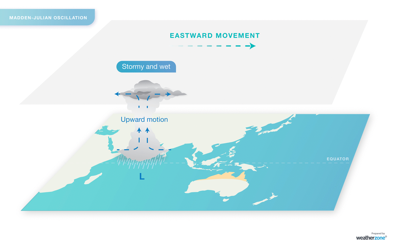
Image: Eastward propagation of stormy weather associated with the MJO.
The MJO varies in strength and its associated impacts. When it is in an active phase near the Australian region, northern Australia is at an increased risk of cloud cover, rainfall, thunderstorms and tropical cyclones.
What is an equatorial Rossby wave?
Equatorial Rossby waves travel through the tropical atmosphere from east to west at roughly the same speed as the MJO (but in the opposite direction). Equatorial Rossby waves typically produce an alternating sequence of high and low pressure systems on either side of the equator, resulting in mirrored zones of cloudiness and clear weather in the tropics of both hemispheres.
The MJO and equatorial Rossby waves both enhance rainy and stormy weather when they are near Australia, but their impacts are compounded when they arrive at the same time.
A recent study found that extreme rainfall is around 1.5 times more likely over northern Australia when an equatorial Rossby wave passes through the Australian region. However, when the Rossby wave coincides with an active pulse of the MJO, extreme rainfall is about three times more likely in northern Australia.
Forecast models show that an active pulse of the MJO will pass to the north of Australia during the first half of December and may even linger near Australia into the second half of the month. At the same time, a stormy node caused by an equatorial Rossby wave is expected to move through the Australian region between about December 5 –13.
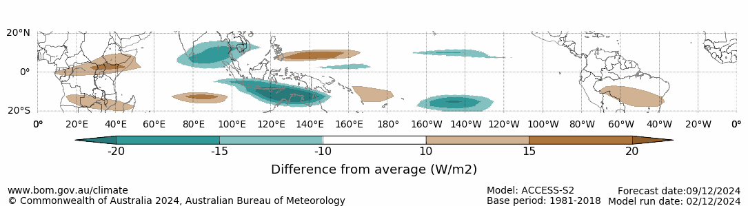
Image: Forecast outgoing long-wave radiation anomaly for December 9, 2024, associated with the MJO. The green areas show where cloud cover is expected to be enhanced, while the brown shading represents suppressed cloud cover. Source: Bureau of Meteorology.
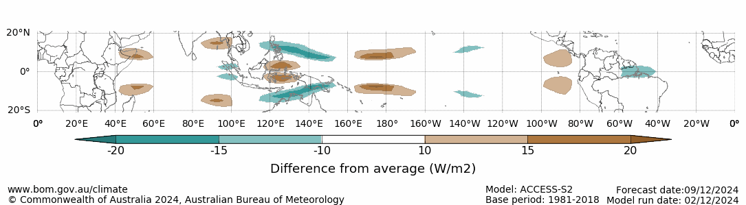
Image: Forecast outgoing long-wave radiation anomaly for December 9, 2024, associated with the equatorial Rossby wave. The green areas show where cloud cover is expected to be enhanced, while the brown shading represents suppressed cloud cover. Source: Bureau of Meteorology.
The coincidence of an active MJO and equatorial Rossby wave will increase the risk of heavy rain, thunderstorms and tropical cyclone activity in the Australian region during the next couple of weeks.
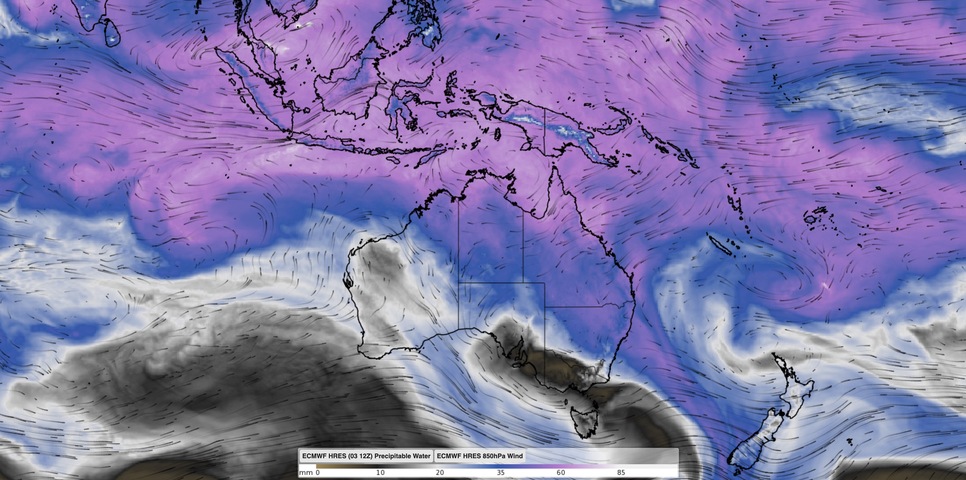
Some computer models are already reacting to the looming presence of these tropical waves. The map below shows the forecast accumulated rain during the next seven days.
.png)
Image: Forecast accumulated rain during the week ending on Tuesday, December 10, 2024, according to the ECMWF-HRES model.
A number of models are also hinting at increased tropical cyclone potential to the northwest of Australia from next week. This is partially in response to the impending influence of the MJO and tropical Rossby wave, but also due to a large pool of abnormally warm water that has developed off Australia’s northwest coast.
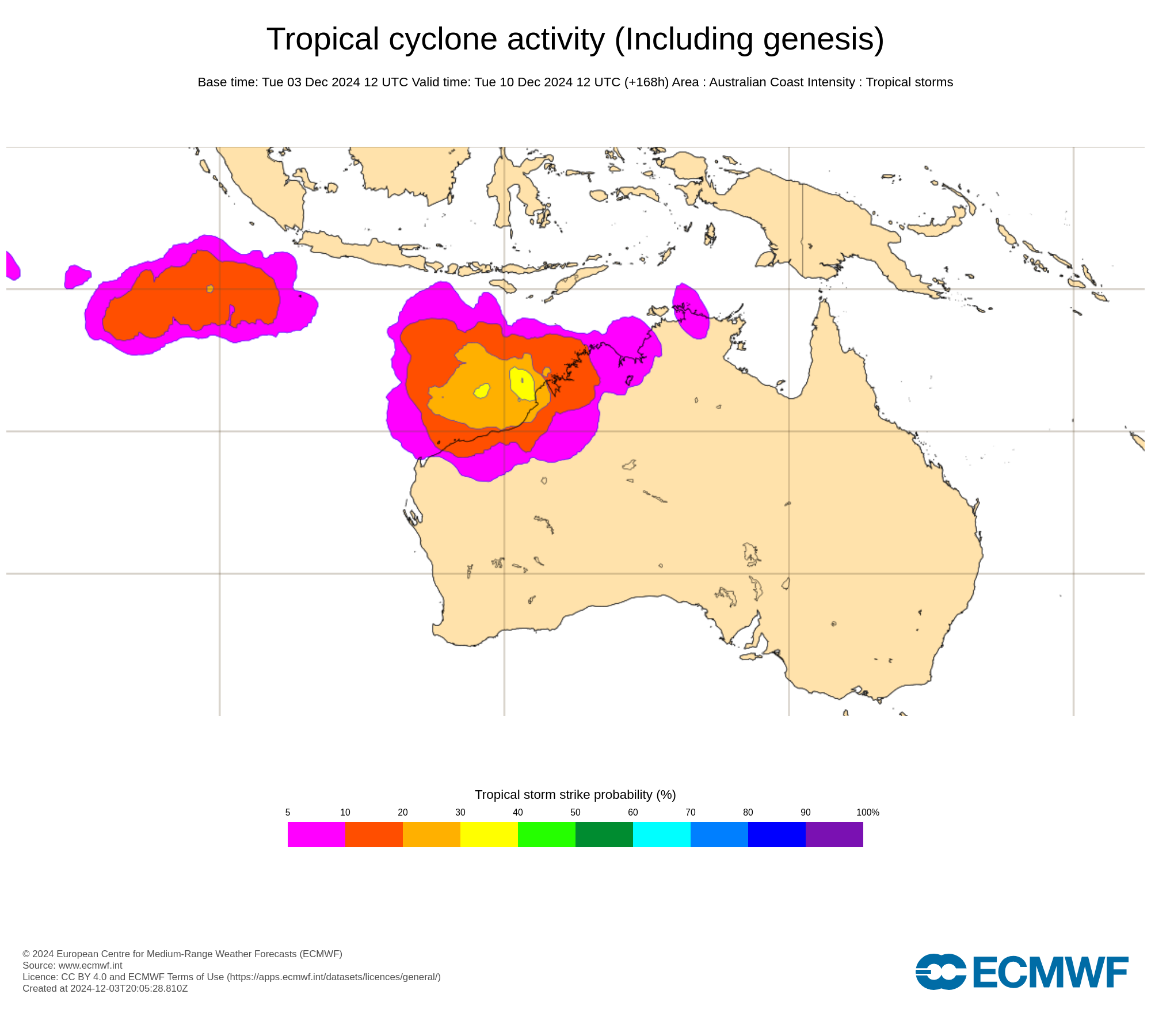
Image: Tropical cyclone potential on December 10, 2024, according to the ECMWF ensemble model. Source: ECMWF
Weatherzone’s meteorologists will be keeping a close eye on the tropics in the coming weeks and providing updates to our clients.
DTN delivers a Rainfall Risk System to equip you with detailed situational awareness.
Advanced Geofence Technology
You can measure rainfall and access rapid-update forecasting across multiple sections of your site or assets with our geofence alerting system. The technology creates hundreds of virtual ‘weather stations’ for each chosen catchment, enabling precise determination of both rainfall intensity and accumulation.
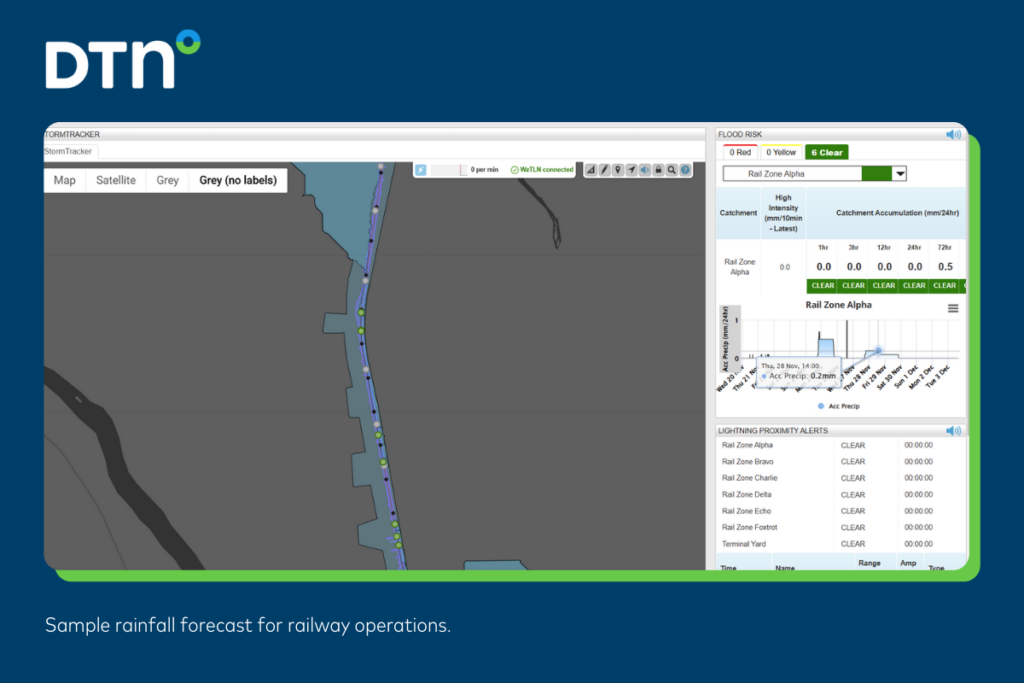
Image: Rainfall forecast for a client’s railway
Real-time Flood Risk and Alerts
Real-time Flood Risk and Alerts Real-time rainfall is measured across each catchment in relation to their defined thresholds. Alerts are raised when thresholds for any section are approaching or have been breached, giving you targeted visibility of flood risk to inform your operational response.
Driven by Precise High-resolution Modelling
Oracle is Weatherzone’s satellite-derived gridded nowcasting system, forecasting at a 1-2km resolution and updating every five minutes. This capacity gives Oracle the upper hand in capturing temperature, lightning, cloud cover, wind, and rainfall for your exact location, no matter how remote.
For more information please visit our website or email us at sales.apac@dtn.com.


