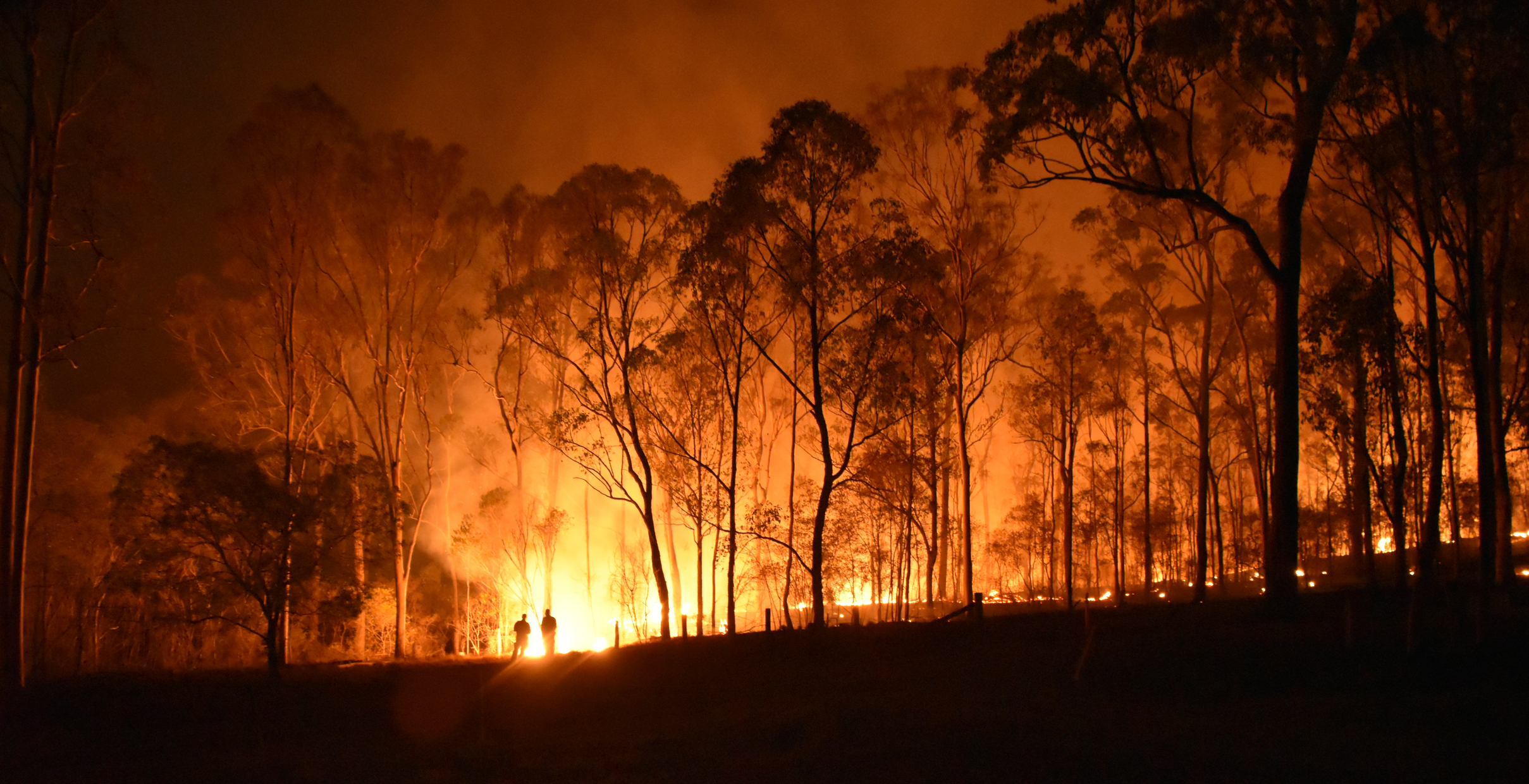
Australia’s warmest August on record has laid the foundations for an increased risk of fires in multiple states and territories this spring.
According to the latest Australian Seasonal Bushfire Outlook, which was released on Wednesday, large areas of Australia will have an increased risk of fires this spring.
The red shading on the map below shows areas that have an increased risk of fires over the next three months. The remaining grey areas on the map have a near-normal risk of spring fires, according to the AFAC outlook.
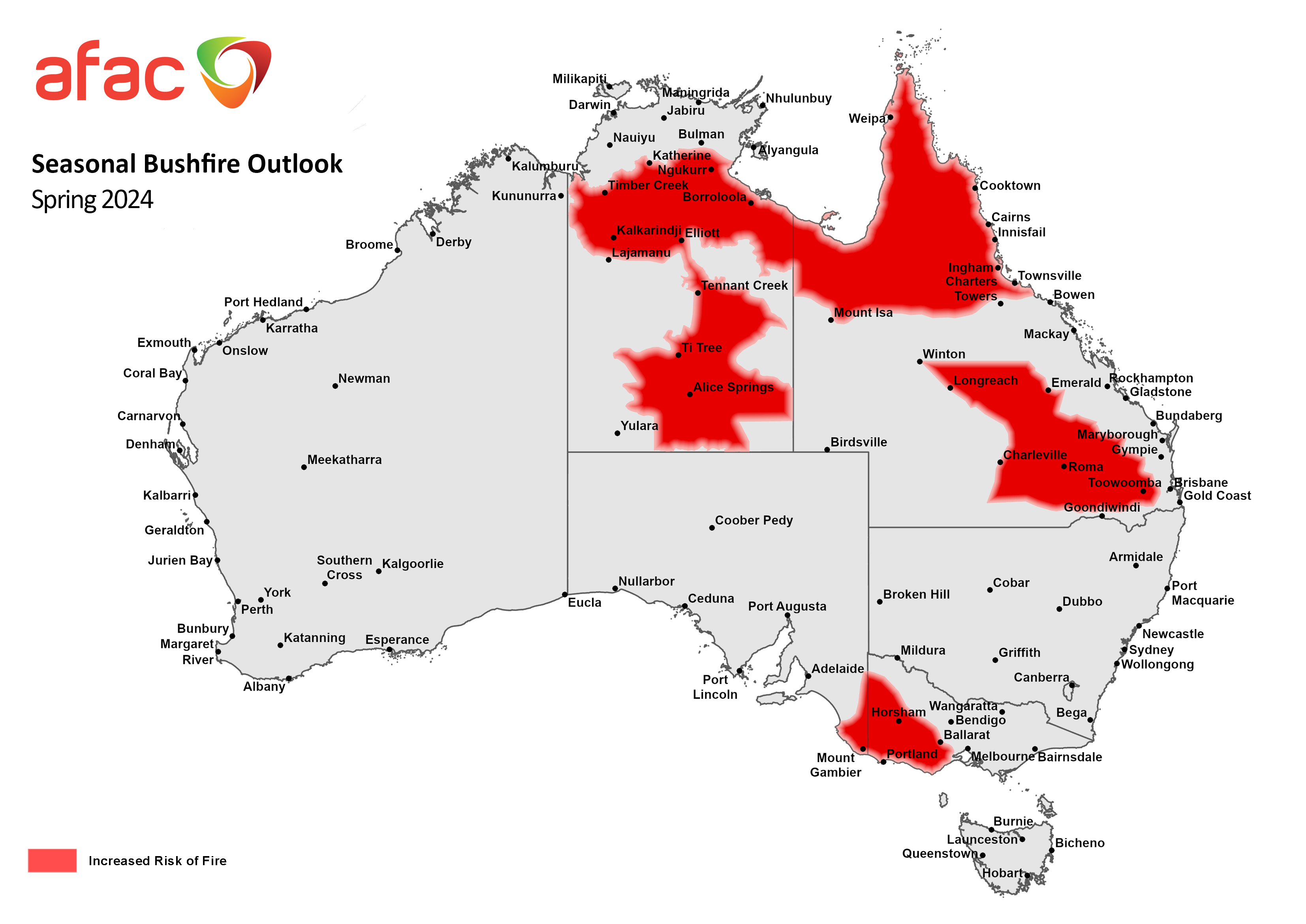
Image: Australian seasonal bushfire outlook for spring 2024. Source: AFAC
The outlook map shows that large areas of the NT and Qld, and parts of southeastern SA and western Vic are expected to see an increased risk of fires in spring.
- In the NT and Qld, this increased fire risk is a result of:
- Healthy rainfall earlier this year and in previous years, which has enhanced vegetation growth
- Abnormally hot and windy weather towards the end of winter, which amplified vegetation curing
- Forecast above average temperatures in the coming months
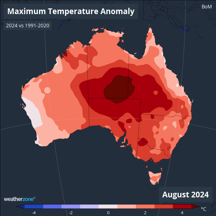
Image: Maximum temperature anomaly in August 2024, showing above-average daytime heat across Australia.
In southern Australia, parts of SA, Vic, Tas and WA experienced record low rainfall during the first half of this year. While above-average rain returned to parts of southwest WA and Tas during August, parts of Vic and SA continued to see abnormally dry weather through late-winter. This ongoing dryness in SA and Vic is depleting soil moisture and enhancing vegetation dryness, with AFAC predicting an increased the risk of fires in western Vic and southeast SA this spring.
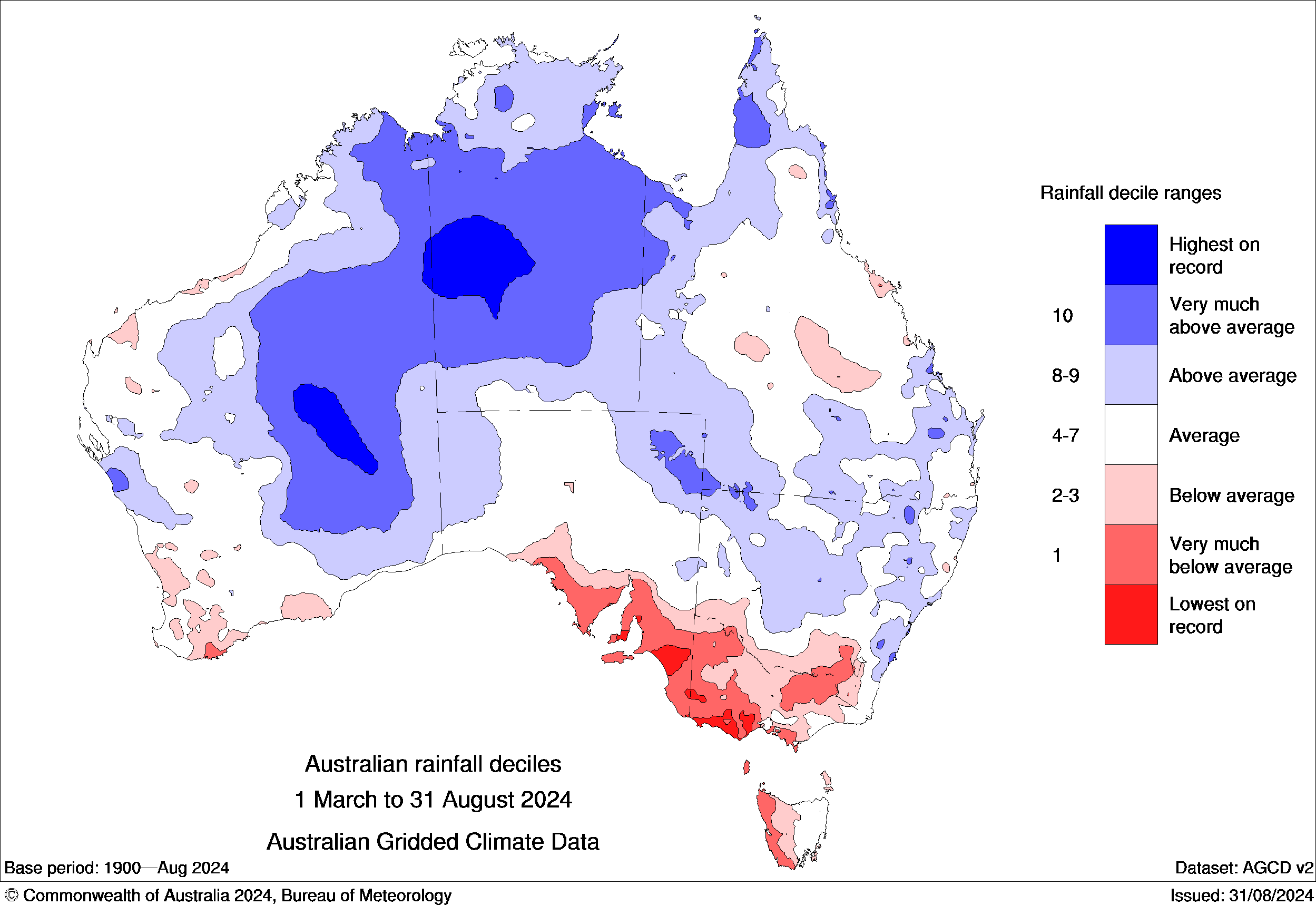
Image: Observed rainfall deciles during the first half of 2024. Source: Bureau of Meteorology
It’s also important to note that the near-normal fire risk predicted for large areas of eastern and southeastern Australia this spring is partially linked to an expectation of above-average rainfall during the next few months. If this wetter-than-average weather does not eventuate, the risk of fires will also be higher than normal.
NSW is one state that has a notable risk of fires if above average rain doesn’t occur this season, particularly in the second half of spring. The AFAC outlook notes that “grass fuel loads remain higher than normal due to favourable growing conditions.”
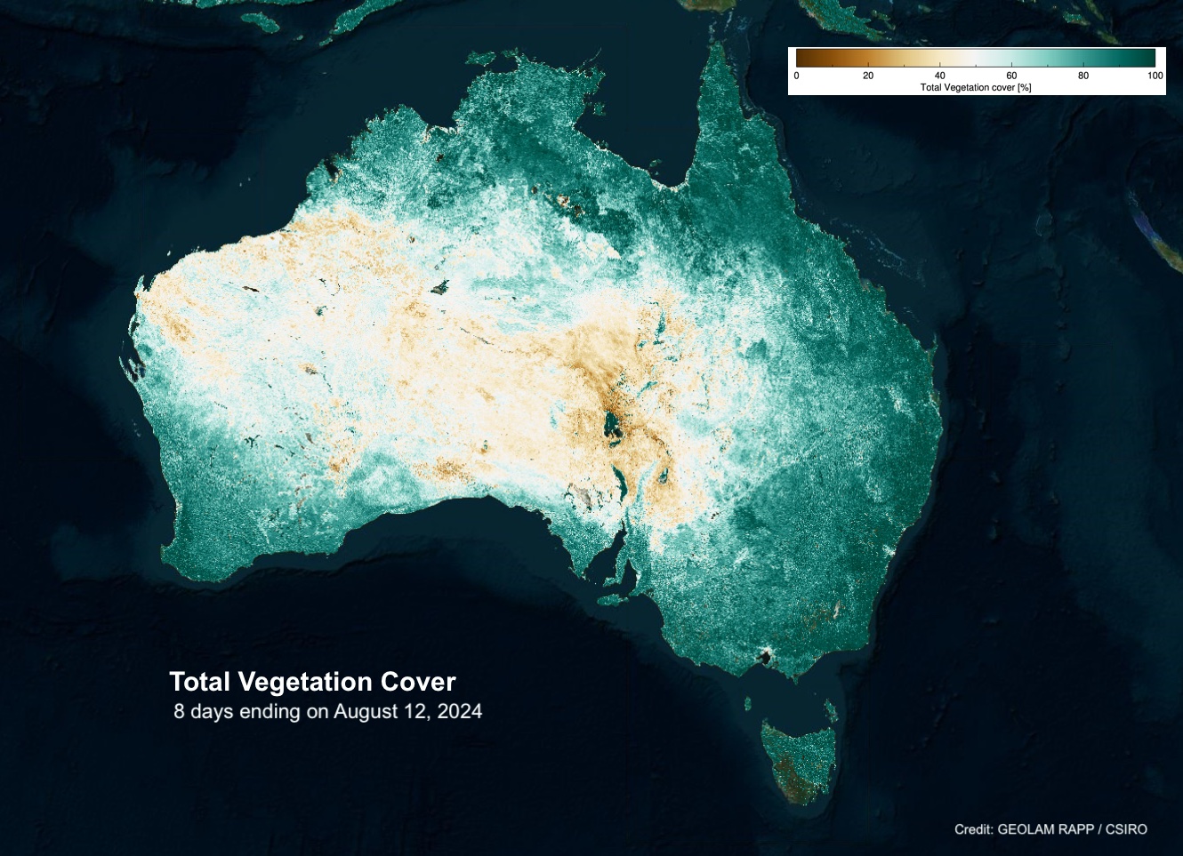
Image: Total vegetation cover in the 8 days ending on August 12, 2024. Source: GEOLAM RAPP / CSIRO
The outlook also highlights the risk of fires in the bushland areas of NSW that were burnt out during the Black Summer fires in 2019-20: “While the elevated fire risk this spring is mainly associated with grassland areas, forested regions impacted by the Black Summer fires have recovered to a point where, if conditions become dry, they could once again sustain dangerous fires.”
Weatherzone will continue to monitor Australia’s bushfire risk in the coming months and provide updated on the Weather News feed.
Working in often severe conditions in the high-risk fields of forestry and emergency, our consolidated weather services can ensure full situational awareness for you and your team.
DTN APAC serves the forestry and emergency sectors, delivering trusted weather data and severe weather alerting to maintain safety, protect your assets and underpin your planning.
Weatherzone’s trusted nowcasting and forecasting system, OpticastTM, is independently proven to outperform other industry models, allowing you to respond rapidly to changing conditions. Opticast can ingest data from your on-site weather observation equipment, ensuring your forecast is customised to your local microclimate. From nowcasting and 14 day forecasting to seasonal outlooks, you have powerful, hyper-local weather alerting and intelligence, giving you decisive confidence when it’s most needed.
With lightning a prominent cause of forest fires throughout Australia, Weatherzone’s Total Lightning Network offers real-time detection and unsurpassed accuracy of lightning strikes to <200m. Based on a vast sensor network, both intra-cloud and cloud-to-ground strikes are located, ensuring you are alerted when severe weather is building and threatening your teams, assets and infrastructure. When volatile conditions increase the ferocity of fire it’s imperative you have lead-time to enact safety plans, keeping your people out of harm’s way.
Your weather intelligence is accessible across all devices in your network via our Weatherguard App, and your customisable interface.
We are there for you when you need us the most – 24/7, 365 days a year. For more information, please visit our website or email us at apac.sales@dtn.com.


