
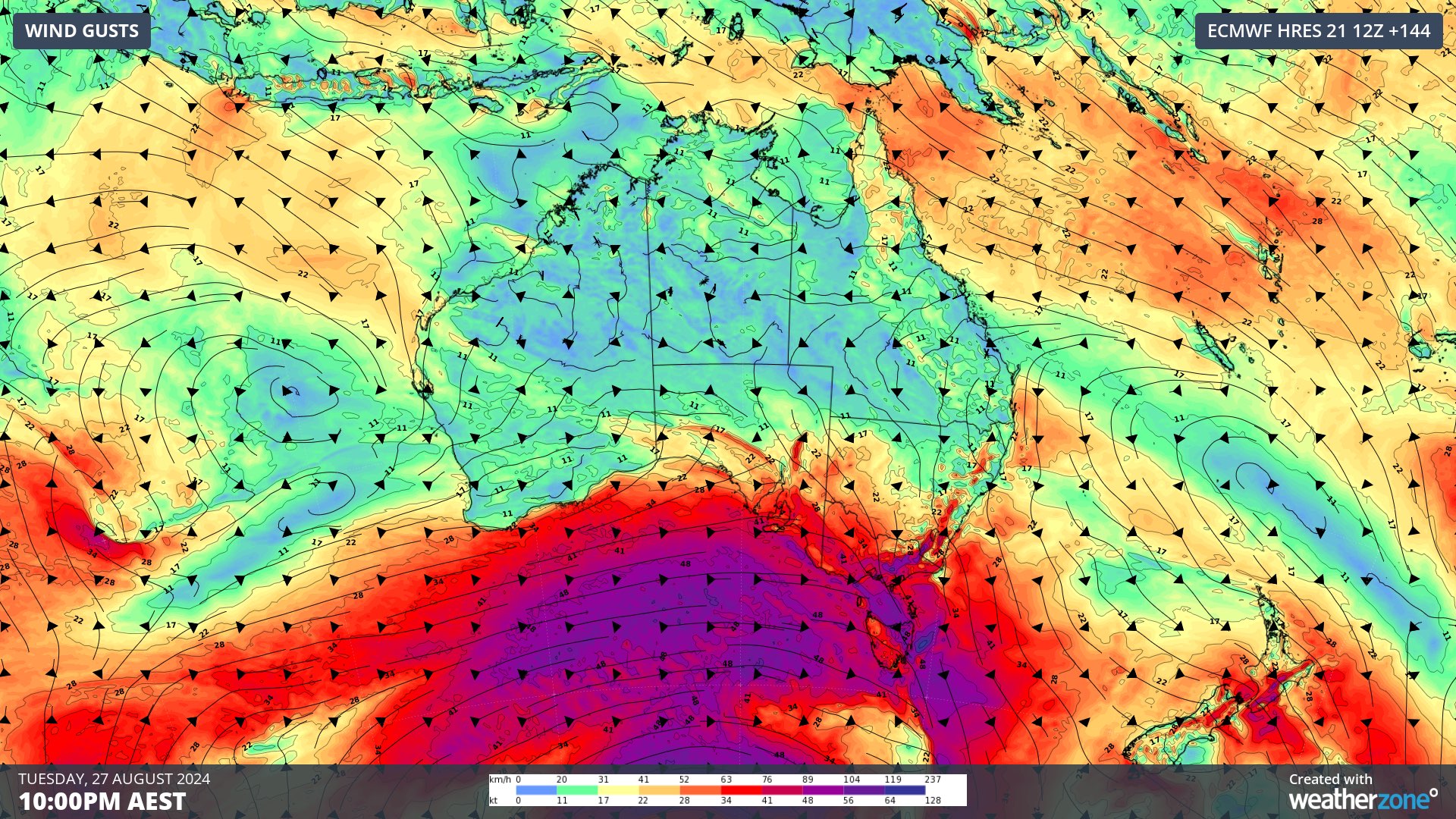
A prolonged period of powerful winds will lash the southern half of Australia from this weekend into next week as a deep low pressure system lingers over the Southern Ocean.
A complex and slow-moving low pressure system will pass between Australia and Antarctica over the coming week. This low will send a series of strong cold fronts across southern Australia, generating a prolonged period of powerful and damaging winds.
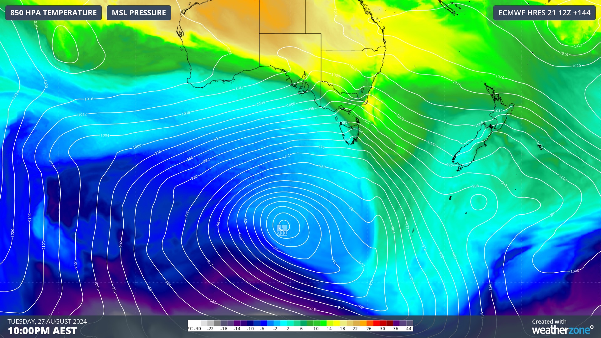
Image: Modelled mean sea level pressure and 850 hPa temperature at 10pm AEST on Tuesday, August 27, according to the ECMWF-HRES model.
Wind will pick up over the southwest of WA on Saturday and spread across SA, Vic, NSW, the ACT and Tas on Sunday and Monday as the first cold front sweeps across southern Australia.
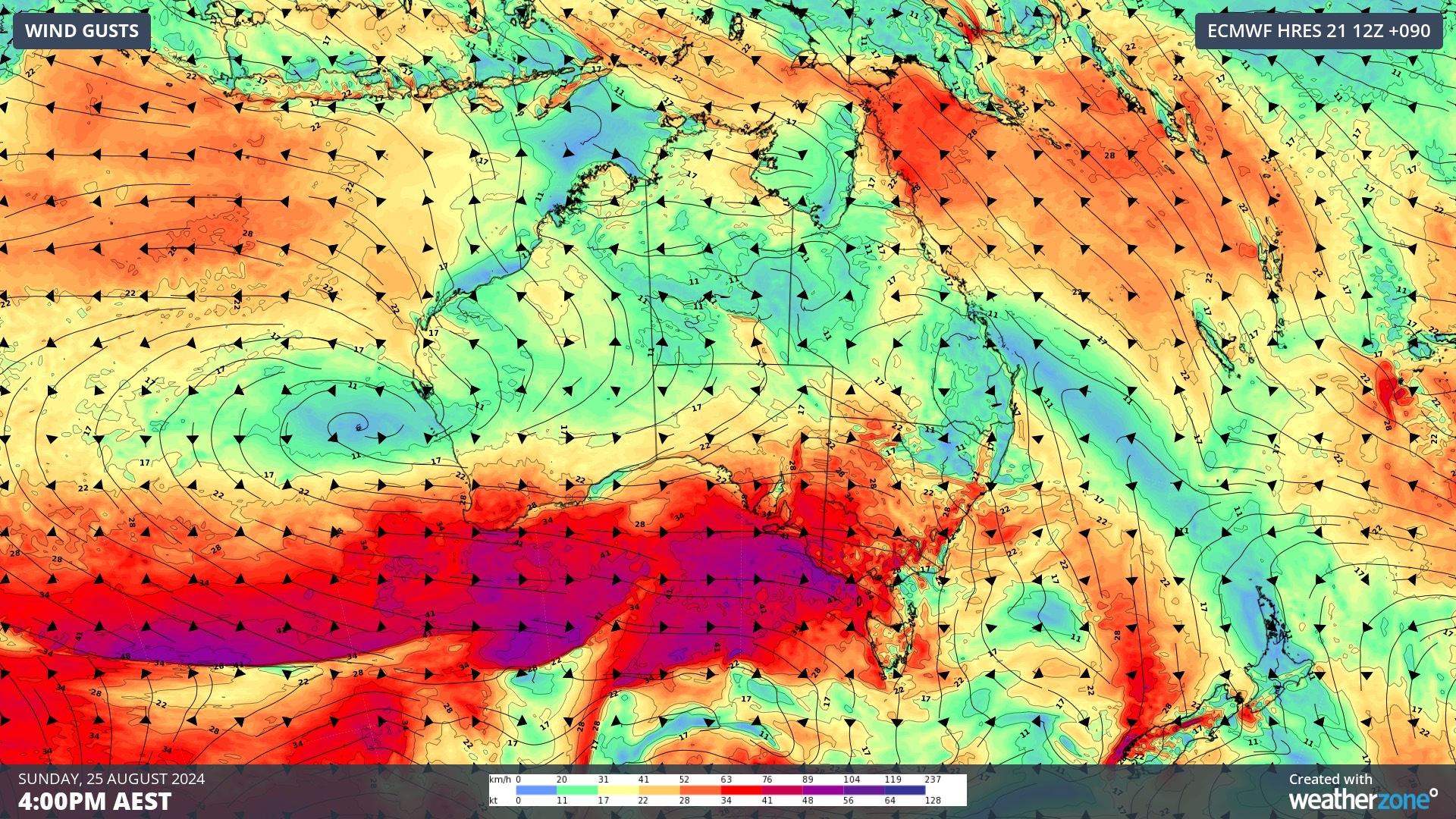
Image: Forecast wind gusts at 4pm AEST on Sunday, August 25, according to the ECMWF-HRES model.
The next front will bring a second and potentially stronger surge of wind across southern and southeastern Australia between Monday and Thursday. This system is likely to cause damaging winds gusts in multiple states and territories.
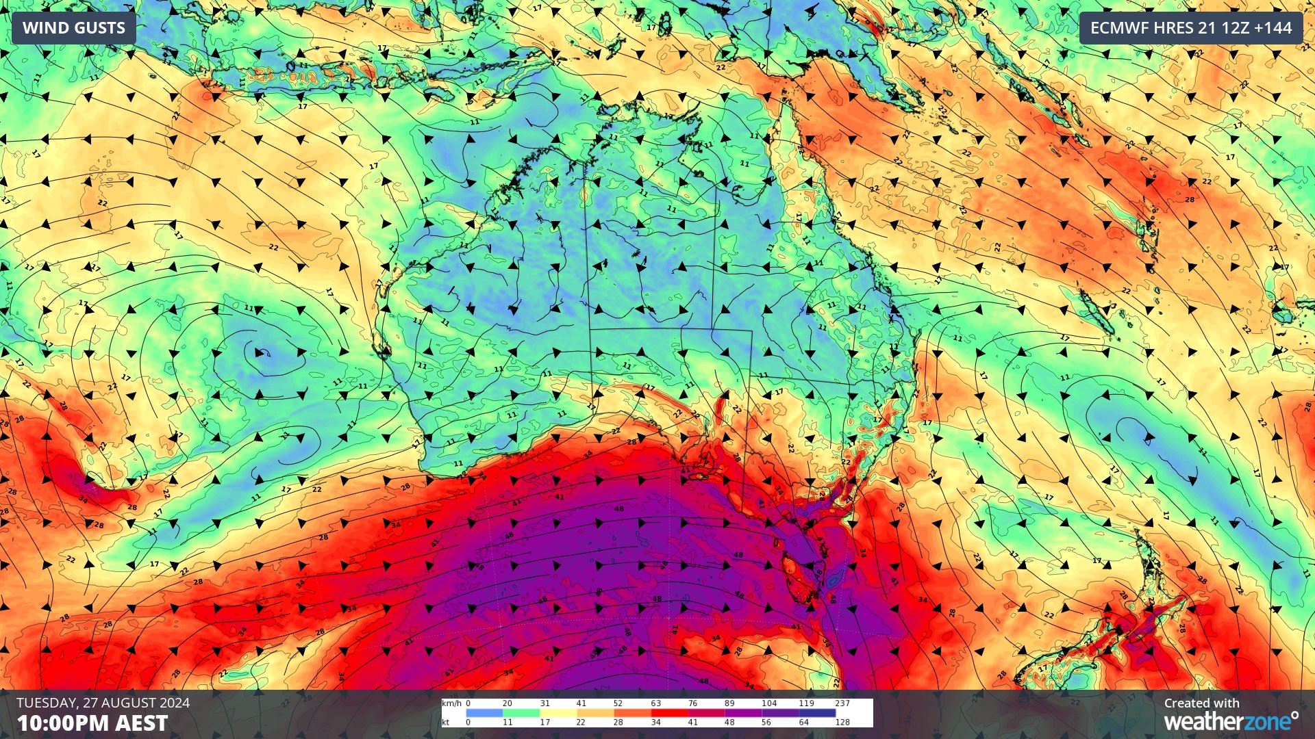
Image: Forecast wind gusts at 4pm AEST on Sunday, August 25, according to the ECMWF-HRES model.
Another strong front could then send a new surge of strong to gale force winds across the southern half of Australia between Thursday and Saturday.
While cold fronts are typical in southern Australia at this time of year, this sequence of fronts will be stronger than usual and will likely result in damaging gusts on multiple days and in multiple states and territories.
Video: Modelled wind speed between now and August 30, showing multiple cold fronts passing through the Australian region.
This sustained period of windy weather will cause days of good wind power across the southern half of Australia, however there will also be periods where the wind is too strong for energy production from wind turbines.
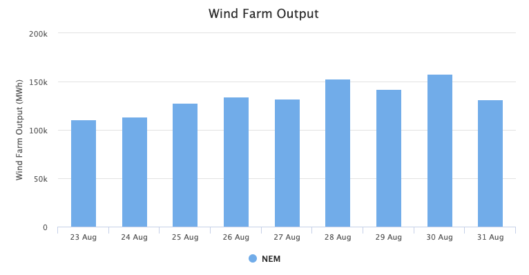
Image: Weatherzone’s National Electricity Market (NEM) wind output for the next nine days.
In addition to the wind, the upcoming sequence of cold fronts will cause bursts of rain and thunderstorms over parts of southern Australia.
Western Tasmania will see the heaviest rain from these systems, with potential for 200 to 300 mm by the end of next week. Parts of southwestern WA, Vic and the southern ranges in NSW could also see more than 50 mm between now and next weekend.
There could also be severe thunderstorms at times, particularly this Sunday in SA, Vic and NSW, and again late next week in parts of southeastern Australia.
Be sure to stay up to date with the latest severe weather and thunderstorm warnings over this period for the latest information.




