
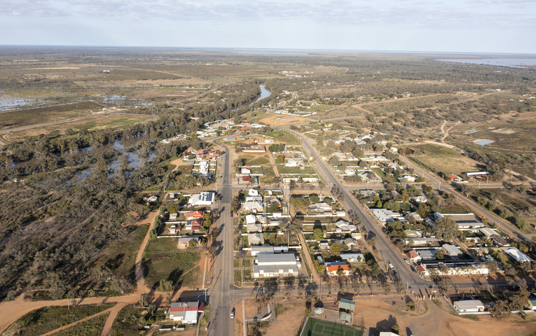
Parts of outback SA, NSW and Queensland have received heavy rain over the weekend, with the town of Menindee in far western NSW recording its wettest July day in 138 years. The weekends downpour has closed multiple roads in NSW, SA, Vic and Qld, due to water over roads.
Take a look at the map below, which shows rainfall accumulations in the 24 hours to 9 am Monday.
It’s not often you see the highest concentration of green dots (falls of 25 to 49 mm) and orange dots (50 to 99 mm) so far from the coast.
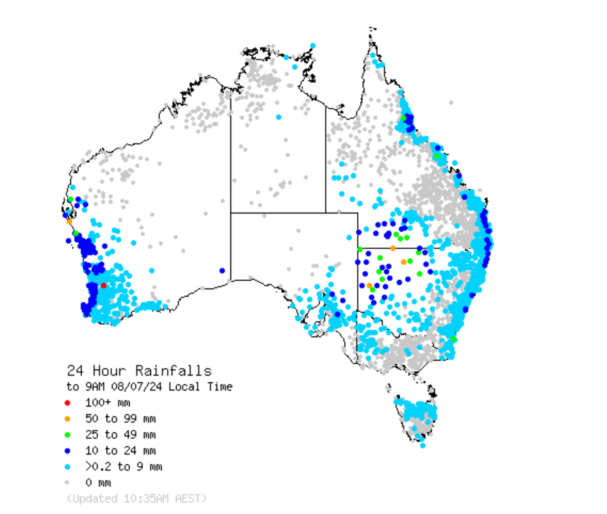
Source: BoM.heavy soaking rain was caused by the interaction between a cut-off upper-level low pressure system and atmospheric moisture flowing from the east, which was given extra fuel by unusually warm sea temperatures.
Some of the observations of note to 9 am Monday included:
NSW
- Inkerman 62 mm: The weather station close to Broken Hill recorded the heaviest reading in the whole of NSW to 9 am Monday.
- Menindee 48 mm: As stated, this was the heaviest day of July rainfall in 138 years for the outback town with a population of just over 500 people, where the entire monthly average rainfall for July is 17.7 mm.
- Bourke 41.6 mm: This was the heaviest day of July rainfall in 36 years for the famous outback town on the Darling River, where the entire monthly average rainfall for July is just 14 mm.
- Wilcannia 41.2 mm: This was the heaviest day of July rainfall in 74 years for the Darling River town about four hours’ drive downstream of Bourke, where the entire monthly average rainfall for July is 18 mm.
QLD
- Hungerford 54 mm: A weather station in the far SW corner of the state, recorded the state-high total to 9 am Monday.
- Cunnamulla 28 mm: It was the heaviest July fall for 18 years in the well-known outback outpost.
South Australia saw generally lighter falls but several spots well north of Adelaide saw 10 mm or more.
The blue dots in the image below show the roads that are closed due to flooding or water over the road as of Monday afternoon, with most roads in NSW’s northwest currently closed due to this rain event.
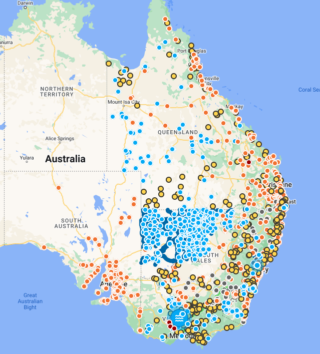
Image: Live Traffic, showing road closures due to water over the road (blue dots) as of 1pm Monday, July 8. Source: LiveTrafficNSW
DTN APAC, a DTN company, can assist during severe weather events such as this with our expert insights and daily briefings, helping to reduce the disruptive delays across the network.
We specialise in building customised weather monitoring and alerting solutions. These guide transport operators to plan and respond effectively. We tailor our data and analytics to your exact requirements. The following tools help the transport and rail sector daily.
- Total Lightning Network- Precise lightning detection which pinpoints where your personnel need to prepare and respond.
- Stormtracker- visualise adverse weather conditions impacting your network, with multiple weather and alert layers which animate over your infrastructure.
- Nowcasting, forecasting and severe weather alerting services to help coordinate your team, limiting downtime and scheduling maintenance in optimal weather windows.
We provide customised weather intelligence to keep your transport business moving. To find out more, please visit our contact page or email us at apac.sales@dtn.com.




