There are signs that an Antarctic airmass is on its way to southern Australia later this week, with the potential for fierce winds, snow and rain.
This comes after southern Australia has seen a sustained period of cold and windy weather this week, with a couple of centimetres of snow falling at the resorts on Wednesday morning.
A burst of moisture at around 9am Wednesday morning, brought snow down to 1400 metres in NSW.
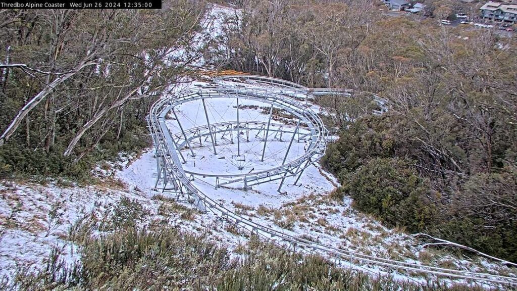
Image: Thredbo Alpine coaster Camera showing snow below around 1500 metres at 12:35pm on Wednesday, June 26
This is just a taste of what is to come later this week, as a deep low pressure system sets its sights on the southeast.
A northwest cloudband and tropical moisture will link up with this low, transporting thick cloud and rain eastwards across southeastern Australia from Friday through to early next week.
The images below shows rain forecast during the next seven days, with rain stretching from the northwest to the southeast of the country associated with the northwest cloud band later this week.
The cloudband and associated rain will reach Qld on Sunday, with the potential for another bout of low solar output for the state.
The low pressure system will also transport an Antarctic airmass over southern Australia later this week into next.
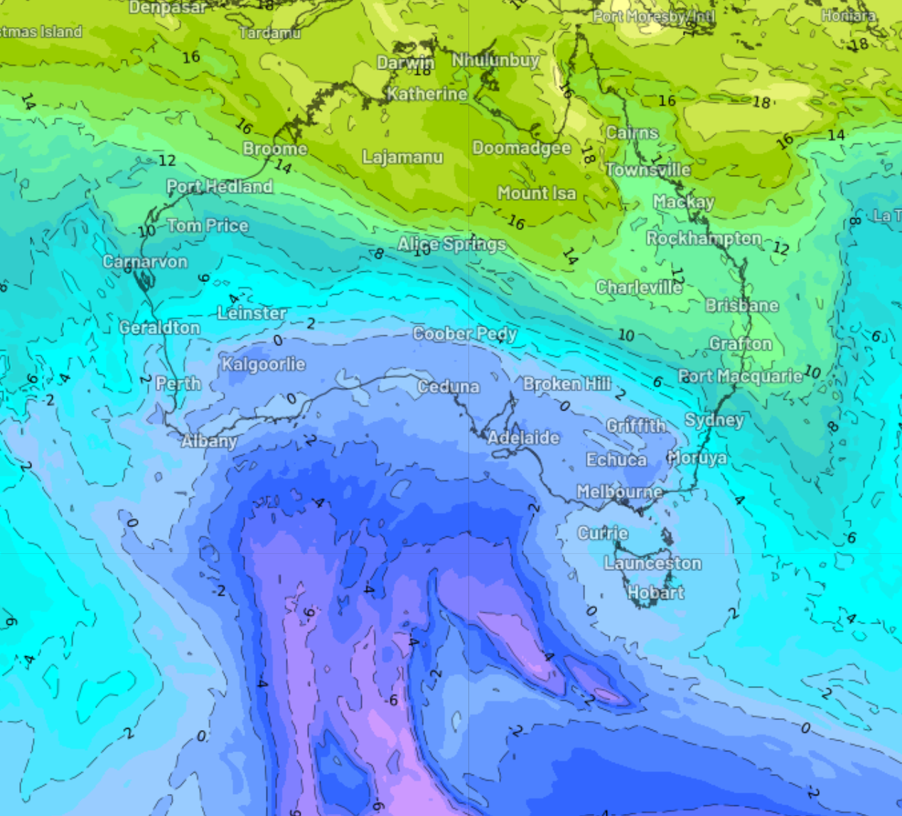
The image below of forecast air temperatures around 1.5km/h above sea level on Sunday morning shows the cold airmass over the southern half of the country, with more on its way in the Bight.

Image: 850hpa temperature at 10am Sunday, June 30, according to ECMWF.
This frigid airmass will cause temperatures to drop further on the weekend in Adelaide, with a run of at least five days of around 13 to 14 °C, while Melbourne will see a run of days around 12 °C.
The colder air will also make it to Sydney and Brisbane next week, with the potential for Sydney’s maximum to drop to 16°C for a day or two.
Chilly nights are also forecast across the southeast early to mid next week, as the skies clear allowing overnight temperatures to plummet.
The freezing air may also link up with moisture with the potential for decent snow to fall in the alpine regions on the weekend and early next week.
The chilly temperatures will be accompanied by strong southerly winds, making the temperature feel much colder than the actual temperature.
Strong winds will begin to impact SA on Friday as the low and front near the state, with strong winds expected in Vic, Tas, parts of the ACT and NSW on Saturday.
The image below shows the strong wind gusts forecast by one computer model on Saturday morning.
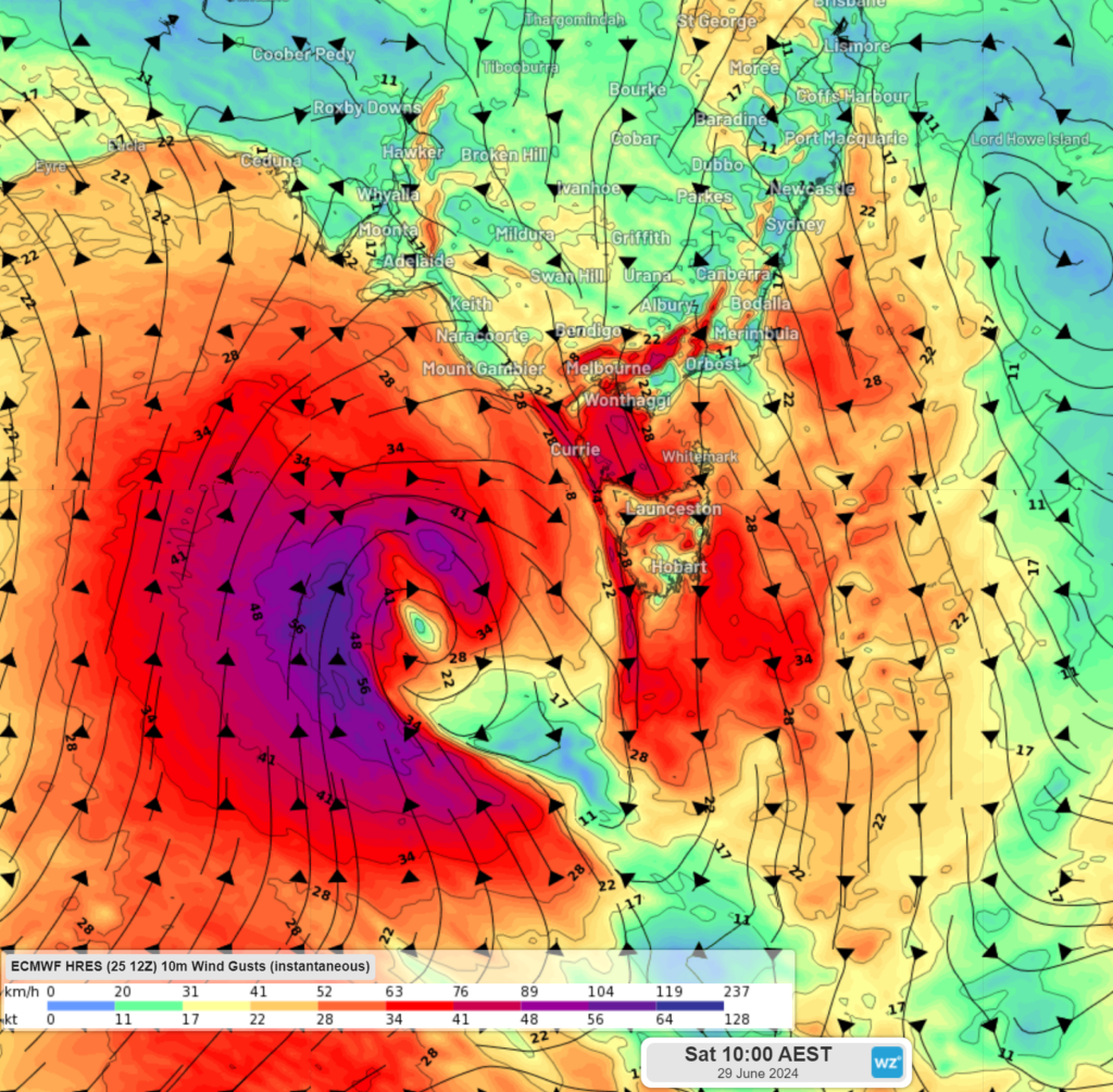
Image: Instantaneous wind gust forecast for 10am on Saturday, June 29, according to ECMWF
The strong winds should continue in these regions on Sunday, before strong southerly winds impact the east coast early next week.
There is potential for these winds to reach damaging strength across southern Australia, so keep an eye out for the latest warnings.


